
Helper in Carbon County, Utah — The American Mountains (Southwest)
Geneva Coal Mine
Horse Canyon Coal Mine
Photographed by Jeremy Snow, June 28, 2025
1. Geneva Coal Mine Marker
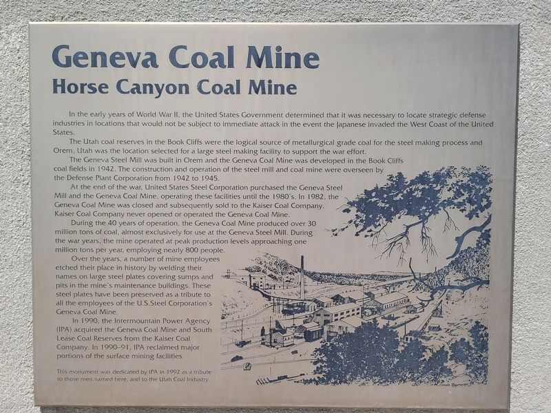
The Utah coal reserves in the Book Cliffs were the logical source of metallurgical grade coal for the steel making process and Orem, Utah was the location selected for a large steel making facility to support the war effort.
The Geneva Steel Mill was built in Orem and the Geneva Coal Mine was developed in the Book Cliffs coal fields in 1942. The construction and operation of the steel mill and coal mine were overseen by the Defense Plant Corporation from 1942 to 1945.
At the end of the war, United States Steel Corporation purchased the Geneva Steel Mill and the Geneva Coal Mine, operating these facilities until the 1980's. In 1982, the Geneva Coal Mine was closed and subsequently sold to the Kaiser Coal Company. Kaiser Coal Company never opened or operated the Geneva Coal Mine.
During the 40 years of operation, the Geneva Coal Mine produced over
this page online
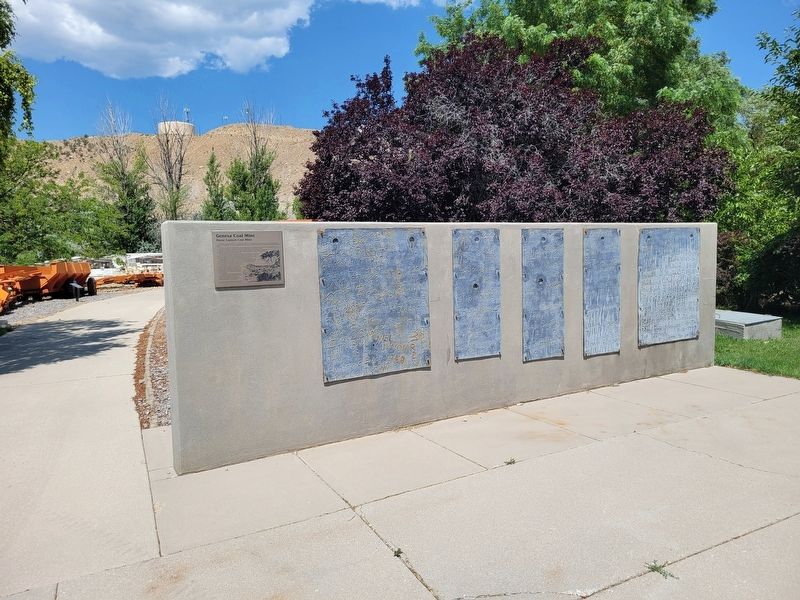
Over the years, a number of mine employees etched their place in history by welding their names on large steel plates covering sumps and pits in the mine's maintenance buildings. These steel plates have been preserved as a tribute to all the employees of the U.S.Steel Corporation's Geneva Coal Mine.
In 1990, the Intermountain Power Agency (IPA) acquired the Geneva Coal Mine and South Lease Coal Reserves from the Kaiser Coal Company. In 1990-91, IPA reclaimed major portions of the surface mining facilities.
This monument was dedicated by IPA in 1992 as a tribute to those men named here, and to the Utah Coal Industry.
Erected by i.p.a.
Topics. This historical marker is listed in these topic lists: Industry & Commerce • War, World II. A significant historical year for this entry is 1942.
Location. 39° 40.979′ N, 110° 51.349′ W. Marker is in Helper, Utah, in Carbon County. It is on South 100 West, on the right when
Photographed by Jeremy Snow, June 28, 2025
2. Geneva Coal Mine Marker

Regionally, this marker is in Canyon Country. It is also in the American Mountain West, on the Colorado Plateau, and at the Four Corners. Globally, it is in North America, the Western Hemisphere, the Western World, and the Anglosphere. Historically, it finds itself in what was once New Spain and also Mexico’s Alta California.

Other nearby markers. At least 8 other markers are within walking distance of this marker: Historic Helper (here, next to this marker); The Four Steps Necessary For Mining Coal (a few steps from this marker); The Mucking Machine (a few steps from this marker); Sullivan Shortwall Machine (a few steps from this marker); Continous Miner Section (a few steps from this marker); Conventional Mining Section (within shouting distance of this marker); Joy Loading Machine (within shouting distance of this marker); Coal Mines of Carbon County Utah (within shouting distance of this marker). Touch for a list and map of all markers in Helper.
Credits. This page was last revised on July 18, 2025. It was originally submitted on July 18, 2025, by Jeremy Snow of Cedar City, Utah. This page has been viewed 207 times since then and 70 times this year. Photos: 1, 2. submitted on July 18, 2025, by Jeremy Snow of Cedar City, Utah. • Andrew Ruppenstein was the editor who published this page.
