Marker Logo
THE HISTORICAL
MARKER DATABASE
“Bite-Size Bits of Local, National, and Global History”
Fort Erie in Niagara Region, Ontario — Central Canada (North America)
 

J.L. Kraft 1874-1953
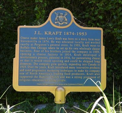
 
 
J.L. Kraft 1874-1953 - Marker image. Click for full size.
Photographed by Kevin Westell, July 18, 2025
1. J.L. Kraft 1874-1953 - Marker
Inscription. Cheese maker James Lewis Kraft was born on a dairy farm near Stevensville in 1874. He was educated locally and worked nearby at Ferguson's general store. In 1903, Kraft went to Buffalo then Chicago where he set up his own wholesale cheese business. Four of his brothers joined the company in 1909, opening a cheese factory in 1914. Kraft developed at revolutionary process, patented in 1916, for pasteurising cheese so that it would resist spoiling and could be shipped long distances. The company grew quickly, expanding into Canada in 1919. Over the years, Kraft introduced many innovative products and used progressive marketing techniques to make his company one of North America's leading food producers. Kraft also supported the Baptist Church and was a strong proponent of religious education for young people.
 
Erected by Ontario Heritage Foundation.
 
Topics and series. This historical marker is listed in this topic list: Industry & Commerce. In addition, it is included in the Canada, Ontario Heritage Trust series list. A significant historical year for this entry is 1874.
 
Location. 42° 54.702′ N, 78° 54.54′ W.
Paid Advertisement
Click or scan to see
this page online
Marker is in Fort Erie, Ontario, in Niagara Region. It can be reached from Niagara Boulevard, on the right when traveling north. The marker is on a post in a "side alley" walkway. It may may be seasonally concealed by tall greenery. Touch for map. Marker is at or near this postal address: 120 Niagara Boulevard, Fort Erie ON L2A, Canada. Touch for directions.

Regionally, this marker is on Ontario’s Golden Horseshoe and in Niagara Canada. It is also in Central Canada. Globally, it is in North America, the Western Hemisphere, the Western World, and the Anglosphere. Historically, it finds itself in what was once a British colony, the Viceroyalty of New France, the Haudenosaunee (Iroquois) Confederacy, and Rupert’s Land.

Other nearby markers. At least 8 other markers are within walking distance of this marker: Bertie Street Ferry Landing (within shouting distance of this marker); Freedom Park (about 90 meters away, measured in a direct line); Fort Erie Ferry Landings (about 90 meters away); Fight at the Fort Erie Docks (approx. 0.4 kilometers away); Nowak Pier (approx. half a kilometer away in the U.S.); Harrowing Journey
J.L. Kraft 1874-1953 - Marker in context image. Click for full size.
Photographed by Kevin Westell, July 18, 2025
2. J.L. Kraft 1874-1953 - Marker in context
Photo faces east from the road. Only the top half of the plaque is visible, in the greenery right of the walkway (centre, in front of the lamp-post).
(approx. 0.6 kilometers away in the U.S.); Black Rock Harbor / From Plantation to Promised Land (approx. 0.6 kilometers away in the U.S.); Broderick Park / Distinctive River Ecosystems (approx. 0.6 kilometers away in the U.S.). Touch for a list and map of all markers in Fort Erie.
 
 
Credits. This page was last revised on July 21, 2025. It was originally submitted on July 19, 2025, by Kevin Westell of St. Catharines, Ontario. This page has been viewed 100 times since then and 21 times this year. Photos:   1, 2. submitted on July 19, 2025, by Kevin Westell of St. Catharines, Ontario. • Andrew Ruppenstein was the editor who published this page.

m=279088

CeraNet Cloud Computing sponsors the Historical Marker Database.
This website earns income from purchases you make after using our links to Amazon.com. We appreciate your support.
Paid Advertisement
Jul. 11, 2026
