Clifford in Wellington County, Ontario — Central Canada (North America)
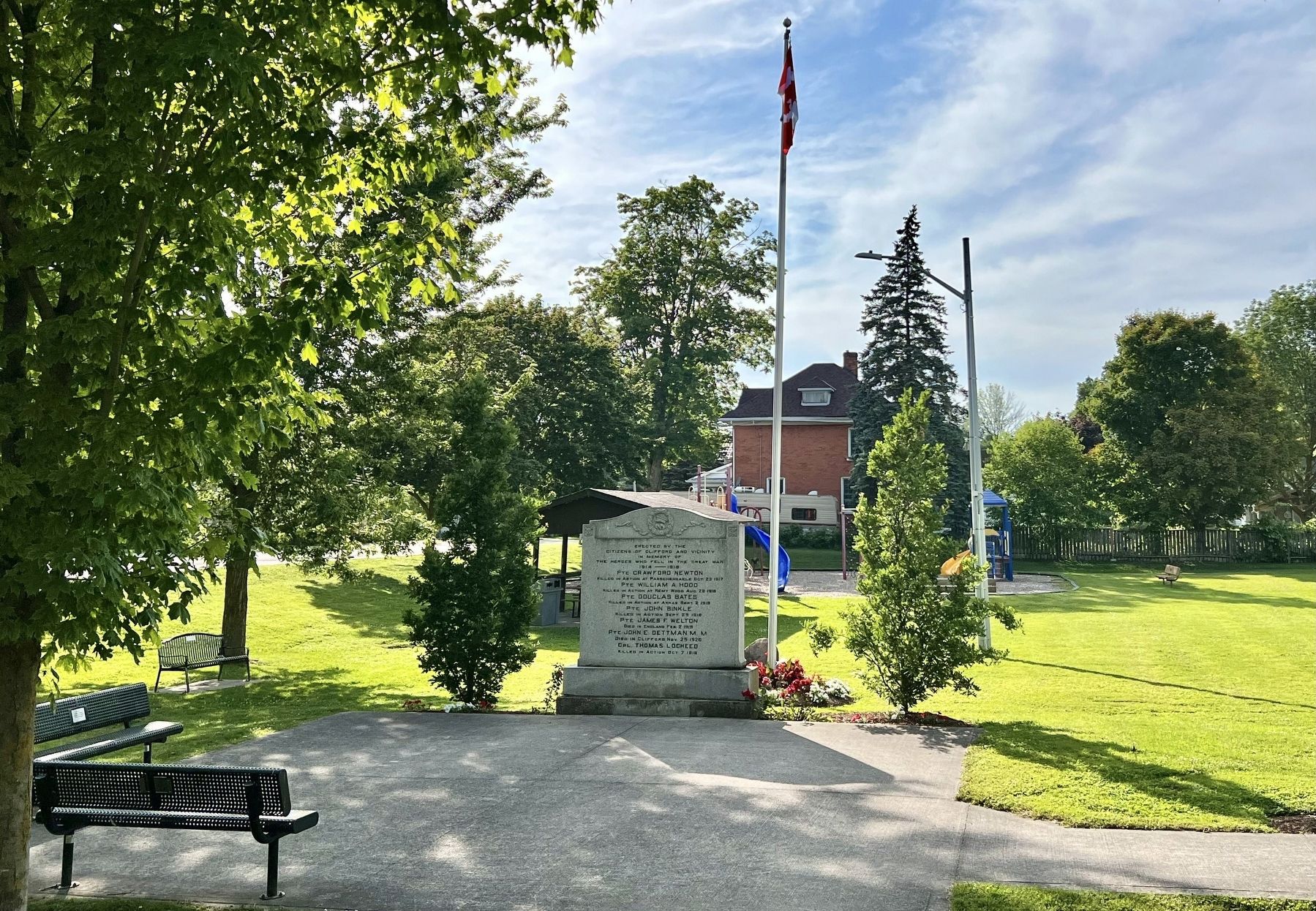
Clifford Cenotaph
![Clifford Cenotaph [south side] image. Click for full size.](Photos8/883/Photo883063.jpg?719202585300AM "Clifford Cenotaph [south side]. Click for full size.")
Photographed by Tim Boyd, July 4, 2025
1. Clifford Cenotaph [south side]
[south side]
Erected by the citizens of Clifford and vicinity in memory of the heroes who fell in the Great War 1914 — 1918
Pte Crawford Newton
Killed in Action at Passchendaele Oct. 23 1917
Pte William A. Hood
Killed in Action at Remy Wood Aug. 28 1918
Pte Douglas Bates
Killed in Action at Arras Sept. 2 1918
Pte John Binkle
Killed in Action Sept. 29 1918
Pte James F. Welton
Died in England Feb. 2 1919
Pte John E. Dettman M. M.
Died in Clifford Nov. 25 1920
Cpl. Thomas Locheed
Killed in Action Oct. 7 1916
[north side]
World War II
Pte Irvin C. Wilson 1944
P.O. Clifford A. Harding 1943
Topics. This memorial is listed in these topic lists: War, World I • War, World II.
Location. 43° 58.122′ N, 80° 58.778′ W. Memorial is in Clifford, Ontario, in Wellington County. It is on Allan Street West 0.1 kilometers west of Elora Street North, on the right when traveling west. Touch for map. Memorial is at or near this postal address: 8 Allan Street W, Clifford ON N0G 1M0, Canada. Touch for directions.

Regionally, this memorial is in the
this page online
Other nearby markers. At least 8 other markers are within 21 kilometers of this marker, measured as the crow flies: 2 Elora Street (about 90 meters away, measured in a direct line); Mansion House (about 120 meters away); The Founding of Clifford (about 120 meters away); Harriston Cenotaph (approx. 10.9 kilometers away); The Founding of Harriston (approx. 10.9 kilometers away); The Rt. Hon. John G. Diefenbaker (approx. 12.5 kilometers away); Hanover Cenotaph (approx. 20.8 kilometers away); The Founding of Hanover / La Fondation de Hanover (approx. 20.8 kilometers away). Touch for a list and map of all markers in Clifford.
![Clifford Cenotaph [north side] image. Click for full size.](Photos8/883/Photo883067.jpg?719202585500AM "Clifford Cenotaph [north side]. Click for full size.")
Photographed by Tim Boyd, July 4, 2025
2. Clifford Cenotaph [north side]
Photographed by Tim Boyd, July 4, 2028
3. Clifford Cenotaph
Credits. This page was last revised on July 21, 2025. It was originally submitted on July 19, 2025, by Tim Boyd of Hamilton, Ontario. This page has been viewed 81 times since then and 22 times this year. Photos: 1, 2, 3. submitted on July 19, 2025, by Tim Boyd of Hamilton, Ontario. • Andrew Ruppenstein was the editor who published this page.
