Penwortham in Lancashire, England, United Kingdom — Northwestern Europe (the British Isles)
St Mary's Penwortham
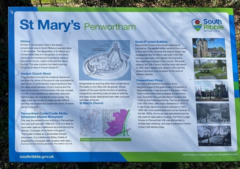
Photographed by Ray Gurganus, April 10, 2025
1. St Mary's Penwortham Marker
History
St Mary's Conservation Area is the largest conservation area in South Ribble at approximately 11.53 hectares. The designation of St Mary's as a Conservation Area is in recognition of the area's historical and architectural importance, centred around the church, castle motte and the site of a priory. The area contains five listed buildings including St Mary's Church (Grade II*).
Ancient Church Wood
This woodland survived the medieval clearances because the nature of the ground was unsuitable for agriculture. A contemporary engraving shows that the steep slope between Church Avenue and the river at the bottom of Penwortham Hill was wooded in 1728. It can therefore be reasonably assumed that the area was wooded for much longer. The steep bank has tended to make access difficult and this has enabled the slope's rich stock of native plants to survive.
Penwortham Castle/Castle Motte: Scheduled Ancient Monument
This was the earliest known building in Penwortham and was built between 1068 and 1072. It is likely to have been used as a defensive structure during the Norman Conquest of the North of England. The Castle
this page online
St Mary's Church: Grade II* Listed Building
Penwortham is one of the ancient parishes of Lancashire. The earliest written record of this church is from the 1140s, however the original church has disappeared and St Mary's was built in the 14th Century. Although much altered, the chancel is the oldest surviving part of the church. The tower dates to the 15th Century and the nave was rebuilt in 1855. Many repairs took place in 1812 and the present structure is an amalgam of the work of different periods.
Penwortham Priory
This was a Benedictine foundation and a daughter house of the great Abbey of Evesham in Worcestershire. It was founded in the early 1140s. There is little information
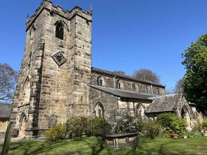
Photographed by Ray Gurganus, April 10, 2025
2. St Mary's Church
Erected by South Ribble Borough Council.
Topics. This historical marker is listed in these topic lists: Forts and Castles • Religion & Religious Structures.
Location. 53° 45.275′ N, 2° 43.432′ W. Marker is in Penwortham, England, in Lancashire. It is on Church Avenue. The marker is located just outside the gate to the cemetery and church grounds. Touch for map. Marker is at or near this postal address: 14 Church Avenue, Penwortham, England PR1 0AH, United Kingdom. Touch for directions.

Regionally, this marker is in North West England. Globally, it is on the Atlantic Ocean, in the North Atlantic Region, in Europe, in Atlantic Europe, on one of the British Isles, in the Western World, and in the Anglosphere. Historically, it finds itself in what was once the Roman Empire.
Other nearby markers. At least 8 other markers are within walking distance of this marker: Penwortham War Memorial (approx. 0.3 kilometers away); Preston Station (approx. 1.1 kilometers away); The Royal Naval Train "Jellicoe Express" (approx. 1.1 kilometers away); Derby Statue (approx. 1.3 kilometers away); Rev Joseph (Daddy) Dunn (approx. 1.4 kilometers away); Edmund Rice (approx. 1.4 kilometers away); South African War Memorial (approx. 1.4 kilometers away); Edith Rigby 1872-1950 (approx. 1.4 kilometers away).
Credits. This page was last revised on July 21, 2025. It was originally submitted on July 19, 2025, by Ray Gurganus of Washington, District of Columbia. This page has been viewed 115 times since then and 35 times this year. Photos: 1, 2. submitted on July 19, 2025, by Ray Gurganus of Washington, District of Columbia. • Andrew Ruppenstein was the editor who published this page.
