Elizabethtown in Lancaster County, Pennsylvania — The American Northeast (Mid-Atlantic)
The Railroad Comes to Elizabethtown
Photographed by William Pope, July 15, 2025
1. The Railroad Comes to Elizabethtown Marker
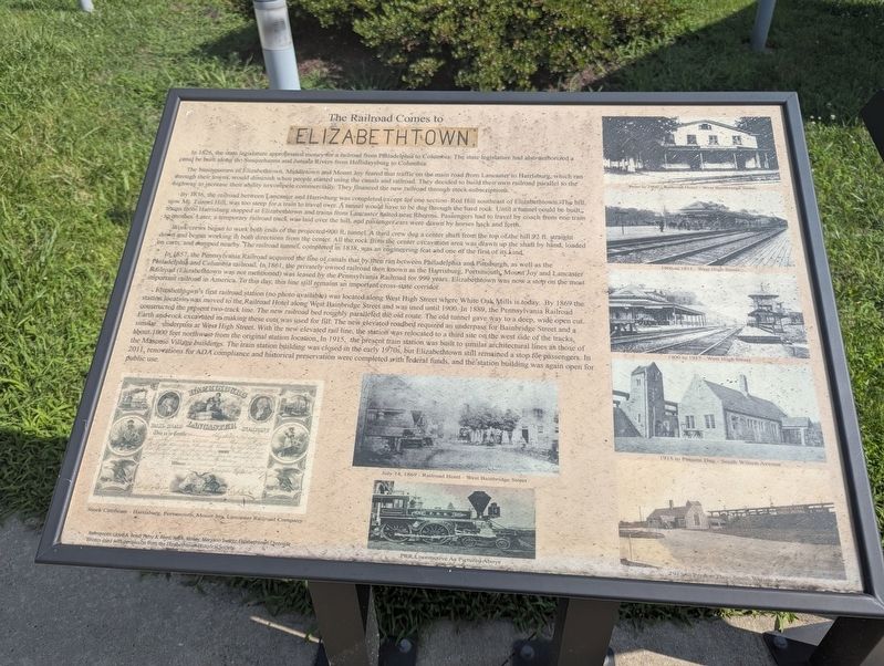
The businessmen of Elizabethtown, Middletown and Mount Joy feared that traffic on the main road from Lancaster to Harrisburg, which ran through their towns, would diminish when people started using the canals and railroad. They decided to build their own railroad parallel to the highway to increase their ability to compete commercially. They financed the new railroad through stock subscriptions.
By 1836, the railroad between Lancaster and Harrisburg was completed except for one section - Red Hill southeast of Elizabethtown. The hill, now Mt. Tunnel Hill, was too steep for a train to travel over. A tunnel would have to be dug through the hard rock. Until a tunnel could be built trains from Harrisburg stopped at Elizabethtown and trains from Lancaster halted near Rheems. Passengers had to travel by coach from one train to another. Later, a temporary railroad track was laid over the hill, and passenger
this page online
Work crews began to work both ends of the projected 900 ft. tunnel. A third crew dug a center shaft from the top of the hill 92 ft. straight down and began working in both directions from the center. All the rock from the center excavation area was drawn up the shaft by hand, loaded on carts, and dumped nearby. The railroad tunnel, completed in 1838, was an engineering feat and one of the first of its kind.
In 1857, the Pennsylvania Railroad acquired the line of canals that by then ran between Philadelphia and Pittsburgh, as well as the Philadelphia and Columbia railroad. In 1861, the privately owned railroad then known as the Harrisburg, Portsmouth, Mount Joy and Lancaster Railroad (Elizabethtown was not mentioned) was leased by the Pennsylvania Railroad for 999 years. Elizabethtown was now a stop on the most important railroad in America. To this day, this line still remains an important cross-state corridor.
Elizabethtown's first railroad station (no photo available) was located along West High Street where White Oak Mills is today. By 1869 the station location was moved to the Railroad
Photographed by William Pope, July 15, 2025
2. The Railroad Comes to Elizabethtown Marker
(Captions from left to right)
Stock Certificate - Harrisburg, Portsmouth, Mount Joy, Lancaster Railroad Company
July 14,1869 - Railroad Hotel - West Bainbridge Street
PRR
Photographed by William Pope, July 15, 2025
3. The Railroad Comes to Elizabethtown Marker
Prior to 1900 Railroad Hotel - West Bainbridge Street
1900 to 1915 - West High Street
1900 to 1915 - West High Street
1915 to present day - South Wilson Avenue
1915 to present day - South Wilson Avenue
References: Lloyd A. Reed, Patsy A. Reed, Jeff K. Kinsey, Maryann Swartz, Elizabethtown Chronicle
Photos used with permission from the Elizabethtown Historical Society.
(2nd photo Captions)
Elizabethtown
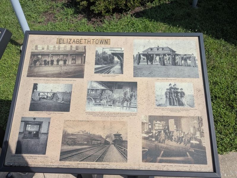
Prior to 1900 Train Station - Railroad Hotel - West Bainbridge Street
1915 to 2011 Eastbound platform
South Wilson Avenue
1900 to 1915 - West High Street
Construction of West High Street Underpass 1899
The Elizabethtown transfer car took travelers from Elizabethtown train station to "all parts of town". Above, driver Isaak Zerphy is pictured with the trusty steeds he used to transport passengers in the early 1900s.
Front L-R Lillie Perrett, Emma Carter, Emma Kline, Anna Keller
Back L-R Josephine Ulrich, Anna Winters
November 1897
Ticket window in current station prior to renovations.
South Wilson Avenue
1900 to 1915 Train Station - West High Street
Inside the 1900-1915 Train Station
References: Jeff K. Kinsey, Maryann Swartz
Photos used with permission from the Elizabethtown Historical Society and the Winters Heritage House and Museum, Elizabethtown
Topics. This historical marker is listed in these topic lists: Railroads & Streetcars • Settlements & Settlers. A significant historical year for this entry is 1826.
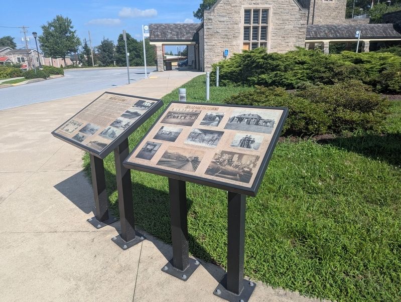
Location. 40° 8.823′ N, 76° 36.754′ W. Marker is in Elizabethtown, Pennsylvania, in Lancaster County. It is on South Wilson Avenue 0.1 miles south of West High Street (Pennsylvania Route 241), on the right when traveling south. Marker is in front of the Elizabethtown Amtrak Station. Touch for map. Marker is at or near this postal address: 50 South Wilson Avenue, Elizabethtown PA 17022, United States of America. Touch for directions.

Regionally, this marker is in South-Central Pennsylvania, specifically in Pennsylvania Dutch Country, and in the Susquehanna Valley. It is also in the American Northeast and in the Mid-Atlantic. Globally, it is in North America, the Western Hemisphere, the Western World, and the Anglosphere. Historically, it finds itself in what was once the Haudenosaunee (Iroquois) Confederacy and also one of the original Thirteen Colonies.
Other nearby markers. At least 8 other markers are within walking distance of this marker: Masonic Village at Elizabethtown (within shouting distance of this marker); The Shoe Industry in Elizabethtown (approx. 0.4 miles away); Elizabethtown (approx. 0.4 miles away); Design of Elizabethtown (approx. half a mile away); Barnabas and Elizabeth Hughes (approx. half a mile away); a different marker also named Elizabethtown (approx. half a mile away); Changes in Elizabethtown (approx. half a mile away); Industry in Elizabethtown (approx. half a mile away). Touch for a list and map of all markers in Elizabethtown.
Credits. This page was last revised on July 23, 2025. It was originally submitted on July 19, 2025, by William Pope of Marietta, Pennsylvania. This page has been viewed 193 times since then and 62 times this year. Photos: 1, 2, 3. submitted on July 19, 2025, by William Pope of Marietta, Pennsylvania. • Bill Pfingsten was the editor who published this page.
