Tombstone in Cochise County, Arizona — The American Mountains (Southwest)
Tombstone City Hall
Opened in 1882
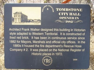
Photographed by Bill Kirchner, February 19, 2010
1. Tombstone City Hall Marker
Erected 2005 by Tombstone Restoration Commission.
Topics and series. This historical marker is listed in these topic lists: Architecture • Charity & Public Work • Government & Politics. In addition, it is included in the National Historic Landmarks series list. A significant historical year for this entry is 1882.
Location. 31° 42.826′ N, 110° 4.029′ W. Marker is in Tombstone, Arizona, in Cochise County. It is on East Fremont Street (State Highway 80), on the right when traveling east. Marker and City Hall building are located between North 3rd and North 4th Streets. Touch for map. Marker is at or near this postal address: 306 East Fremont Street, Tombstone AZ 85638, United States of America. Touch for directions.

Regionally, this marker is in the Sky
this page online
Other nearby markers. At least 8 other markers are within walking distance of this marker: Did Wyatt Earp Kill Johnny Ringo? (within shouting distance of this marker); Gunfight at the O.K. Corral (within shouting distance of this marker); Schieffelin Hall (within shouting distance of this marker); "You're a Lucky Cuss!" (about 300 feet away, measured in a direct line); Can Can Restaurant (about 300 feet away); Edward L. Schieffelin (about 300 feet away); Cochise County Bank (about 400 feet away); Brown's Hotel and Hafford's Saloon (about 400 feet away). Touch for a list and map of all markers in Tombstone.
Also see . . . The City of Tombstone.
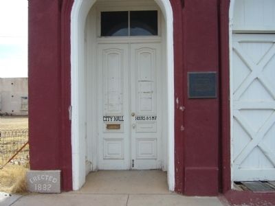
Photographed by Bill Kirchner, February 19, 2010
2. Tombstone City Hall
Tombstone City Hall Marker is just to the left of the entrance.
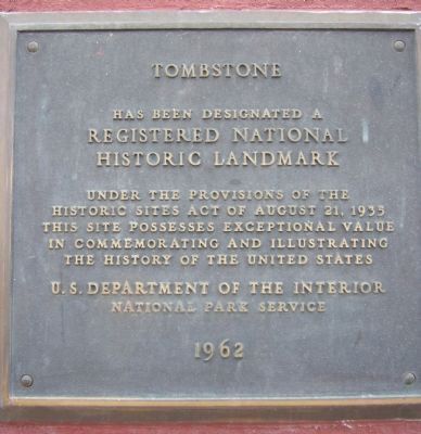
Photographed by Bill Kirchner, February 19, 2010
3. Tombstone National Historical Landmark Plaque
Plaque is just to right of City Hall Entrance.
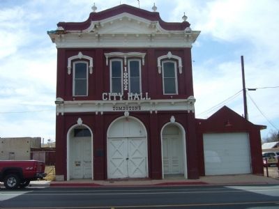
Photographed by Bill Kirchner, February 19, 2010
4. Tombstone City Hall
Tombstone City Hall Marker is hidden behind red truck.
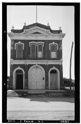
Photographed by Frederick D. Nichols, Photographer, November 1937
5. Tombstone City Hall
Historic American Buildings Survey (Library of Congress)
HABS ARIZ,2-TOMB,4-
Click for more information.
HABS ARIZ,2-TOMB,4-
Click for more information.
Credits. This page was last revised on January 8, 2025. It was originally submitted on February 24, 2010, by Bill Kirchner of Tucson, Arizona. This page has been viewed 2,680 times since then and 121 times this year. Photos: 1, 2, 3, 4. submitted on February 24, 2010, by Bill Kirchner of Tucson, Arizona. 5. submitted on February 25, 2010. • Syd Whittle was the editor who published this page.
