Niagara Falls in Niagara Region, Ontario — Central Canada (North America)
Battle of Lundy's Lane
Bataille de Lundy's Lane
Photographed by Dale K. Benington, July 27, 2011
1. Battle of Lundy's Lane Marker

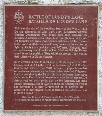
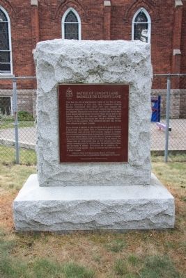
This was the site of the bloodiest battle of the War of 1812. On the afternoon of 25th July, 1814, Lieutenant-General Gordon Drummond with about 2800 men engaged the invading American army which had recently been victorious at Chippawa. The armies were evenly matched and the six-hour battle lasted until darkness and heavy losses put an end to the fighting. Each force had lost over 800 men. Although each claimed victory, the Americans had failed to dislodge Drummond from his position. They withdrew the next day, ending their offensive in Upper Canada.
this page online
Erected 1938 by Historic Sites and Monuments Board of Canada.
Topics and series. This historical marker is listed in this topic list: War of 1812. In addition, it is included in the Canada, Historic Sites and Monuments Board series list. A significant historical date for this entry is July 25, 1814.
Location. 43° 5.349′ N, 79° 5.755′ W. Marker is in Niagara Falls, Ontario, in Niagara Region. It can be reached from the intersection of Lundy's Lane and Hanan Avenue, on the right when traveling east. This historical marker is located in the Drummond Hill Cemetery which is situated off of Lundy's Lane near the intersection with Drummond Road. However it is best reached by driving to the end of Buchner Place (off Drummond Road) and parking your vehicle in the parking lot. Within this cemetery, the marker is adjacent to the fence on the east side of Drummond Hill Presbyterian Church, in a row with other memorials from the War of 1812. Touch for map. Marker is at or near this postal address: 6136 Lundy's Lane, Niagara Falls ON L2G 1T1, Canada. Touch for directions.

Regionally,
Photographed by Dale K. Benington, July 27, 2011
2. Battle of Lundy's Lane Marker
Other nearby markers. At least 8 other markers are within walking distance of this marker: I’ll Try, Sir (here, next to this marker); Holding the High Ground (a few steps from this marker); Soldier's Monument (within shouting distance of this marker); Churches Atop of Drummond Hill (within shouting distance of this marker); One Hundredth Anniversary of the Battle of Lundy's Lane (within shouting distance of this marker); The Aftermath of Battle (within shouting distance of this marker); American Withdrawal (within shouting distance of this marker); Edgeworth Ussher, Esq. (within shouting distance of this marker). Touch for a list and map of all markers in Niagara Falls.
Also see . . .
1. Battle of Lundy's Lane National Historic Site of Canada.
Photographed by Dale K. Benington, July 27, 2011
3. Battle of Lundy's Lane Marker
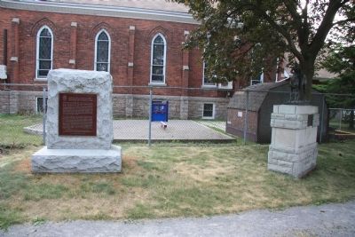
View of the historic marker with the Drummond Hill Presbyterian Church in the background and the "Holding the High Ground" marker, which was dedicated to General Gordon Drummond, just to the right of the featured historic marker.
2. Battle of Lundy's Lane. This is a link to information provided by Wikipedia, the free encyclopedia. (Submitted on November 3, 2011, by Dale K. Benington of Toledo, Ohio.)
3. The Battle of Lundy's Lane. This is a link to information provided by a War of 1812 website. (Submitted on November 3, 2011, by Dale K. Benington of Toledo, Ohio.)
4. War of 1812 Battle of Lundy Lane. This is a link to information provided by HistoryCentral.com (Submitted on November 3, 2011, by Dale K. Benington of Toledo, Ohio.)
Photographed by Dale K. Benington, July 27, 2011
4. Battle of Lundy's Lane Marker
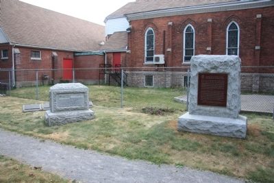
View of the historical marker with the Drummond Hill Presbyterian Church in the background and the memorial marker dedicated to the American officer, Captain Abraham F. Hull, seen to the left of the featured historic marker.
Photographed by Dale K. Benington, July 27, 2011
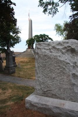
5. Battle of Lundy's Lane Marker
View with the backside of the historic marker in the foreground and a view of the memorial dedicated to the British and Canadian soldiers killed in the battle in the background.
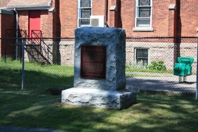
Photographed by Dale K. Benington, June 10, 2012
6. Battle of Lundy's Lane Marker
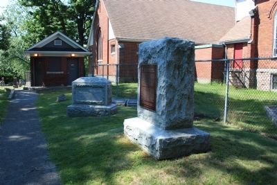
Photographed by Dale K. Benington, June 10, 2012
7. Battle of Lundy's Lane Marker
View of the historic marker with a view of the memorial to the American, Captain Abraham Hull, in the background.
Credits. This page was last revised on July 25, 2025. It was originally submitted on November 1, 2011, by Dale K. Benington of Toledo, Ohio. This page has been viewed 1,476 times since then and 42 times this year. Last updated on July 20, 2025, by Kevin Westell of St. Catharines, Ontario. Photos: 1, 2, 3, 4, 5. submitted on November 3, 2011, by Dale K. Benington of Toledo, Ohio. 6, 7. submitted on June 29, 2012, by Dale K. Benington of Toledo, Ohio. • Devry Becker Jones was the editor who published this page.
