Southampton City Centre , England, United Kingdom — Northwestern Europe (the British Isles)
Southampton in the Second World War 1939-1945
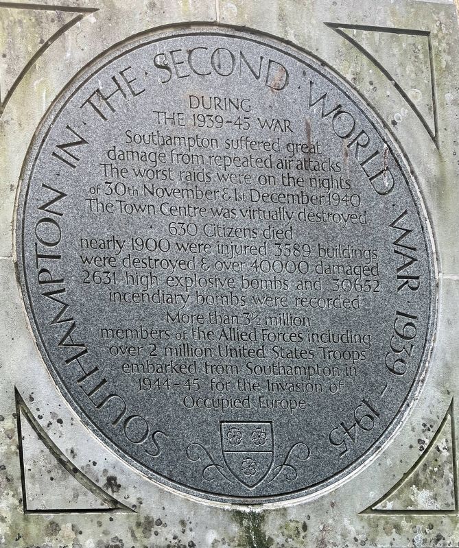
Photographed by Ray Gurganus, April 1, 2025
1. Southampton in the Second World War 1939-1945 Marker
630 Citizens died, nearly 1900 were injured, 3589 buildings were destroyed & over 40000 damaged. 2631 high explosive bombs and 30652 incendiary bombs were recorded.
More than 3½ million members of the Allied Forces including over 2 million United States troops embarked from Southampton in 1944-45 for the invasion of occupied Europe.
Topics. This historical marker is listed in this topic list: War, World II.
Location. 50° 54.173′ N, 1° 24.243′ W. Marker is in Southampton, England. It is in Southampton City Centre. It is on High Street. Touch for map. Marker is at or near this postal address: 151 High St, Southampton, England SO14, United Kingdom. Touch for directions.

Regionally, this marker is in the Hampshire Ports. Globally, it is on the Atlantic Ocean, in the North Atlantic Region, in Europe, in Atlantic Europe, on one of the British Isles, in the Western
this page online
Other nearby markers. At least 8 other markers are within walking distance of this marker: Bargate and Guildhall (a few steps from this marker); Defence of the Town (within shouting distance of this marker); Jane Austen (within shouting distance of this marker); Town Walls (within shouting distance of this marker); All Saints Church (about 120 meters away, measured in a direct line); A Fashionable Resort (about 120 meters away); Arundel Tower (about 150 meters away); Castle Gate (about 180 meters away). Touch for a list and map of all markers in Southampton.
Credits. This page was last revised on July 29, 2025. It was originally submitted on July 20, 2025, by Ray Gurganus of Washington, District of Columbia. This page has been viewed 139 times since then and 40 times this year. Photo 1. submitted on July 20, 2025, by Ray Gurganus of Washington, District of Columbia. • Andrew Ruppenstein was the editor who published this page.
Editor’s want-list for this marker. photo of the marker within its surroundings • Can you help?
