Verona in LaMoure County, North Dakota — The American Midwest (Upper Plains)
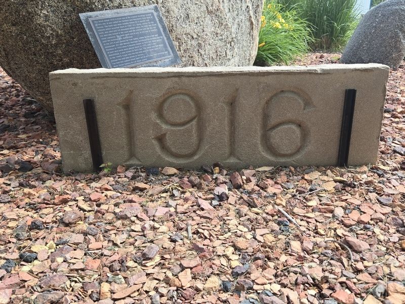
1916 Block

Photographed by Mark Parker, June 27, 2025
1. 1916 Block Marker
This block dated 1916 is from one of the original buildings located on this site. It was called the Farmers and Merchants State Bank of Verona. The bank was most notably known for a murder and robbery which occurred there in 1927. H.C. Bjone, cashier for the bank, was shot and 3-4 thousand dollars taken. His body was found the next day locked in the vault and the criminal who did this was never captured. The bank vault was in use, in one way or another, until the building was demolished.
In the 30's it was owned by Tom Sabby, where he ran a bar and restaurant. Erv and Delores Henniger purchased the building and the business in 1952 when it became known as Erv's Bar. Many games of pool and cards were played there! In 1972, until it was demolished, it was known as Bob's Bar. The owner was Bob Maley. In the 1940's it was also the bus stop and for many years it housed the only pay phone in Verona.
Too bad this cement block can't tell us all it has seen watching over Main Street Verona for all these years!
Topics. This historical marker is listed in this topic list: Industry & Commerce. A significant historical year for this entry is 1916.
Location. 46° 21.85′ N,
this page online

Regionally, this marker is in the Drift Prairie. It is also in the American Lewis & Clark Corridor, on the prairies, and on the Northern Plains. Globally, it is in North America, the Western Hemisphere, the Western World, and the Anglosphere. Historically, it finds itself in what was once Rupert’s Land and also the Louisiana Purchase.
Other nearby markers. At least 8 other markers are within 15 miles of this marker, measured as the crow flies: Early Settlers of the Valley (approx. 10.2 miles away); St. Ansgar Lutheran Church (approx. 10.8 miles away); Historic Fort Ransom / Life at the Fort (approx. 12.4 miles away); Writing Rock / Native American Legends (approx. 12.4 miles away); Fort Ransom Historic Site (approx. 12.4 miles away); Stagecoach Relay Station
Photographed by Mark Parker, June 27, 2025
2. 1916 Block in front of the marker

Photographed by Mark Parker, June 27, 2025
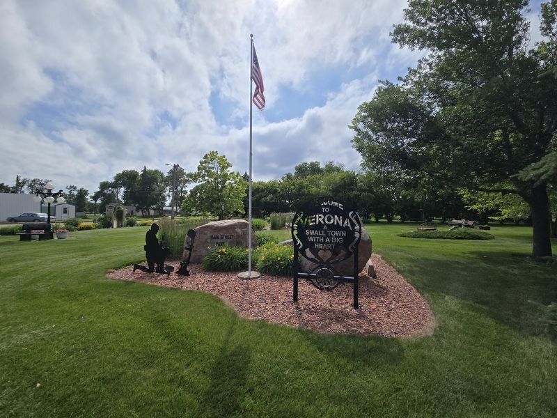
3. 1916 Block Marker at the planter at Verona Park
Photographed by Mark Parker, June 27, 2025
4. Street side view of 1916 Block Marker at the planter at Verona Park
The marker itself is obscured on the street side by the boulder.
Credits. This page was last revised on July 21, 2025. It was originally submitted on July 21, 2025, by Mark Parker of Hickory, North Carolina. This page has been viewed 101 times since then and 29 times this year. Photos: 1, 2, 3, 4. submitted on July 21, 2025, by Mark Parker of Hickory, North Carolina. • J. Makali Bruton was the editor who published this page.
