Ryan Township near LaMoure in LaMoure County, North Dakota — The American Midwest (Upper Plains)
Early Settlers of the Valley
The Chan SanSan Scenic Backway
| — | James River Valley Scenic Backway | — |
Photographed by Mark Parker, June 27, 2025
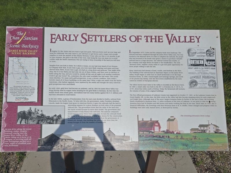
1. Early Settlers of the Valley Marker
Map inset
The pristine 35 miles of the Charles SanSan Trail / James River Valley Scenic Byway offers visitors splendid views of unspoiled, rich North Dakota landscapes. Along the route are many scenic and historic places to visit and explore. Enjoy them all!
Sidebar
As you drive along the scenic roadway today, imagine yourself coming into the James River Valley in the 1800s riding on a horse or in a wagon, or arriving with all your belongings packed on a train, eager to establish your own farmstead.
Imagine it's the 1860s and you want to get rich quick. Well you better pack up your bags and head for California! The only catch is, you will have to get horses and a wagon and enough supplies to cross the prairies of the Dakota Territory. It may take you four to six months to get to your treasure, the gold in the hills of the west. And along the way you must try to avoid conflict with the Native Americans who are trying to keep ownership of the land you will have to cross.
Imagine how you look to them. No T-shirts or jeans, no one had even heard of Levi's & Company back then. If you were a guy, you were
this page online
By early 1849, gold fever had become an epidemic, and by 1866 the James River Valley was being heavily used by wagon trains heading for the gold fields in Montana. By this time the buffalo herds were nearly gone, and Indians had lost many battles against the U.S. military and had been relocated to reservations.
In the late 1800s, a group of businessmen from the east coast decided to build a railroad from Wisconsin

Photographed by Mark Parker, June 27, 2025
2. Early Settlers of the Valley Marker looking south along County Road 60
In September 1873, Cooke and his company bank went bankrupt. The railroad had been completed through the James Rover Valley area, but only reached to the Missouri River. In order to complete the railroad, the people who had invested in the bonds were given a chance to purchase valuable raiload land at a huge discount. The railroad wanted fast results, so the company
Photographed by Mark Parker, June 27, 2025
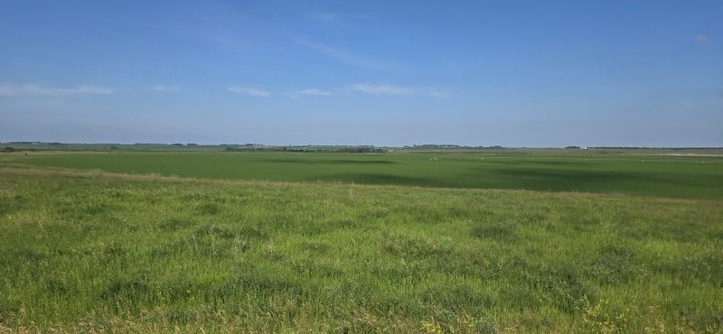
3. LaMoure River Valley from County Road 60
Many Americans had dreams of land, wealth, and freedom in the West. The building of the railroad had an important impact on the James River Valley. People began to settle here on small farmsteads or on the large Bonanza Farms. In 1880, Grand Rapids and Saratoga Springs, just north of the present day Dickey, were the first towns established by the early American settlers of European descent.
The oldest known land claim in the valley is recorded as the Roscoe farm. In 1880, a small cabin was built in the SE 1/4 of Section 26, T. 135 N., R. 63 W., about four miles south of Dickey. Today the farmstead includes the remains of some of the original buildings.
The first official government of LaMoure County was organized on October 17, 1881, at the Lamour County Seat in Grand Rapids, ND. At this time, the little towns in the valley had also become stopping pains for early stagecoach and freight lines. Although most of the area's largest bonanza farms lie further to the east of here, the Downing family established a Bonanza Farm 1.5 miles northeast of the town of LaMoure. At one point is time the Downing Bonanza Farm had 96 binders and 480 horses and males working the land at one time. Mach later, in 1943, due to financial difficulties, the Downings sold their Bonanza farm to M. H. Steffes. Times changed and progress rolled on. Buildings were later sold, burned down, or destroyed by storms.
Captions
The Roscoe farmstead
The Downing Bonanza Farm today
Photos courtesy of the James River Valley Scenic Backway Committee
Erected by North Dakota Department of Transportation.
Topics. This historical marker is listed in these topic lists: Exploration • Settlements & Settlers. A significant historical year for this entry is 1866.
Location. 46° 18.039′ N, 98° 15.877′ W. Marker is near LaMoure, North Dakota, in LaMoure County. It is in Ryan Township. It is on County Road 60 0.3 miles south of 76 1/2 Street Southeast, on the left when traveling south. Touch for map. Marker is at or near this postal address: 7700 Co Rd 60, Lamoure ND 58458, United States of America. Touch for directions.

Regionally, this marker is in the Drift Prairie. It is also in the American Lewis & Clark Corridor, on the prairies, and on the Northern Plains. Globally, it is in North America, the Western Hemisphere, the Western World, and the Anglosphere. Historically, it finds itself in what was once Rupert’s Land and also the Louisiana Purchase.
Other nearby markers. At least 8 other markers are within 11 miles of this marker, measured as the crow flies: St. Ansgar Lutheran Church (approx. 1.3 miles away); Honorable Milton R. Young (approx. 4.1 miles away); Symbol of Freedom (approx. 4.1 miles away); Steamboats on the River (approx. 4.1 miles away); Civilian Conservation Corps Project (approx. 4.3 miles away); LaMoure County Courthouse (approx. 4.4 miles away); 1916 Block (approx. 10.2 miles away); Grand Rapids, North Dakota (approx. 11 miles away). Touch for a list and map of all markers in LaMoure.
Credits. This page was last revised on August 11, 2025. It was originally submitted on July 21, 2025, by Mark Parker of Hickory, North Carolina. This page has been viewed 142 times since then and 39 times this year. Photos: 1, 2, 3. submitted on July 21, 2025, by Mark Parker of Hickory, North Carolina. • J. Makali Bruton was the editor who published this page.
