Workington in Cumberland, England, United Kingdom — Northwestern Europe (the British Isles)
Workington Station
Photographed by Ray Gurganus, April 11, 2025
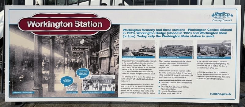
1. Workington Station Marker
Workington formerly had three stations - Workington Central (closed in 1931), Workington Bridge (closed in 1951) and Workington Main (or Low). Today, only the Workington Main station is used.
The goods lines were used to supply materials to the various local industries, transporting goods all over the country. Today the main freight use of the line is to serve the Sellafield nuclear facility alongside the Workington Docks with passenger services connecting towns and villages along the Cumbrian coast.
The the map of 1845 shows the area as open fields with only a few buildings located just to the north.
After the Workington Main (low) station was built in the 1800s, the area soon became a busy railway yard surrounded by terraced streets. An iron foundry, a stool works, and a gas works were built to the west of the station.
Many buildings associated with the railway have been demolished. The remaining railway tracks to the goods shed are no longer in use.
The locomotive shed was originally built in the 1870s and modified into a 10 road shed with a central dividing wall. Over the years the shed has proven its
this page online
Main uses of the locomotive shed include:
• Sub-shed of Barrow and Creation (1960)
• Owned by WK Steam (until 1968) house steam trains
• Home to Diesel locomotives
• Wagon repair shop (1980s)
In the mid 1990s Workington Transport Heritage Trust were negotiating to buy the shed with the aim to restore the shed to use as their own office use.
In 2006 the shed was sold to the Great Central Railway, dismantled and moved to Loughborough but unfortunately their plans for its future use did not materialise.
Erected by Cumbria County Council.
Topics. This historical marker is listed in this topic list: Railroads & Streetcars. A significant historical year for this entry is 1845.
Location. 54° 38.702′ N, 3° 33.482′ W. Marker is in Workington, England, in Cumberland. It is at the intersection of Falcon Street (Route A597) and Station Road, on the right when traveling south on Falcon Street. Touch for map. Marker is in this post office area: Workington, England CA14, United Kingdom. Touch for directions.

Regionally, this marker is in North West England. Globally, it is on the Atlantic Ocean, in the North
Photographed by Ray Gurganus, April 11, 2025
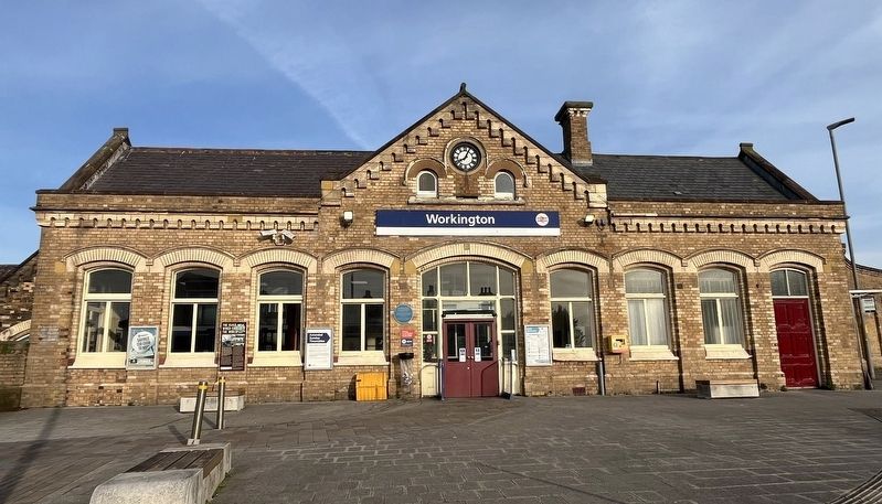
2. Workington Station
Other nearby markers. At least 8 other markers are within walking distance of this marker: James Alexander Smith (here, next to this marker); The Rails Which Circled the World (a few steps from this marker); Remembering World War II (within shouting distance of this marker); The Helena Thompson Museum (within shouting distance of this marker); A History of Workington Station (within shouting distance of this marker); Remembering World War I (within shouting distance of this marker); a different marker also named The Rails Which Circled the World (within shouting distance of this marker); Shipping Throughout the Years (within shouting distance of this marker). Touch for a list and map of all markers in Workington.
Also see . . . Workington railway station (Wikipedia). (Submitted on August 23, 2025, by Michael Herrick of Southbury, Connecticut.)
Photographed by Ray Gurganus, April 11, 2025
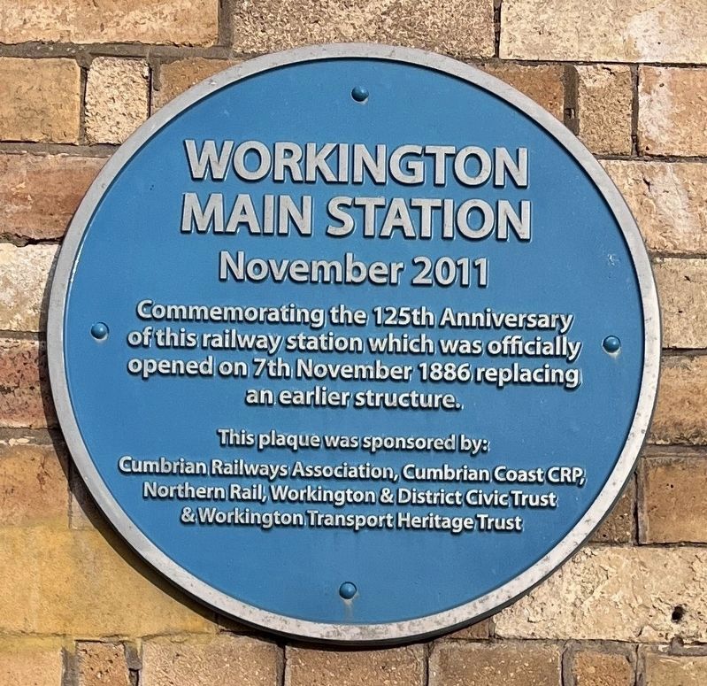
3. Workington Main Station
Credits. This page was last revised on August 23, 2025. It was originally submitted on July 23, 2025, by Ray Gurganus of Washington, District of Columbia. This page has been viewed 61 times since then and 8 times this year. Photos: 1, 2, 3. submitted on July 23, 2025, by Ray Gurganus of Washington, District of Columbia. • Michael Herrick was the editor who published this page.
