Marker Logo
THE HISTORICAL
MARKER DATABASE
“Bite-Size Bits of Local, National, and Global History”
Central Township in Perryville in Perry County, Missouri — The American Midwest (Upper Plains)
 

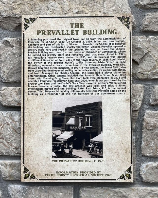
The Prevallet Building
 
 
The Prevallet Building Marker image. Click for full size.
Photographed by Thomas Smith, July 19, 2025
1. The Prevallet Building Marker
Inscription. J. Manning purchased the original town Lot 48 from the Commissioners of Perryville for $67.12 in 1830. On October 2, 1899, Esther and Issac Kampe Kaempfe sold part of this lot to Vincent L. Prevallet for $2,100. It is believed the building was constructed shortly thereafter. Vincent Prevallet opened a jewelry store here and lived in the upstairs. He later purchased the Shoults Blechle Building next door (current home of Chamber of Commerce), where he moved his jewelry store and remained until that store closed in 1971. Mr. Prevallet's jewelry store started in 1895, and his business was located at different times on all four sides of the town square. In 1926, Louis Hecht, the owner of the popular Hecht's Ladies Store on Main Street in Cape Girardeau, opened a branch store here in the Prevallet Building, with Mrs. Oswald Bergman as the manager. In 1927, a new tenant, the Sweet Shop, also from Cape Girardeau opened, selling homemade candies, ice cream, soft drinks, and fruit. Managed by Charles Sepinza, the store had a player plano for entertainment. Other tenants included the Famous Shoe Store, Myer Drug Store
Paid Advertisement
Click or scan to see
this page online
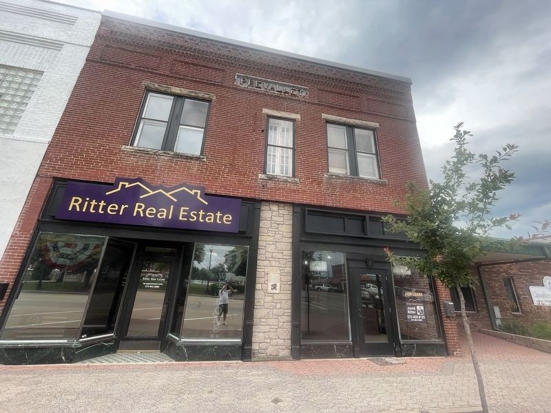
and Manning Drug Store. Ron Horr took over Manning's in 1972 and operated Perryville Prescription here until 2000, when it was purchased by the Brewer Law Firm, and the Daniel's Clock Shop moved in upstairs. When Dennis Brewer became a judge, the law practice was sold, and Edward Jones Investments moved into the building. Ritter Real Estate, LLC, is the current owner. This 120-year-old building still proudly bears the Prevallet name on the building as a reminder of the rich heritage of our downtown square.
 
Erected 2023 by Perry County Historical Society.
 
Topics. This historical marker is listed in these topic lists: Industry & CommerceSettlements & Settlers.
 
Location. 37° 43.553′ N, 89° 51.762′ W. Marker is in Perryville, Missouri, in Perry County. It is in Central Township. It is on West Saint Marie Street 0.1 miles west of N. Main Street, on the right when traveling west. Across from Perry County Courthouse. Touch for map. Marker is at or near this postal address: 6 W Saint Marie Street, Perryville MO 63775, United States of America. Touch for directions.

Regionally,

The Prevallet Building Marker image. Click for full size.
Photographed by Thomas Smith, July 19, 2025
2. The Prevallet Building Marker
this marker is in Southeast Missouri. It is also in the American Lewis & Clark Corridor, in the Corn Belt, and in the Great River Road Region. Globally, it is in North America, the Western Hemisphere, the Western World, and the Anglosphere. Historically, it finds itself in what was once the Viceroyalty of New France, the territory of the Mississippian Culture, the Louisiana Purchase, and the Antebellum South.

Other nearby markers. At least 8 other markers are within walking distance of this marker: Shoults - A. B. C. - Chamber Of Commerce Building (a few steps from this marker); Phillip's Opera House (within shouting distance of this marker); Perry County Union Soldiers Monument (within shouting distance of this marker); Levi Block Building (within shouting distance of this marker); Doerr - Zoellner Building (within shouting distance of this marker); Lurk Brothers Building (within shouting distance of this marker); In Honor of those who served in the Military Forces of America (within shouting distance of this marker); El Camino Real (within shouting distance of this marker). Touch for a list and map of all markers in

The Prevallet Building Marker image. Click for full size.
Photographed by Thomas Smith, July 19, 2025
3. The Prevallet Building Marker
Perryville.
 
 
Credits. This page was last revised on July 30, 2025. It was originally submitted on July 23, 2025, by Thomas Smith of Waterloo, Ill. This page has been viewed 110 times since then and 27 times this year. Photos:   1, 2, 3. submitted on July 23, 2025, by Thomas Smith of Waterloo, Ill. • Andrew Ruppenstein was the editor who published this page.

m=279492

CeraNet Cloud Computing sponsors the Historical Marker Database.
This website earns income from purchases you make after using our links to Amazon.com. We appreciate your support.
Paid Advertisement
Jul. 28, 2026