Oakhill Jackson in Cedar Rapids in Linn County, Iowa — The American Midwest (Upper Plains)
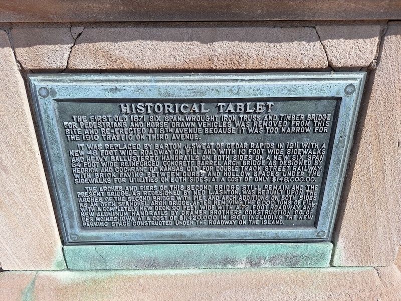
Historical Tablet
Photographed by Jason Voigt, June 19, 2025
1. Historical Tablet Marker
The first old 1871 six span wrought iron truss and timber bridge for pedestrians and horse drawn vehicles was removed from this site and re-erected at 8th Avenue because it was too narrow for the 1910 traffic on Third Avenue.
It was replaced by Barton J. Sweat of Cedar Rapids in 1911 with a new 48 foot wide roadway on fill and with 10 foot wide sidewalks and heavy ballustered handrails on both sides on a new six span 64 foot wide reinforced concrete barrel arch bridge as designed by Hedrick and Cochrane of Kansas City for Double Track Street Railway, with brick paving between curbs and hollow spaces under the sidewalks for utilities on both sides, at a cost of only $148,000.00.
The arches and piers of this second bridge still remain and the present bridge, as redesigned by Ned L. Ashton, was rebuilt upon the arches of the second bridge with pier and arch additions on both sides as an open spandrel arch bridge. After removing the 6,000 tons of fill, with a completely new deck 90 feet wide with a 72 foot roadway and new aluminum handrails by Cramer Brothers Construction Co. of Des Moines, Iowa at a cost of $1,420,000
this page online
Topics. This historical marker is listed in this topic list: Bridges & Viaducts. A significant historical year for this entry is 1871.
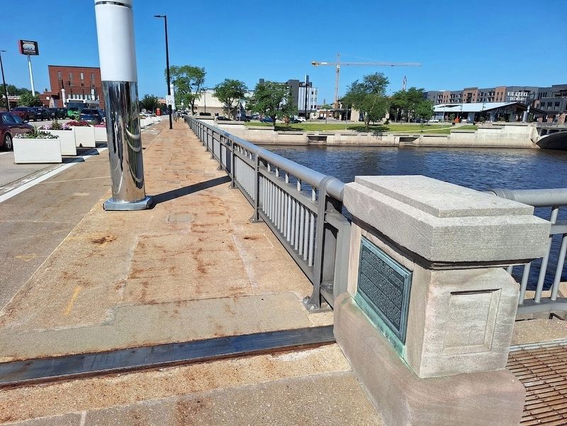
Location. 41° 58.521′ N, 91° 40.234′ W. Marker is in Cedar Rapids, Iowa, in Linn County. It is in Oakhill Jackson. It is on 3rd Avenue Bridge east of 1st Street Southwest, on the right when traveling west. Touch for map. Marker is at or near this postal address: 51 3rd Ave Bridge, Cedar Rapids IA 52401, United States of America. Touch for directions.

Regionally, this marker is in Eastern Iowa. It is also in the American Midwest and in the Corn Belt. Globally, it is in North America, the Western Hemisphere, the Western World, and the Anglosphere. Historically, it finds itself in what was once the territory of the Mississippian Culture and also the Louisiana Purchase.
Other nearby markers. At least 8 other markers are within walking distance of this marker: Vietnam Conflict (about 300 feet away, measured in a direct line); Virgil Powell / King Building Police Station (about 400 feet away); War Memorial (about
Photographed by Jason Voigt, June 19, 2025
2. Historical Tablet Marker
Credits. This page was last revised on July 24, 2025. It was originally submitted on July 24, 2025, by Jason Voigt of Glen Carbon, Illinois. This page has been viewed 87 times since then and 21 times this year. Photos: 1, 2. submitted on July 24, 2025, by Jason Voigt of Glen Carbon, Illinois.
