Norman in Cleveland County, Oklahoma — The American South (West South Central)
100 Block – South
100 Block East Main

Photographed by Duane and Tracy Marsteller, June 20, 2025
1. 100 Block – South Marker
The easternmost buildings, most notably the First National Bank building, were not destroyed. Although any fire is tragic, many of the town's early boosters considered it a blessing. Many of the early buildings were considered shacks and a few weeks after the fire, investors began work on brick buildings to replace those lost.
The blaze began in Holland's Restaurant and quickly moved to Pedro Ramos' Chill Joint next door. The flames and heat were so intense it damaged buildings and goods on the north side of Main Street, where most of the buildings were already made of brick.
Those early brick buildings that followed the fire on the south side included Barbour's Drug Store at 100 E. Main, a popular place to meet friends and the I.O.O.F. Lodge was upstairs. The men could get a shave and a haircut next door at Ira Wheeler's barber shop, an elaborate shop decorated with marble and mirror walls.
Besides
this page online
The era of prohibition that followed with statehood on November 17, 1907 shut down the road houses and taverns in the community. A headline in a November, 1907 Transcript talked of a final “orgy” of booze that heralded the end of legal alcohol.
On the east end of the block, the Norman State Bank occupied the southwest corner of Main Street and Peters Avenue with construction beginning in 1892. It became First National Bank on Feb. 1, 1900. Years later the bank moved to the 100 block of S. Peters Avenue but kept a presence along Main Street with a bank drive-thru and, later, a parking lot.
Merchants got tired of Main Street becoming a mudhole and pushed for street paving by 1911. Electric lights followed giving Norman the appearance of a thriving business district. OG&E operated for many years from a building at 128 E. Main.
McCall's Men's
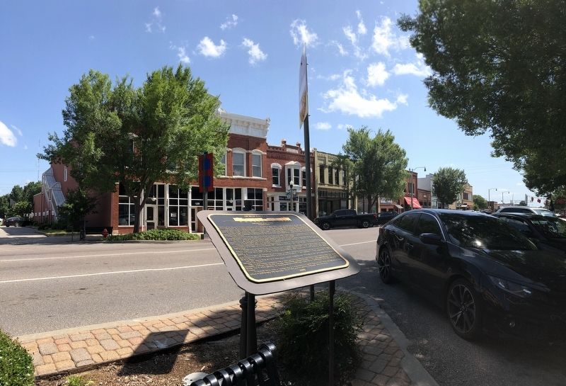
Photographed by Duane and Tracy Marsteller, June 20, 2025
2. 100 Block – South Marker
The Varsity Theatre operated at 108 E. Main, across from the Sooner Theatre from 1937 to 1955. The nearby interurban street car line, on the west side of the railroad, reached Norman in 1913 and operated until 1947. During World War II, when gasoline was scarce, passengers could ride round trip to Oklahoma City on the interurban for 77 cents.
In 1926, the block hosted a bowling alley, two drug stores, two barber shops, a book store, café and various other offices. A photography shop operated at 122 E. Main next to a jewelry store and a hardware store.
Erected 2008.
Topics and series. This historical marker is listed in these topic lists: Disasters • Industry & Commerce. In addition, it is included in the National Register of Historic Places (NRHP) series list. A significant historical date for this entry is November 17, 1907.
Location. 35° 13.292′ N, 97° 26.527′ W. Marker is in Norman, Oklahoma, in Cleveland County. It is at the intersection of East Main Street and North Peters Avenue, on the left when traveling east

Courtesy of Cleveland County Historical Society (Public Domain), circa 1920
3. 100 Block – South
Many buildings in this block, including the C.L.L.C. Building (second from left), were constructed at the turn of the 20th century. The corner building no longer stands; it is now a parking lot. The view is westward from the intersection of Main Street and Peters Avenue.

Regionally, this marker is in Central Oklahoma—Frontier Country and in Greater Oklahoma City. It is also in the American South, specifically on the prairies, and on the Southern Plains. Globally, it is in North America, the Western Hemisphere, the Western World, and the Anglosphere. Historically, it finds itself in what was once the territory of the Mississippian Culture and also the Louisiana Purchase.
Other nearby markers. At least 8 other markers are within walking distance of this marker: 100 Block – North (a few steps from this marker); The Inception of Oklahoma Football (within shouting distance of this marker); 200 Block – South (within shouting distance of this marker); 200 Block North (within shouting distance of this marker); Sooner Theater (about 400 feet away, measured in a direct line); “The Clock Plaza” (about 400 feet away); Norman and Oklahoma's Centennial (about 400 feet away); A History of Norman's “Bank Corner” at Main Street & Peters Avenue (about 400 feet away). Touch for a list and map of all markers in Norman.
Also see . . . Downtown Norman Historic District (boundary expansion) (PDF). National Register of Historic Places nomination that expanded and modified the district (originally listed in 1978) in 2012. (Prepared by Kelli E. Gaston; via State Historic Preservation Office of Oklahoma) (Submitted on July 25, 2025, by Duane and Tracy Marsteller of Murfreesboro, Tennessee.)
Credits. This page was last revised on July 31, 2025. It was originally submitted on July 25, 2025, by Duane and Tracy Marsteller of Murfreesboro, Tennessee. This page has been viewed 89 times since then and 27 times this year. Photos: 1, 2, 3. submitted on July 25, 2025, by Duane and Tracy Marsteller of Murfreesboro, Tennessee.
