
Mackinac Island in Mackinac County, Michigan — The American Midwest (Great Lakes)
The Defenses of Fort Mackinac: The American Fort, 1796 - 1895
Photographed by Bill Coughlin, July 11, 2025
1. The Defenses of Fort Mackinac: The American Fort, 1796 - 1895 Marker
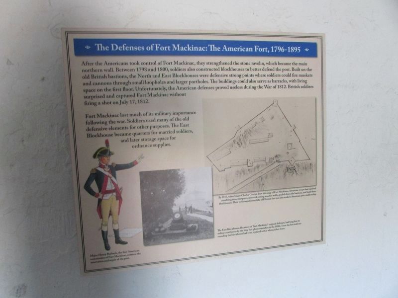
After the Americans took control of Fort Mackinac, they strengthened the stone ravelin, which became the main northern wall. Between 1798 and 1800, soldiers also constructed blockhouses to better defend the post. Built on the old British bastions, the North and East Blockhouses were defensive strong points where soldiers could fire muskets and cannons through small loopholes and larger portholes. The buildings could also serve as barracks, with living space on the first floor. Unfortunately, the American defenses proved useless during the War of 1812. British soldiers surprised and captured Fort Mackinac without firing a shot on July 17, 1812.
Fort Mackinac lost much of its military importance following the war. Soldiers used many of the old defensive elements for other purposes. The East Blockhouse became quarters for married soldiers, and later storage space for ordnance supplies.
Topics. This historical marker is listed in these topic lists: Forts and Castles • War of 1812. A significant historical date for this entry is July 17, 1812.
Location. 45° 51.145′ N, 84° 37.005′ W. Marker is on Mackinac Island, Michigan, in Mackinac
this page online

Regionally, this marker is on Michigan’s Upper Peninsula and on the Straits of Mackinac. It is also in the American Midwest and on the Great Lakes. Globally, it is in North America, the Great North Woods, the Western Hemisphere, the Western World, and the Anglosphere. Historically, it finds itself in what was once the Viceroyalty of New France and also the Northwest Territory.
Other nearby markers. At least 8 other markers are within walking distance of this marker: The Defenses of Fort Mackinac: The British Fort, 1779-1796 (here, next to this marker); The 1780 British Water Well (within shouting distance of this marker); Historic Fort Mackinac (within shouting distance of this marker); Dr. William Beaumont (about 300 feet away, measured in a direct line); Scout Barracks / Parade Ground (about 300 feet away); Flags at Fort Mackinac

Photographed by Bill Coughlin, July 11, 2025
2. The Defenses of Fort Mackinac: The American Fort, 1796 - 1895 Marker
Two markers are found at this location. The Defenses of Fort Mackinac: The American Fort, 1796 - 1895 marker is seen here on the right.
More about this marker. A picture on the lower left of the marker has a caption of “Major Henry Burbeck, the first American commander of Fort Mackinac, oversaw the renovation and repair of the post.
Next to this is a photograph with the caption “The East Blockhouse, like many of Fort Mackinac’s original defenses, had long lost its military usefulness by the time this photo was taken in the 1880s. Even the fort wall surrounding the blockhouse had been replaced with a white picket fence.”
A map of the right side of the marker included a caption of “By 1817, when Major Charles Gratiot drew this map of Fort Mackinac, American troops had repaired crumbling stone ramparts, removed rotting wooden walls, graded down the bastions, and built three blockhouses. Their work transformed the old British fort into the modern American post visible today.”
Also see . . . Fort Mackinac. Mackinac State Historic Parks website. (Submitted on July 27, 2025, by Bill Coughlin of Woodland Park, New Jersey.)

Photographed by Bill Coughlin, July 11, 2025
3. Cannon in the East Blockhouse
Credits. This page was last revised on December 3, 2025. It was originally submitted on July 27, 2025, by Bill Coughlin of Woodland Park, New Jersey. This page has been viewed 103 times since then and 20 times this year. Photos: 1, 2, 3. submitted on July 27, 2025, by Bill Coughlin of Woodland Park, New Jersey.
