Central Oklahoma City in Oklahoma County, Oklahoma — The American South (West South Central)
Oklahoma City No. 1
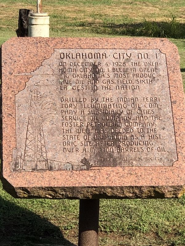
Photographed by Duane and Tracy Marsteller, June 20, 2025
1. Oklahoma City No. 1 Marker
Drilled by the Indian Territory Illuminating Oil Company, a subsidiary of Cities Service Oil Company, and the Foster Petroleum Company, the well was deeded to the State of Oklahoma as a historic site after producing over a million barrels of oil.
Erected 1980 by Oklahoma Historical Society.
Topics and series. This historical marker is listed in these topic lists: Industry & Commerce • Natural Resources. In addition, it is included in the Oklahoma Historical Society series list. A significant historical date for this entry is December 4, 1928.
Location. 35° 24.489′ N, 97° 27.688′ W. Marker is in Oklahoma City, Oklahoma, in Oklahoma County. It is in Central Oklahoma City. It is at the intersection of Itio Boulevard and Southeast 57th Street, on the left when traveling south on Itio Boulevard. Touch for map. Marker is at or near this postal address: 5800 Itio Blvd, Oklahoma City OK 73129, United States of America. Touch for directions.

Regionally, this marker is in Central Oklahoma—Frontier
this page online
Other nearby markers. At least 8 other markers are within 4 miles of this marker, measured as the crow flies: Dedicated to America's Wing 552nd (approx. 2½ miles away); a different marker also named Dedicated to America's Wing 552nd (approx. 2½ miles away); a different marker also named Dedicated to America's Wing 552nd (approx. 2.6 miles away); Staff Sergeant Daniel N. Fannin (approx. 2.6 miles away); a different marker also named Dedicated to America's Wing 552nd (approx. 2.6 miles away); A-7D “Corsair II” (approx. 3.6 miles away); F-105D “Thunderchief” (approx. 3.6 miles away); Major Charles B. Hall & The Tuskegee Airmen (approx. 3.6 miles away). Touch for a list and map of all markers in Oklahoma City.
Also see . . .
1. Oklahoma City Discovery Well (PDF). National Register of Historic Places
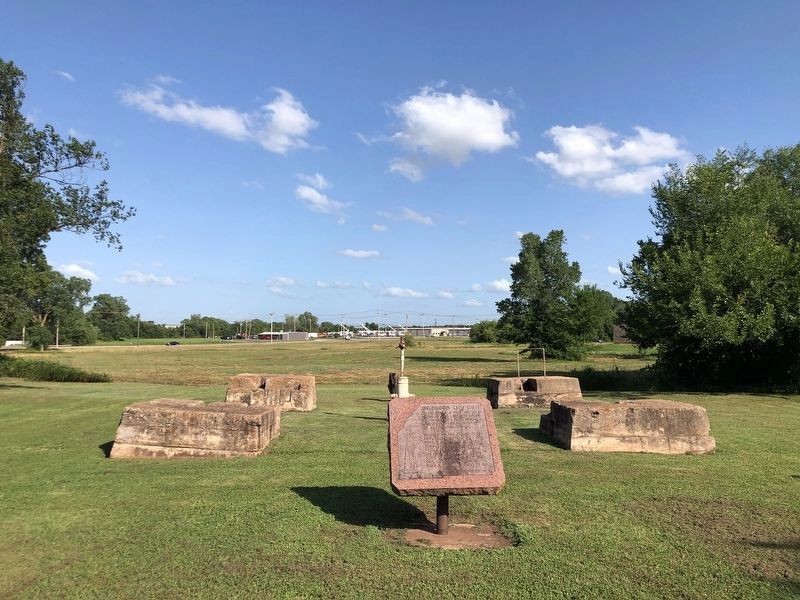
Photographed by Duane and Tracy Marsteller, June 20, 2025
2. Oklahoma City No. 1 Marker
It is in front of the concrete drilling derrick foundations and the capped well head.
2. Black Gold! Oil Gushes in Oklahoma City. While other parts of the state had grown and become wealthy on oil, by the late 1920s Oklahoma City had become a medium-sized capital city with a diversified economy. Things changed very quickly on December 4, 1928 when the Indian Territory Illuminating Oil Company (ITIO), working with Foster Petroleum, found oil at 6,402 feet. (Metropolitan Library System of Oklahoma County (Submitted on July 28, 2025, by Duane and Tracy Marsteller of Murfreesboro, Tennessee.)
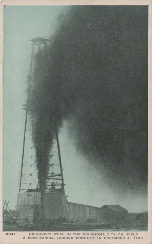
Not idenified; Courtesy of Metropolitan Library System of Oklahoma County (Public Domain), December 4, 1928
3. Oklahoma City Discovery Well
No workers were injured when the well blew in, but some nearby houses were damaged. The well produced more than 110,000 barrels of oil in its first four weeks alone.
Credits. This page was last revised on July 28, 2025. It was originally submitted on July 28, 2025, by Duane and Tracy Marsteller of Murfreesboro, Tennessee. This page has been viewed 225 times since then and 86 times this year. Photos: 1, 2, 3. submitted on July 28, 2025, by Duane and Tracy Marsteller of Murfreesboro, Tennessee.
