Carrizozo in Lincoln County, New Mexico — The American Mountains (Southwest)
Carrizozo
Population 1,222 - Elevation 5,438 Ft
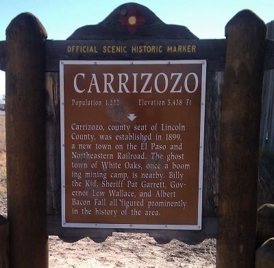
Photographed by Gregory Walker, November 23, 2010
1. Carrizozo Marker
Erected by New Mexico Historic Preservation Division.
Topics. This historical marker is listed in these topic lists: Railroads & Streetcars • Settlements & Settlers. A significant historical year for this entry is 1899.
Location. 33° 39.269′ N, 105° 53.021′ W. Marker is in Carrizozo, New Mexico, in Lincoln County. It is on U.S. 380 at milepost 64.5, 0.2 miles west of B Avenue, on the right when traveling east. Touch for map. Marker is in this post office area: Carrizozo NM 88301, United States of America. Touch for directions.

Regionally, this marker is in the Pecos Valley. It is also in the American Southwest. Globally, it is in North America, the Western Hemisphere, the Western World, and the Anglosphere. Historically, it finds itself in what was once New Spain, the Comanchería, and
this page online
Other nearby markers. At least 8 other markers are within 2 miles of this marker, measured as the crow flies: Malpais (approx. half a mile away); Carrizozo Woman's Club (approx. 0.9 miles away); a different marker also named Carrizozo Woman's Club (approx. 0.9 miles away); End of the Line for the End of a Train (approx. 0.9 miles away); Carrizozo History (approx. 0.9 miles away); a different marker also named Carrizozo (approx. one mile away); a different marker also named Carrizozo (approx. 1.3 miles away); a different marker also named Carrizozo (approx. 1.4 miles away). Touch for a list and map of all markers in Carrizozo.
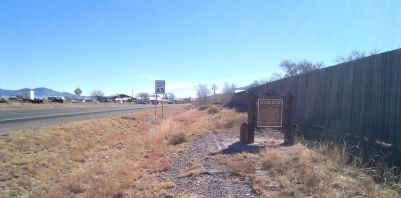
Photographed by Gregory Walker, November 23, 2010
2. Carrizozo Marker, west of town.
Credits. This page was last revised on October 14, 2025. It was originally submitted on December 12, 2010, by Gregory Walker of La Grange, Texas. This page has been viewed 1,281 times since then and 72 times this year. Last updated on July 30, 2025, by Bill Wingate of Albuquerque, New Mexico. Photos: 1, 2. submitted on December 12, 2010, by Gregory Walker of La Grange, Texas. • Devry Becker Jones was the editor who published this page.
