
Columbus in Luna County, New Mexico — The American Mountains (Southwest)
Columbus
Photographed by Bill Kirchner, November 3, 2010
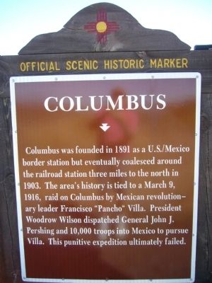
1. Columbus Marker
Columbus was founded in 1891 as a U.S./Mexico border station but eventually coalesced around the railroad station three miles to the north in 1903. The area’s history is tied to a March 9, 1916, raid on Columbus by Mexican revolutionary leader Francisco “Pancho" Villa. President Woodrow Wilson dispatched General John J. Pershing and 10,000 troops into Mexico to pursue Villa. This punitive expedition ultimately failed.
Erected by New Mexico Historic Preservation Division.
Topics and series. This historical marker is listed in this topic list: Settlements & Settlers. In addition, it is included in the Former U.S. Presidents: #28 Woodrow Wilson series list. A significant historical month for this entry is March 1916.
Location. 31° 51.54′ N, 107° 38.957′ W. Marker is in Columbus, New Mexico, in Luna County. It is on State Road 11 at milepost 5.3, on the right when traveling south. Touch for map. Marker is in this post office area: Columbus NM 88029, United States of America. Touch for directions.

Regionally, this marker is in Southwest New Mexico. It is also in the American Southwest. Globally, it is in North America, the
this page online
Other nearby markers. At least 8 other markers are within 3 miles of this marker, measured as the crow flies: James Leander Walker (approx. 2 miles away); Mary Alice and Archibald Douglass (approx. 2 miles away); Columbus Mercantile Company (approx. 2 miles away); James Todd Dean and Charles Chase Miller (approx. 2.1 miles away); "The Columbus State Bank" (approx. 2.1 miles away); William Christopher Hoover (approx. 2.1 miles away); The Commercial Hotel (approx. 2.1 miles away); First Aero Squadron Airfield (approx. 2.2 miles away). Touch for a list and map of all markers in Columbus.
Photographed by Bill Kirchner, November 3, 2010
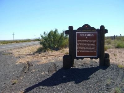
2. Columbus Marker
View south along highway 11.
Photographed by Bill Kirchner, November 3, 2010
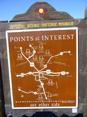
3. Rear of Columbus Marker
Photographed by Bill Kirchner, November 3, 2010
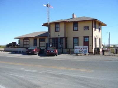
4. Columbus Railroad Station
Credits. This page was last revised on October 1, 2025. It was originally submitted on November 10, 2010, by Bill Kirchner of Tucson, Arizona. This page has been viewed 863 times since then and 20 times this year. Last updated on July 30, 2025, by Bill Wingate of Albuquerque, New Mexico. Photos: 1, 2, 3, 4. submitted on November 10, 2010, by Bill Kirchner of Tucson, Arizona. • J. Makali Bruton was the editor who published this page.
