
San Juan Pueblo (Ohkay Owingeh) in Rio Arriba County, New Mexico — The American Mountains (Southwest)
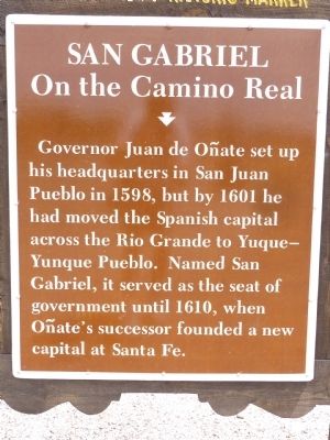
San Gabriel
On the Camino Real
Photographed by Thomas Chris English, June 29, 2010
1. San Gabriel Marker
Governor Juan de Oñate set up his headquarters in San Juan Pueblo in 1598, but by 1601 he had moved the Spanish capital across the Rio Grande to Yuque-Yunque Pueblo. Named San Gabriel, it served as the seat of government until 1610, when Oñate's successor founded a new capital at Santa Fe.
Erected by New Mexico Historic Preservation Division.
Topics and series. This historical marker is listed in these topic lists: Government & Politics • Notable Places • Settlements & Settlers. In addition, it is included in the El Camino Real de Tierra Adentro series list. A significant historical year for this entry is 1598.
Location. 36° 3.017′ N, 106° 3.611′ W. Marker is in San Juan Pueblo (Ohkay Owingeh), New Mexico, in Rio Arriba County. It is on State Road 68, on the right when traveling north. Touch for map. Marker is in this post office area: Alcalde NM 87511, United States of America. Touch for directions.

Regionally, this marker is in Northern New Mexico. It is also in the American Southwest, in the Mountain West, and at the Four Corners. Globally, it is in North America, the Rocky Mountains, the Western
this page online
Other nearby markers. At least 8 other markers are within 5 miles of this marker, measured as the crow flies: Esther Martinez - P’oe Tsáwäˀ (1912-2006) (here, next to this marker); Shrine of Our Lady of Lourdes (approx. 0.7 miles away); Dominguez Escalante Trail (approx. 2.4 miles away); Española Valley (approx. 2.9 miles away); Chimayo Trading Post / Trujillo House (approx. 4.1 miles away); Santa Cruz de la Cañada / Santa Cruz Plaza on the Camino Real (approx. 4.2 miles away); The Bond House (approx. 4.3 miles away); Doña Margarita Martín c1700-1743 / Historic Women of Colonial New Mexico and their Wills 1598 - 1821 (approx. 4½ miles away).
Regarding San Gabriel. Yuque-Ynque Pueblo/San Gabriel no longer exists. Its adobe remains are visible on aerial photos.
One must study every history and people of this area, indeed the puebloan Southwest, to understand why Oñate's insertion of his settlers into Ohkay Owingeh sowed the seeds of the 1680 Pueblo Revolt.
The San Gabriel marker
Photographed by Thomas Chris English, June 29, 2010
2. San Gabriel Marker
State Road 68, Building 854
Alcalde, NM 87511
36.105752N , 106.031762W
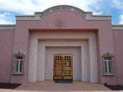
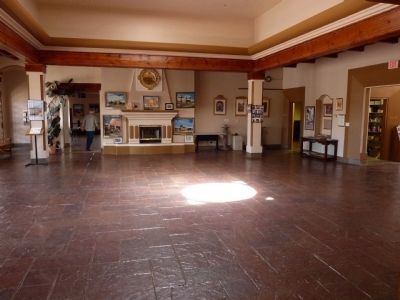
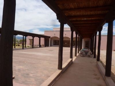
The Center is a beautiful historical institution with library, kitchen, document conversion workstation and performance area. The Center's mission is to provide a center of knowledge for all inhabitants of the area, and provide a point of unity for the residents of the Middle Rio Grande Valley.
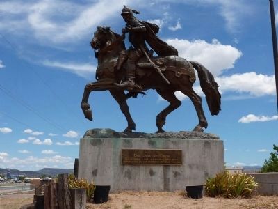
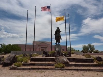
The Oñate statue at the Center was removed by authorities on June 16, 2020 and placed in storage.
Related markers. Click here for a list of markers that are related to this marker. Oñate's subjugation of Acoma Pueblo earned him an official hearing in Spain
Also see . . .
1. Onate Memorial Center. Rio Arriba County website entry (Submitted on July 6, 2010, by Chris English of Phoenix, Arizona.)
2. History of New Mexico. Wikipedia website entry (Submitted on July 6, 2010, by Chris English of Phoenix, Arizona.)
3. Onate's Missing Foot. IAIA Chronicle website entry:>br> The statue at the Onate Center reputedly had a foot removed in 1998, the 400th Anniversary of Onate's settlement of New Mexico.
Photographed by Thomas Chris English, June 29, 2010
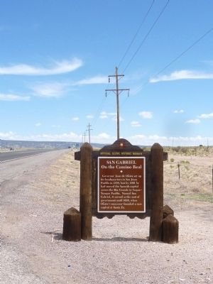
3. San Gabriel Marker
Looking North from the Marker
Photographed by Thomas Chris English, June 29, 2010
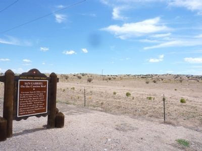
4. San Gabriel Marker
Looking East from the Marker
Photographed by Thomas Chris English, June 29, 2010
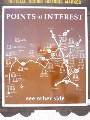
5. Reverse of the San Gabriel Marker
New Mexico Historic Marker Maps
The state's Official Scenic Historic Markers usually have a map on the reverse side showing the location of more local markers. For the die-hard historical marker seeker, these maps are a mine of information, waiting for extraction.
The state's Official Scenic Historic Markers usually have a map on the reverse side showing the location of more local markers. For the die-hard historical marker seeker, these maps are a mine of information, waiting for extraction.
Photographed by Thomas Chris English, June 29, 2010
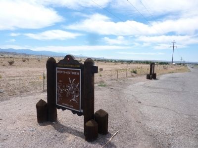
6. San Gabriel Marker
Reverse side, looking south beyond the adjacent Esther Martinez Marker.
Photographed by Thomas Chris English, June 29, 2010
7. Equestrian Statue of Juan de Oñate
Located at the Oñate Center, 5.07 miles North of this marker. This statue was removed on June 16, 2020 by authorities.
Photographed by Thomas Chris English, June 29, 2010
8. The Oñate Center
Phone: (505) 852-4639
Fax: (505) 852-2848
State Road 68, Building 854 P.O. Box 370 Alcalde, NM 87511
36.105752,-106.031762
Photographed by Thomas Chris English, June 29, 2010
9. Oñate Statue and Oñate Center
Photographed by Thomas Chris English, June 29, 2010
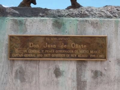
10. Inscription Plaque - Oñate Statue
Don Juan de Oñate
Captain General and First Governor of New Mexico. 1598 - 1610
Photographed by Thomas Chris English, June 29, 2010
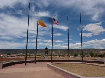
11. View of Alcalde New Mexico
From the Oñate Center. The Rio Grande flows at the foot of the distant hills.
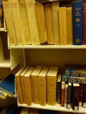
Photographed by Thomas Chris English, June 29, 2010
12. Volumes of Spanish Colonial Law
The bottom-most shelves in the Oñate Center Library contain five volumes of Spanish Colonial law transcribed from the original manuscripts in the Spanish Archives. It was the responsibility of "El Adelantado," first general and Governor of Neuva Mexico to abide by these laws and enforce them with prudence, wisdom and justice. He apparently had a subset of his own laws.
Photographed by Thomas Chris English, June 29, 2010
13. Oñate Memorial Center
Central Room
Photographed by Thomas Chris English, June 29, 2010
14. Oñate Memorial Center
Performance Plaza
Credits. This page was last revised on August 19, 2025. It was originally submitted on July 6, 2010, by Chris English of Phoenix, Arizona. This page has been viewed 3,736 times since then and 137 times this year. Last updated on July 30, 2025, by Bill Wingate of Albuquerque, New Mexico. Photos: 1, 2, 3, 4, 5, 6, 7, 8, 9, 10, 11, 12, 13, 14. submitted on July 6, 2010, by Chris English of Phoenix, Arizona. • J. Makali Bruton was the editor who published this page.
