Spanish Fort in Baldwin County, Alabama — The American South (East South Central)
Blakeley
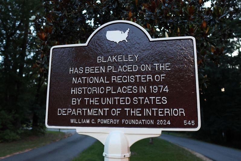
Photographed by Jeff Leichsenring, July 9, 2025
1. Blakeley Marker
National Register of Historical Places Registration Form
Click for more information.
Click for more information.
Erected 2024 by William G. Pomeroy Foundation. (Marker Number 545.)
Topics and series. This historical marker is listed in this topic list: Notable Places. In addition, it is included in the William G. Pomeroy Foundation series list.
Location. 30° 43.947′ N, 87° 53.983′ W. Marker is in Spanish Fort, Alabama, in Baldwin County. It is at the intersection of State Highway 225 and Upper Shay Branch Rd, on the right when traveling south on State Highway 225. Marker is located just inside entrance of Historic Blakeley State Park. Touch for map. Marker is at or near this postal address: 34745 St Hwy 225, Daphne AL 36527, United States of America. Touch for directions.

Regionally, this marker is on the Gulf Coast and in the Mobile Bay area. It is also in the American South, specifically in the Deep South, and on the Gulf Coast. Globally, it is in North America, a Gulf of Mexico state, the Western Hemisphere, the Western World, and the Anglosphere.
this page online
Other nearby markers. At least 8 other markers are within 2 miles of this marker, measured as the crow flies: The Town of Blakeley / The Battle of Fort Blakeley (a few steps from this marker); Saluda Hill Cemetery (about 300 feet away, measured in a direct line); Women's Veterans Memorial (approx. 0.2 miles away); 173d Airborne Brigade (Sep) (approx. 0.2 miles away); Union Artillery Batteries (approx. ¾ mile away); Alabama (approx. 1.2 miles away); Battle of Blakeley (approx. 1.2 miles away); Redoubt Six (approx. 1.2 miles away). Touch for a list and map of all markers in Spanish Fort.
More about this marker. The Blakely Court Square Historic District is a small commercial downtown centered on the Early County Courthouse in extreme southwest Georgia. The courthouse is situated on a slightly raised knoll with gentle downward slopes leading to the edges of the historic district. The town, laid out in 1826, represents a variation
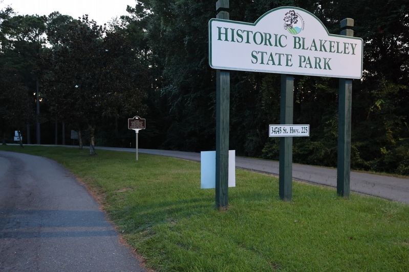
Photographed by Jeff Leichsenring, July 9, 2025
2. Blakeley Marker
Also see . . . Historic Blakely State Park. Encyclopedia of Alabama website entry (Submitted on September 2, 2025, by Larry Gertner of New York, New York.)

Photographed by Jimmy Emerson, 2019
3. Site of Baldwin County's First Courthouse at Blakeley

Photographed by Jimmy Emerson, 2019
4. Foundation of first Baldwin County Courthouse at Blakeley

Photographed by Jimmy Emerson, 2019
5. Old Washington Square
Credits. This page was last revised on May 21, 2026. It was originally submitted on August 2, 2025, by Jeff Leichsenring of Garland, Texas. This page has been viewed 118 times since then and 35 times this year. Photos: 1, 2. submitted on August 2, 2025, by Jeff Leichsenring of Garland, Texas. 3, 4, 5. submitted on May 21, 2026, by Jimmy Emerson of Dalton, Georgia. • James Hulse was the editor who published this page.
