
Thorold in Niagara Region, Ontario — Central Canada (North America)
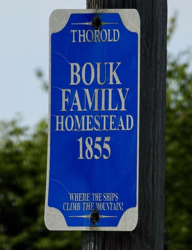
Bouk Family Homestead 1855
Photographed by Kevin Westell, August 1, 2025
1. Bouk Family Homestead 1855 - Marker
Bouk Family Homestead
1855
Where the ships climb the mountain!
Erected by City Of Thorold.
Topics. This historical marker is listed in this topic list: Settlements & Settlers. A significant historical year for this entry is 1855.
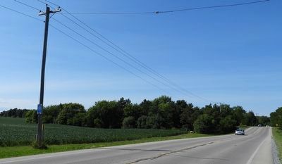
Location. 43° 4.014′ N, 79° 15.074′ W. Marker is in Thorold, Ontario, in Niagara Region. It is on Merrittville Hwy, on the left when traveling south. The marker is a metal sign affixed to a utility pole, on the west side of Merrittville Hwy, 800 metres north of Highway 20. The utility pole is adjacent to a farm field, and 50 metres south of a wooded area. Touch for map. Marker is at or near this postal address: 1983 Merrittville Hwy, Thorold ON L0S 1E6, Canada. Touch for directions.

Regionally, this marker is on Ontario’s Golden Horseshoe and in Niagara Canada. It is also in Central Canada. Globally, it is in North America, on the Great Lakes, in the Western Hemisphere, in the Western World, and in the Anglosphere. Historically, it finds itself in what was once a British colony, the Viceroyalty of New France, the Haudenosaunee (Iroquois) Confederacy,
this page online
Other nearby markers. At least 8 other markers are within 5 kilometers of this marker, measured as the crow flies: St. Johns (approx. 2.6 kilometers away); The Old Welland Canal (approx. 3.4 kilometers away); Celebrating 200 Years of the Welland Canal (approx. 3.4 kilometers away); Allanburg United Church 1876 (approx. 3.7 kilometers away); Dexter D’Everardo (approx. 3.7 kilometers away); Allanburg Village Cemetery c.1813 (approx. 3.7 kilometers away); The Brethren in Christ Church / L’Église de la Fraternité Chrétienne (approx. 4.4 kilometers away); Founding Of Port Robinson (approx. 4.5 kilometers away). Touch for a list and map of all markers in Thorold.
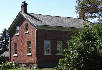
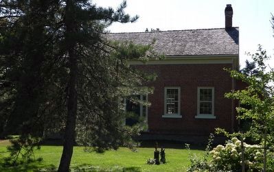
Also see . . . Christian Bouk acquired this property. Christian Bouk acquired this property in 1795. He first built a log house; then a frame house around 1818. George Bouk built this brick house in 1856. It is a five-bay Georgian structure, with 12″ thick walls of bricks hand-made from clay excavated from the basement. In 1872-3 a carriage house, pantry, and summer kitchen were added; which made the house L-shaped. The house was restored in
Photographed by Kevin Westell, August 1, 2025
2. Bouk Family Homestead 1855 - Marker in context
Photo faces north and north-west. The marker (the sign) faces south, so for cars driving south, only the back of the sign is visible on the right. Along this stretch, no other utility pole bears such a sign.
Photographed by Kevin Westell, August 1, 2025
3. Bouk Family Homestead
The home on the west side of the road, 100 metres north of the marker.
Photographed by Kevin Westell, August 1, 2025
4. Bouk Family Homestead
The home on the west side of the road, 100 metres north of the marker.
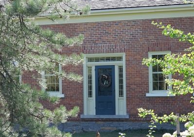
Photographed by Kevin Westell, August 1, 2025
5. Bouk Family Homestead
The home on the west side of the road, 100 metres north of the marker. The front entrance is unused - there are no front stairs and a 2-foot drop.
Credits. This page was last revised on March 12, 2026. It was originally submitted on August 3, 2025, by Kevin Westell of St. Catharines, Ontario. This page has been viewed 119 times since then and 37 times this year. Photos: 1, 2, 3, 4, 5. submitted on August 3, 2025, by Kevin Westell of St. Catharines, Ontario. • Andrew Ruppenstein was the editor who published this page.
