Munford in Botetourt County, Virginia — The American South (Mid-Atlantic)
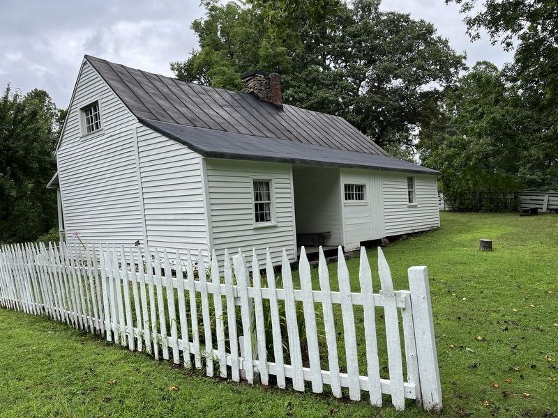
The Johnson Farmhouse

Photographed by Craig Swain, August 2, 2025
1. The Johnson Farmhouse Marker
In 1974, the house was restored to its 1920s appearance. The furnishings where chosen based on information provided by the family and former community residents.
Erected by National Park Service, U.S. Department of the Interior.
Topics. This historical marker is listed in this topic list: Notable Buildings. A significant historical year for this entry is 1974.
Location. 37° 27.33′ N, 79° 36.265′ W. Marker is in Munford, Virginia, in Botetourt County. It is on Johnson Farm Road. The marker is located on the Johnson Farm Trail, part of the Peaks of Otter section of the Blue Ridge Parkway. Touch for map. Marker is at or near this postal address: 125 Johnson Farm Rd, Buchanan VA 24066, United States of America. Touch for directions.

Regionally, this marker is in the Mountain Region. It is also in the American South, specifically in the Upper South, in
this page online
Other nearby markers. At least 8 other markers are within walking distance of this marker: Johnson Farm Apple House (within shouting distance of this marker); Johnson Farm (about 400 feet away, measured in a direct line); The Hotel Mons (approx. half a mile away); Abbott Lake (approx. 0.6 miles away); Polly Woods' Ordinary (approx. 0.7 miles away); A Community at "the Mons" (approx. ¾ mile away); Peaks of Otter (approx. ¾ mile away); Sharp Top Mountain (approx. 0.9 miles away). Touch for a list and map of all markers in Munford.
Also see . . . The Peaks of Otter and the Johnson Farm. Article summarizing the history of the Peaks of Otter area, with details about the Johnson Farm. (Submitted on August 6, 2025, by Craig Swain of Leesburg, Virginia.)
Photographed by Craig Swain, August 2, 2025
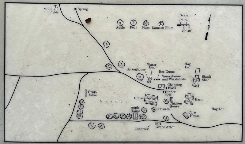
2. Map of the Johnson Farm
The very detailed map shows all the structures and features of the farm, to include locations of trees by species.

Photographed by Craig Swain, August 2, 2025
3. First Floor
Layout of the first floor of the Johnson farmhouse.
Photographed by Craig Swain, August 2, 2025
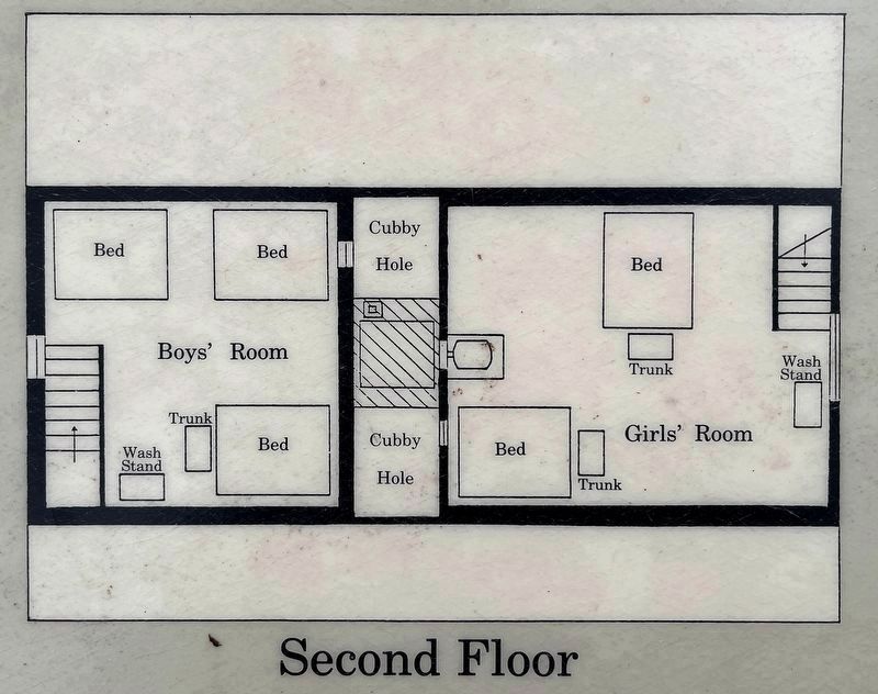
4. Second Floor Floorplan

Photographed by Craig Swain, August 2, 2025
5. Kitchen Addition and Lower Room (1st Floor)
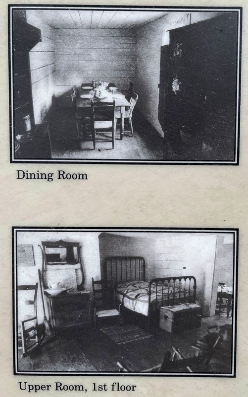
Photos from the reconstructed Johnson farmhouse, from the 1980s.
Photographed by Craig Swain, August 2, 2025
6. Dining Room and Upper Room, 1st Floor
Photographed by Craig Swain, August 2, 2025
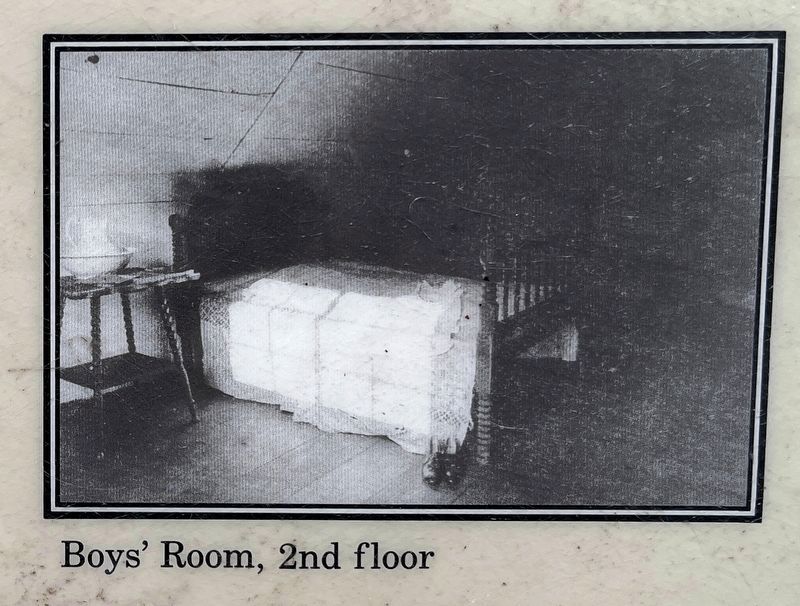
7. Boy's Room, 2nd Floor

Photographed by Craig Swain, August 2, 2025
8. The Johnson Farmhouse Marker

Photographed by Craig Swain, August 2, 2025
9. The Johnson Farmhouse
Photographed by Craig Swain, August 2, 2025
10. Back of the Johnson Farmhouse
Credits. This page was last revised on August 6, 2025. It was originally submitted on August 6, 2025, by Craig Swain of Leesburg, Virginia. This page has been viewed 101 times since then and 30 times this year. Photos: 1, 2, 3, 4, 5, 6, 7, 8, 9, 10. submitted on August 6, 2025, by Craig Swain of Leesburg, Virginia.
