Fairgrounds in Columbus in Franklin County, Ohio — The American Midwest (Great Lakes)
Surveying the Northwest Territory

Photographed by Craig Doda, July 27, 2025
1. Surveying the Northwest Territory Marker
The Seven Ranges: Thomas Hutchins
Thomas Hutchins (1730-1789) was an American military engineer, cartographer, geographer, and surveyor. As a Regular Officer in the British Army and later as a U.S. Army engineer, Hutchins explored our expanding new nation and became an authority on our western frontier. In 1781 he was named Geographer of the United States, and in 1785 was commissioned to survey the Seven Ranges in the Northwest Territory. He was the first surveyor to implement the Public Land Survey System. Hutchins died in 1789 while surveying the Seven Ranges.
The Ohio Company: Rufus Putnam
In 1788, American military officer Rufus Putnam (1738-1824) and others organized The Ohio Company, which purchased about 1 million acres of land north of the Ohio River. Putnam, a veteran of the French and Indian War and the American Revolutionary War, advocated for granting lands to veterans of the Revolution. He and his team reached the mouth of the Muskingum River and founded Marietta, which became America's first permanent settlement within the Northwest Territory. Putnam's role in early Ohio is significant. A distinguished
this page online
Could you brave the wilds of the Northwest Territory?
Surveying was dangerous and physically demanding work during the 18th century. The surveyor's job was to venture into wild, unchartered territories that were at best challenging to navigate, but could also present life- threatening conditions. Their tools were simple-only a compass and metal chain to trace lines along rough terrain.
Day and night, they faced large and often dangerous animals like mountain lion, bear, elk, bison, and wolves. Constantly on the move, surveyors had to make and break camp daily (no doubt sharing their makeshift camps with mosquitoes, snakes, and skunks). Often considered trespassers, surveyors were threatened by indigenous people and early American squatters alike.
Surveying was a slow and perilous task. Diaries left behind by 18th century surveyors tell of the many adversities they faced while retreating, regrouping, and restarting explorations.
In
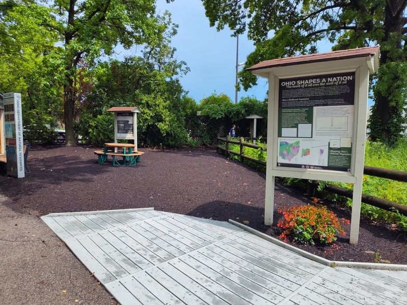
Photographed by Craig Doda, July 27, 2025
2. Surveying the Northwest Territory Marker
Arrival of Rufus Putnam and pioneers at the confluence of the Ohio and Muskingum rivers on April 7, 1788.
Erected by Ohio Department of Natural Resorces Division of Natural Areas & Preserves.
Topics. This historical marker is listed in these topic lists: Exploration • Military. A significant historical date for this entry is April 7, 1788.
Location. 39° 59.66′ N, 82° 59.264′ W. Marker is in Columbus, Ohio, in Franklin County. It is in Fairgrounds. It is at the intersection of East 11th Avenue and Essex Avenue, on the right when traveling west on East 11th Avenue. Located in Natural Resources Park. Touch for map. Marker is at or near this postal address: 632 E 11th Avenue, Columbus OH 43211, United States of America. Touch for directions.

Regionally, this marker is in the Scioto Valley. It is also in the American Midwest and in the Corn Belt. Globally, it is in North America, the Western Hemisphere, the Western World, and the Anglosphere. Historically, it finds itself in what was once the Haudenosaunee (Iroquois) Confederacy, the territory of the Mississippian Culture, and the Northwest Territory.
Other nearby markers. At least 8 other markers are within walking distance of this marker: What Did Ohio's Colonial Settlers See? (here, next to this marker); Ohio Shapes A Nation (here, next to this marker); Rattlesnake Master (a few steps from this marker); Tall Grass Prairie (a few steps from this marker); Bison (a few steps from this marker); Ohio Department of Natural Resources 75th Anniversary (within shouting distance of this marker); Apple Tree (about 400 feet away, measured in a direct line); Ohio Buckeye (about 400 feet away). Touch for a list and map of all markers in Columbus.
Credits. This page was last revised on August 20, 2025. It was originally submitted on August 6, 2025, by Craig Doda of Napoleon, Ohio. This page has been viewed 124 times since then and 24 times this year. Photos: 1, 2. submitted on August 6, 2025, by Craig Doda of Napoleon, Ohio. • Andrew Ruppenstein was the editor who published this page.
