Gouda, South Holland, Netherlands — Northwestern Europe
Station onder vuur en een bommenregen
⎯⎯⎯
Station Under Fire and a Rain of Bombs
Photographed by Andrew Ruppenstein, June 21, 2025
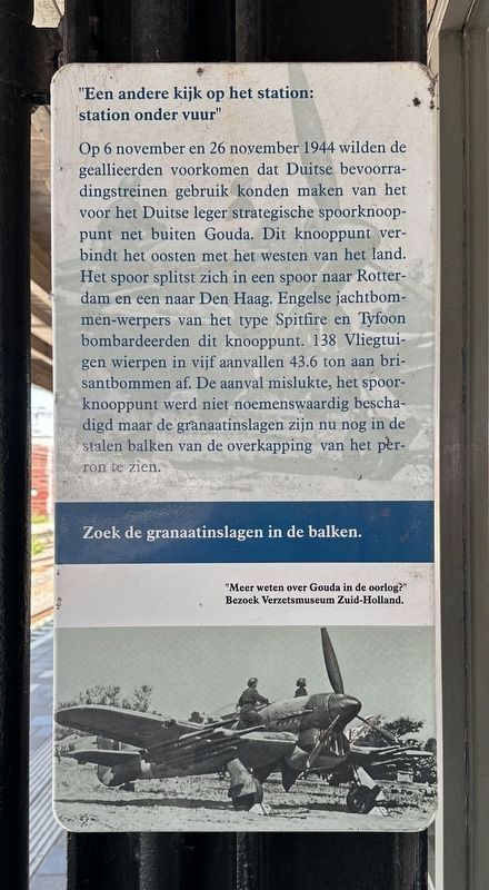
1. Station onder vuur / Station Under Fire panel

Op 6 november en 26 november 1944 wilden de geallieerden voorkomen dat Duitse bevoorradingstreinen gebruik konden maken van het voor het Duitse leger strategische spoorknooppunt net buiten Gouda. Dit knooppunt verbindt het oosten met het westen van het land. Het spoor splitst zich in een spoor naar Rotterdam en een naar Den Haag. Engelse jachtbommen-werpers van het type Spitfire en Tyfoon bombardeerden dit knooppunt. 138 Vliegtuigen wierpen in vijf aanvallen 43.6 ton aan brisantbommen af. De aanval mislukte, het spoorknooppunt werd niet noemenswaardig beschadigd maar de granaatinslagen zijn nu nog in de stalen balken van de overkapping van het perron te zien.
"Een andere kijk op het station: een bommenregen op het station"
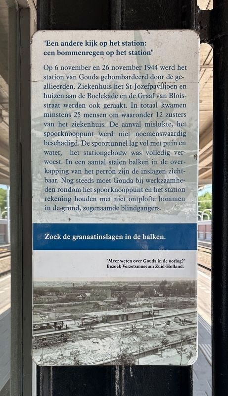
Op 6 november en 26 november 1944 werd het station van Gouda gebombardeerd door de geallieerden. Ziekenhuis het St-Jozefpaviljoen en huizen aan de Boelekade en de Graaf van Bloisstraat werden ook geraakt. In totaal kwamen minstens 25 mensen om waaronder 12 zusters van het ziekenhuis. De aanval mislukte, het spoorknooppunt werd niet noemenswaardig beschadigd. De spoortunnel lag vol met puin en water, het stationgebouw was volledig verwoest. In een aantal stalen balken in de overkapping van het perron zijn de inslagen zichtbaar. Nog steeds moet Gouda bij werkzaamheden rondom het spoorknooppunt en het station rekening houden met niet ontplofte bommen in de grond, zogenaamde blindgangers.
Zoek de granaatinslagen in de balken.
"Meer weten over Gouda in de oorlog?"
Bezoek Verzetsmuseum Zuid-Holland.
"A Different View of the Station: Station Under Fire"
On November 6 and 26, 1944, the Allies attempted to prevent German supply trains from using the strategic railway junction just outside
this page online
"A Different View of the Station: a Rain of Bombs on the Station"
On November 6 and 26, 1944, the Gouda station was bombed by the Allies. The St. Joseph Pavilion hospital and houses on Boelekade and Graaf van Bloisstraat were also hit. At least 25 people were killed, including 12 nurses from the hospital. The attack failed; the railway junction sustained no significant damage. The railway tunnel was filled with rubble and water, and the station building was completely destroyed. The impacts are visible in several steel beams in the platform roof. Gouda still has to be aware of unexploded bombs in the ground, so-called unexploded bombs, during work around the rail junction and the station.
Look
Photographed by Andrew Ruppenstein, June 21, 2025
2. Een bommenregen / A Rain of Bombs panel
"Want to know more about Gouda during the war?" Visit the South Holland Resistance Museum.
Topics. This historical marker is listed in this topic list: War, World II. A significant historical date for this entry is November 6, 1944.
Location. 52° 1.038′ N, 4° 42.397′ E. Marker is in Gouda, Zuid-Holland (South Holland). It can be reached from Stationsplein. Touch for map. Marker is at or near this postal address: Stationsplein 13A, Gouda, Zuid-Holland 2801 AK, Netherlands. Touch for directions.

Regionally, it is in Europe, the European Union, Atlantic Europe, the Benelux Low Countries, the Schengen Area, Western Europe, and the Western World. Historically, it finds itself in what was once the Roman Empire and specifically also the Holy Roman Empire.
Other nearby markers. At least 8 other markers are within walking distance of this marker: Toon Pille (about 120 meters away, measured in a direct line); Nathan Jacob Cats (approx. 0.4 kilometers away); Kazerne / Barracks (approx. 0.4 kilometers away); Bank de wed. Knox and Dortland / Bank of the Widow Knox and Dortland (approx. 0.6 kilometers away); Agnietenkapel / Saint Agatha Chapel (approx. 0.6 kilometers away); Woonhuis voogd Erasmus / Home of Erasmus’ Guardian (approx. 0.6 kilometers away); Turfmarkt 54, 54a en 56 (approx. 0.6 kilometers away); Gouda Synagogue Holocaust Memorial (approx. 0.6 kilometers away). Touch for a list and map of all markers in Gouda.
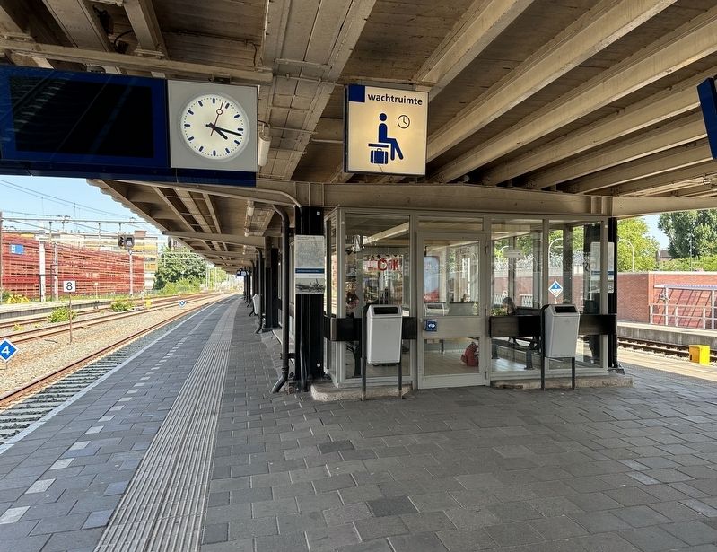
More about this marker. The marker is located on the platform of the Gouda train station.
Photographed by Andrew Ruppenstein, June 21, 2025
3. Station Under Fire and a Rain of Bombs Marker
The two panels are visible here on either side of the entrance to the waiting room on the station platform (looking east, Track 5 is on the left).
circa 1944
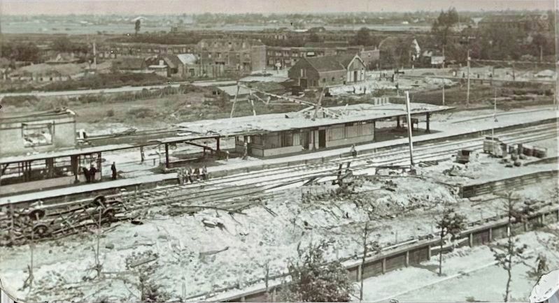
4. Marker photo: Gouda station after the attacks
Credits. This page was last revised on August 6, 2025. It was originally submitted on August 6, 2025, by Andrew Ruppenstein of Lamorinda, California. This page has been viewed 107 times since then and 27 times this year. Photos: 1, 2, 3, 4. submitted on August 6, 2025, by Andrew Ruppenstein of Lamorinda, California.
