Hanover in Hennepin County, Minnesota — The American Midwest (Upper Plains)
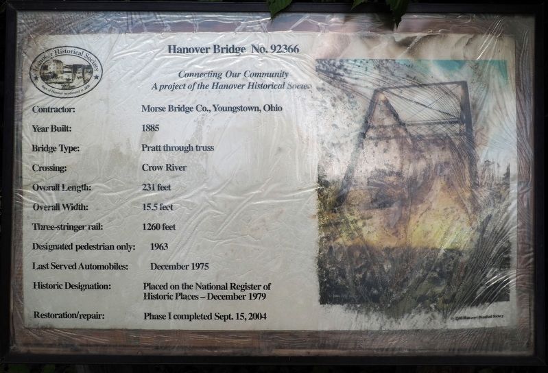
Hanover Bridge No. 92366
Photographed by McGhiever, June 19, 2025
1. Hanover Bridge No. 92366 Marker
A project of the Hanover Historical Society
Contractor: Morse Bridge Co., Youngstown, Ohio
Year Built: 1885
Bridge Type: Pratt through truss
Crossing: Crow River
Overall Length: 231 feet
Overall Width: 15.5 feet
Three-stringer rail: 1260 feet
Designated pedestrian only: 1963
Last Served Automobiles: December 1975
Historic Designation: Placed on the National Register of Historic Places – December 1979
Restoration/repair: Phase I completed Sept. 15, 2004
Erected by Hanover Historical Society.
Topics. This historical marker is listed in this topic list: Bridges & Viaducts. A significant historical year for this entry is 1885.
Location. 45° 9.17′ N, 93° 39.717′ W. Marker is in Hanover, Minnesota, in Hennepin County. It is on 109th Avenue N. (County Road 19), on the right when traveling west. Touch for map. Marker is at or near this postal address: 29953 109th Avenue N, Hanover MN 55341, United States of America. Touch for directions.

Regionally, this marker is in the Twin Cities Metropolitan Area. It is also in the American Midwest, in the Corn Belt, and in the Great River Road
this page online
Other nearby markers. At least 8 other markers are within 10 miles of this marker, measured as the crow flies: Bridge No. 92366—Hanover Pratt Through Truss Bridge (here, next to this marker); Historic 1885 Hanover Bridge (about 300 feet away, measured in a direct line); Burschville School (approx. 2.7 miles away); Dahlheimers in Minnesota (approx. 9.1 miles away); The River Highway (approx. 9.4 miles away); Mississippi River & Woodlands Trail (approx. 9.4 miles away); Relaxing on the River (approx. 9.4 miles away); Oak Woods—A Changing Forest (approx. 9.4 miles away). Touch for a list and map of all markers in Hanover.

Photographed by McGhiever, June 19, 2025
2. Hanover Bridge No. 92366 Marker (left) and the Hanover Bridge

Photographed by McGhiever, July 21, 2015
3. The Hanover Bridge
Credits. This page was last revised on March 27, 2026. It was originally submitted on August 8, 2025, by McGhiever of Minneapolis, Minnesota. This page has been viewed 89 times since then and 22 times this year. Photos: 1, 2, 3. submitted on August 8, 2025, by McGhiever of Minneapolis, Minnesota.
