Ward Estates in Kansas City in Jackson County, Missouri — The American Midwest (Upper Plains)
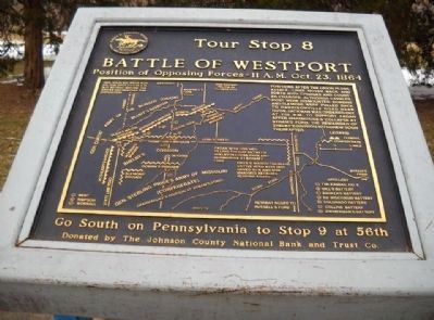
Battle of Westport
Position of Opposing Forces - 11a.m. Oct. 23, 1864
Gen. Sterling Price was on this spot at 11:00 a.m. but retired before the armies had reached this disposition.
Positions after the Union flank attack. Lines moved back and forth with charges and countercharges, although cavalry, most were dismounted. Dobbins and Slemons were pulled back to Harrisonville Road near noon. Jackman was ordered out at 1:00 p.m. to support Fagan after Marmaduke's collapse at Byram's Ford. The remainder of Shelby's Division withdrew soon thereafter.
map of battle of Westport - Third Day
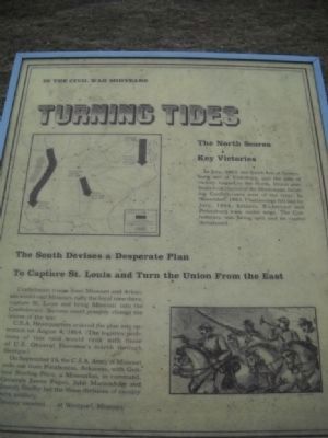
Turning Tides
In the Civil War Midyears the North Scores Key Victories
In July, 1863, the South lost at Gettysburg and at Vicksburg, and the tide of victory turned to the North. Union gunboats took control of the Mississippi, isolating Confederates west of the river. In November, 1863, Chattanooga fell and by July, 1864, Atlanta, Richmond and Petersburg were under siege. The Confederacy was being split and its capitol threatened.
(map of situation mid 1863 - mid 1864)
The South Devises a Desperate Plan to Capture St. Louis and Turn the Union From the East
Confederate troops from Missouri and Arkansas would raid Missouri, rally the loyal men there, capture St. Louis and bring Missouri into the Confederacy. Success could possibly change the course of the war.
C.S.A. Headquarters ordered the plan into operation on August 4, 1864. (The logistics problems of this raid would rand with those of U.S. General Sherman's march through Georgia.)
On September 19, the C.S.A. Army of Missouri rode out from Pocahontas, Arkansas, with General Sterling Price, a Missourian, in command. Generals James Fagan, John Marmaduke and Joseph Shelby led three divisions of cavalry with artillery.
(picture of Confederate cavalry)
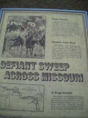
Defiant Sweep Across Missouri
Plans Change
(picture of Price's Raid into Missouri)
The Confederates advanced slowly, stopping for raids and supplies. On September 27, they arrived at Ft. Davidson, south of St. Louis, and attacked. They were repulsed, and, after dark, the outnumbered Union garrison slipped from the fort. Some Southern troops gave chase. Before the Confederates could regroup, St. Louis was alerted. The necessary "moment of surprise" was lost ... and also the major objective of the raid.
Raiders Turn West
General Price's men turned toward Jefferson City, the state capitol. Enroute, they recruited men, and swept the area of mules, cattle and military supplies. But, at Jefferson City, unexpected Union
strength discouraged attack. The army rode on westward, through the river towns, on toward Kansas City and Ft. Leavenworth.
(map of the Campaign of the Army of Missouri)
A Trap Awaits
Meanwhile, two large Union forces were in pursuit from St. Louis: General Alfred Pleasanton's cavalry behind them and General Andrew Smith's infantry to the south. The deep, bridgeless Missouri River was north and General Samuel Curtis' U.S. Army of the Border was ahead.
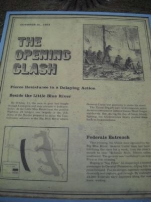
The Opening Clash
October 21, 1864
Fierce Resistance in a Delaying Action Beside the Little Blue River
(picture of skirmish line)
By October 21, the men in gray had fought through Lexington and were enroute to Independence. At the Little Blue River (near the present Highway 24 bridge), one brigade of the U.S. Army of the Border prepared to delay the Confederates' advance to the Big Blue River where General Curtis was planning to make his stand. The Union brigade and reinforcements under division commander James Blunt fought stubbornly. But, during the day of fierce, bloody fighting, the Confederates slowly pushed them back to Independence.
(map of Battle at the Big Blue River)
Federals Entrench
That evening, the Union men retreated to the
Big Blue River. General Curtis' men had been fortifying the river for a week, from the river's mouth to Hickman Mills, fifteen miles southward. The general was "confident I can stop Price at this crossing."
Hoping to "bag Price," he dispatched a trusted messenger to General Pleasanton, urging him to press forward. The messenger, narrowly escaping drowning and capture, got through. By midnight 15,000 were deployed along the west bank, waiting.
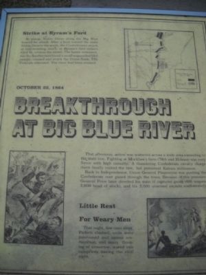
Breakthrough at Big Blue River
22 October 1864
Strike at Byram's Ford
(map of the position of October 22, 1864)
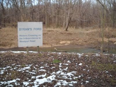
At sunup, Union forces along the Big Blue braced for attack. After a feint toward the main Union force to the north, the Confederates struck at mid-morning, south, at Byram's ford (where 63rd St. crosses the river). The battle seesawed, but the Southerners found a small unguarded ford nearby, crossed and struck the Unoin flank. The Federals retreated. The river had been crossed.
(picture of hand-to-hand fighting)
That afternoon, action was scattered across a wide area extending to the state line. Fighting at Mockbee's farm (78th and Holmes) was very fierce with high casualty. A thundering Confederate cavalry charge there finally routed the raw, but persistent Kansas militiamen.
Back in Independence, Union General Pleasanton was pushing the Confederate rear guard through the town. Because of this pressure, General Price later directed his train of captured goods (600 wagons, 5,000 head of stock), and his 5,000 unarmed recruits soutwesterly.
(picture of troops around campfire)
Little Rest For Weary Men
That night, few men slept. Pickets clashed; units were positioned and issued ammunition; and many, thinking of tomorrow, stared into the campfires during the chill night.
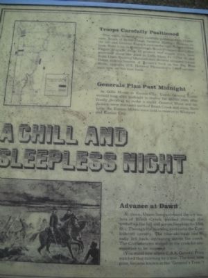
A Chill & Sleepless Night
Troops Carefully Positioned
(map of positions of October 23, 1864)
That night, General Price carefully positioned his 10,000 men. South of Brush Creek, General Shelby's division on the left and General Fagan's men on the right formed a front from State Line to Harrisonville Road (Prospect Ave.). One stretched along the road to Little Santa Fe (121st St. and State Line). General Marmaduke's division occupied former Union entrenchments at Byram's ford on the Big Blue River, opposite U.S. General Pleasanton's 7,000 cavalrymen now on the east bank.
Generals Plan Past Midnight
At Gillis House in Kansas City, Union General Curtis worked long after midnight to deploy his 20,000 men, after finally deciding to make a stand.
General Blunt and his division were stationed north of Brush Creek and along State Line; the Kansas Militia were held in reserve in Westport and in Kansas City.
(picture of Union Officers at the head of their troops)
Advance at Dawn
At dawn, Union troops crossed the icy waters of Brush Creek, pushed through the timber up the hill and across the plain (to 55th St.). Through the morning mist came the Confederate cavalry. The blue skirmish line finally fell back, retreating across the creek. The Confederates waited on the creek for ammunition to be reissued.
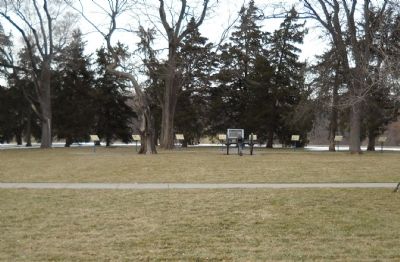
(You now stand where C.S.A. General Price watched that morning by a tree. The tree, now gone, became known as the "General's Tree.")
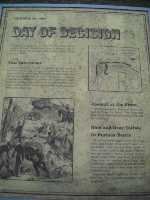
Day of Decision
October 23, 1864
(map of Battle of Westport Oct 23, 1864 11am)
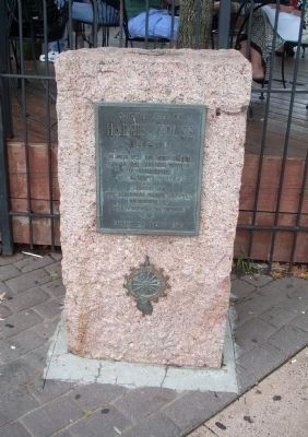
U.S. General Curtis, watching from the Harris House roof in Westport, ordered his reserves forward. He arrived at Brush Creek about 11 a.m. But another Union advance failed.
Fate Intervenes
He was preparing to lead another assault when a local farmer, George Thoman, arrived. The farmer was angry at the Confederates for taking his gray mare, and told General Curtis how to reach the the hilltop - and the Confederate left flank - undetected. Curtis' men,
with artillery, followed him up a small ravine (now Rockwell Lane and Sunset Drive) and shocked the Southerners by firing down their line.
(picture of Union attack)
Assault at the Front
Simultaneously, General Blunt attacked from the front. The bluecoats poured up and over the heights, followed by artillery.
Blue and Grey Collide in Furious Battle
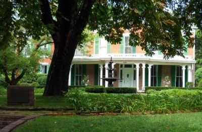
A furious battle raged across the stone walls and brown, frost-killed fields - a screaming, hacking, exploding melee of men, horses, sabers, and guns. Fighting was particularly fierce around William Bent's house (55th and Ward Parkway). More than 40 cannon were firing. One Confederate battery fired so rapidly that a cannon burst from its heat (near 56th and Pennsylvania).
Superior Union numbers finally took their toll. The Confederates slowly gave up ground.
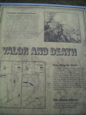
Valor & Death
Collapse on Second Front
At the same time that morning at Byram's ford on the Big Blue River, General Pleasonton's bluecoats were fighting a pitched battle against General Marmaduke's men. The Southerners were entrenched by the river and on steep rock ledges to the west. They had superior position, but were outnumbered two to one and low on ammunition. After long, bloody, hand-to-hand combat, they were pushed to the Harrisonville Road (Prospect Ave.) where they retreated south.
General Fagan's division and one of General Shelby's brigades then engaged General Pleasonton's men. But the Union forced through and a battery came upon General Shelby's right flank at Hinkle Grove (63rd and Walnut) about 1:30 p.m. and opened up with a searing fire.
(maps of the Battle afternoon October 23, 1864)
Iron Brigade Holds
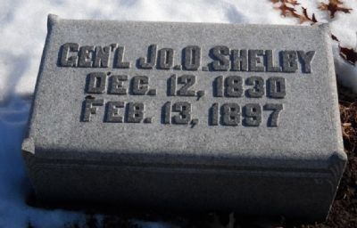
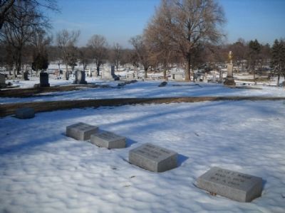
Caught in a pincers, General Shelby's "Iron Brigade" made a last desperate stand behind stone fences (now 71st St.) which stretched to the state line. (His right flank fought where Forest Hill Cemetery is now - where both farmer George Thoman and General Shelby would be buried years later.) This delaying action allowed Generals Fagan and Marmaduke and the wagon train to retreat south along the state line. The "Iron Brigade" then fell back in orderly retreat.
The Chase Begins
Union Commanders met at Indian Creek to decide who should give chase. The Confederates rode on southward.
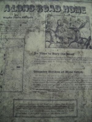
A Long Road Home
(picture of Union and Confederate cavalry clash)
The wagon train miraculously survived the day. General Smith's 6,000 infantry men veered north and missed intercepting it. The Union brigade dispatched by General Pleasonton to destroy it, was repulsed then later fooled by a "battle line" of unarmed recruits and finally turned back by a grass fire set by the Southerners.
(map of the Confederate retreat & Union pursuit through Kansas & Missouri)
No Time to Bury the Dead
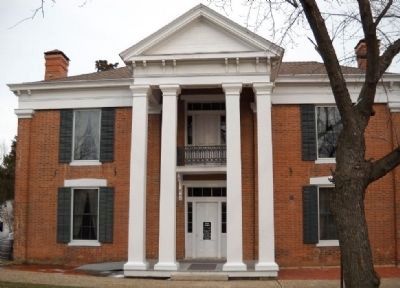
Dead and wounded were left on the fields to be gathered up by local farmers. (One mass grave was near 55th St. and Ward parkway) John Wornall's Home (61st St. Terrace and Wornall) served as field hospital for both sides.
Disaster at Mine Creek
On October 25, Union cavalry caught the Confederates crossing Mine Creek in Kansas, 65 miles south and killed and captured many. General Price burned one third of the wagon train the next day to speed retreat. On October 28, the Union attacked again at Newton Missouri. They ended pursuit at Fayetteville, Arkansas, November 4.
After enduring cold, starvation and smallpox during their march across the Choctaw Nation, the raiders finally disbanded at Laynesport, Arkansas, December 2, 1864.
Southern Resistance in the West was broken. The Battle of Westport was the last major Civil War battle west of the Mississippi. More than 30,000 men fought approximately 10,000 Confederates and 20,000 Federals. Some estimate that 3,500 were killed or wounded though no one knows exactly.
Erected by The Johnson County
National Bank and Trust Co. (Marker Number 8.)
Topics and series. This historical marker is listed in this topic list: War, US Civil. In addition, it is included in the Missouri – Battle of Westport series list. A significant historical month for this entry is July 1863.
Location. 39° 1.704′ N, 94° 35.672′ W. Marker is in Kansas City, Missouri, in Jackson County. It is in Ward Estates. Marker is on West 55th Street, 0.1 miles north of Pennsylvania Avenue, on the right when traveling east. Park on Summit Street. Touch for map. Marker is in this post office area: Kansas City MO 64112, United States of America. Touch for directions.
Other nearby markers. At least 8 other markers are within walking distance of this marker. A different marker also named Battle of Westport (about 700 feet away, measured in a direct line); McGhee's Charge (approx. 0.2 miles away); The French and the Osage (approx. 0.3 miles away); Carolyne Farwell Fuller (approx. 0.4 miles away); Centennial Anniversary of Japan's Gift of Cherry Trees (approx. 0.4 miles away); William Bent - Seth Ward Home (approx. 0.4 miles away); Bent & Ward Houses (approx. 0.4 miles away); First Home of the Kansas City Country Club (approx. 0.4 miles away). Touch for a list and map of all markers in Kansas City.
Regarding Battle of Westport. From the Kansas City Parks & Recreation website:
http://www.kcmo.org/CKCMO/Depts/ParksandRecreation/LoosePark/index.htm
At 75-acres, Jacob L. Loose Park, is one of Kansas City's most popular and beautiful and also has an interesting history. The park is well-known locally as being a major site for the Battle of Westport where Confederate forces holding ground where the park is now located were routed by Union forces. It is estimated that 29,000 people were involved in the battle. The property at that time was owned by William Bent who led wagon trains and traded with the Indians.
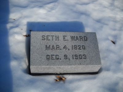
Seth Ward bought the property in 1871 after William Bent’s death. In 1896 a group of people, many of whom had been members of the golf club near Hyde Park, incorporated as the Kansas City Country Club and signed a lease with Seth Ward to use part of his property as a golf course for $1 a year plus taxes. The property included what is now Loose Park and was used as a golf course until 1927. In 1926, Ella Loose bought the property from the Hugh Ward estate (the son of Seth Ward) so that it could be made into a park to honor her husband, Jacob Loose. She gave the property to the city in 1927. Jacob Loose founded the Loose-Wiles Biscuit Company which produced Sunshine Biscuits and other products and died in 1923.
My commentary:
Ella Loose was approached by leading citizens of Kansas City to commemorate the Battle Area like other cities had with monuments, etc. Ella was horrified of the
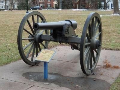
Photographed By Thomas Onions, February 28, 2010
11. Battle of Westport Marker
Closeup of 10 pounder Parrott Gun at the marker site.
Text on small marker below cannon:
Battle of Westport
October 21-23, 1864
This Display Made Possible By Generous Community Support
The 1976 Eagle Scout Project OF John Douglas Dietrich
Ten-Pounder Parrott Gun
Text on small marker below cannon:
Battle of Westport
October 21-23, 1864
This Display Made Possible By Generous Community Support
The 1976 Eagle Scout Project OF John Douglas Dietrich
Ten-Pounder Parrott Gun
Also see . . .
1. Battle of Westport. Link from the Civil War Muse with further information on this tour stop. (Submitted on March 2, 2010, by Thomas Onions of Olathe, Kansas.)
2. Battle of Little Blue River. Wikipedia entry on the opening clash at the Little Blue River - the opening skirmish of the Battle of Westport. (Submitted on March 7, 2010, by Thomas Onions of Olathe, Kansas.)
3. Battle of Mine Creek. Wikipedia entry on the Battle of Mine Creek (Submitted on March 7, 2010, by Thomas Onions of Olathe, Kansas.)
4. Sterling Price. Wikipedia entry on the life and career of the C.S.A. Commander of the Battle. (Submitted on March 7, 2010, by Thomas Onions of Olathe, Kansas.)
5. Joseph Shelby. Wikipedia link to the life & career of the commander of the Confederate "Iron Brigade" and the officer that saved the Confederate Army more than once from disaster. (Submitted on March 7, 2010, by Thomas Onions of Olathe, Kansas.)
6. John S Marmaduke. Wikipedia link on the life and career of Confederate division commander who took and lost Byram's Ford during the Battle of Westport. (Submitted on March 7, 2010, by Thomas Onions of Olathe, Kansas.)
7. James Fagan. Wikipedia entry of the life and career of Confederate Division commander whose command was hard hit throughout
the Campaign. (Submitted on March 7, 2010, by Thomas Onions of Olathe, Kansas.)
8. Samuel Curtis. Wikipedia link to the Union Officer that was in overall command at the Battle of Westport. (Submitted on March 7, 2010, by Thomas Onions of Olathe, Kansas.)
9. Alfred Pleasonton. Wikipedia Link to the life and career of the Commander of the Union Forces pursuing General Price across Missouri. (Submitted on March 7, 2010, by Thomas Onions of Olathe, Kansas.)
10. John Wornall House. Link from Jackson County Historical Society on the historic Wornall House. (Submitted on March 7, 2010, by Thomas Onions of Olathe, Kansas.)
11. Loose Park. Wikipedia Entry of the Park where the markers are located. (Submitted on March 7, 2010, by Thomas Onions of Olathe, Kansas.)
12. Parrott Rifle. Wikipedia Link discussing the Parrott Rifle - including this common ten-pounder field piece. (Submitted on March 7, 2010, by Thomas Onions of Olathe, Kansas.)
13. Little Santa Fe. Link to the Little Santa Fe Historical Society (Submitted on March 7, 2010, by Thomas Onions of Olathe, Kansas.)
Credits. This page was last revised on February 10, 2023. It was originally submitted on March 2, 2010, by Thomas Onions of Olathe, Kansas. This page has been viewed 3,368 times since then and 85 times this year. Photos: 1. submitted on March 2, 2010, by Thomas Onions of Olathe, Kansas. 2, 3, 4, 5, 6, 7, 8, 9. submitted on March 7, 2010, by Thomas Onions of Olathe, Kansas. 10, 11. submitted on March 2, 2010, by Thomas Onions of Olathe, Kansas. 12, 13, 14. submitted on March 7, 2010, by Thomas Onions of Olathe, Kansas. 15. submitted on July 14, 2009, by Thomas Onions of Olathe, Kansas. 16. submitted on August 17, 2009, by Thomas Onions of Olathe, Kansas. 17. submitted on February 28, 2010, by Thomas Onions of Olathe, Kansas. 18. submitted on March 7, 2010, by Thomas Onions of Olathe, Kansas. 19. submitted on June 21, 2009, by Thomas Onions of Olathe, Kansas.
