Oswego in Oswego County, New York — The American Northeast (Mid-Atlantic)
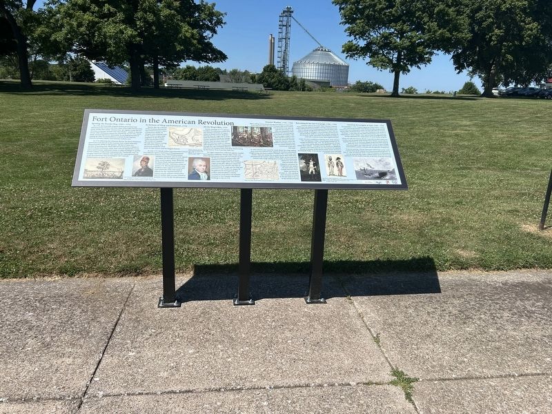
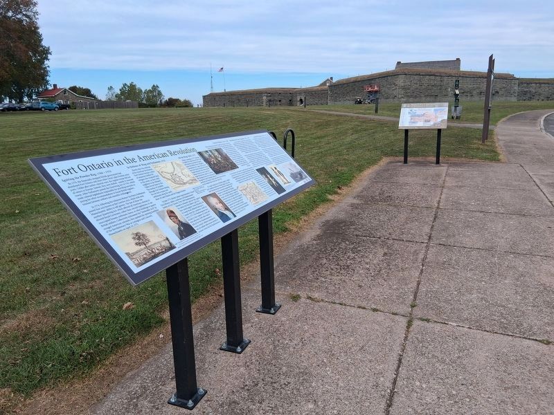
Fort Ontario in the American Revolution

Photographed by Steve Stoessel, July 23, 2025
1. Fort Ontario in the American Revolution Marker
Igniting the Powder Keg, 1765 - 1775
By 1770, the financially strapped British government had abandoned Fort Ontario and most other Great Lakes frontier army posts. Unlike after earlier colonial wars, the regular troops did not all return to Europe. Instead, they were shifted - mainly to seacoast towns. After Parliament passed the Quartering Act of 1765, which made colonial legislatures responsible for providing barracks or paying for other accommodations to house British regulars, tensions between soldiers and resentful civilians rose.
In 1774, following the infamous Boston Tea Party, Parliament passed four acts known as the Coersive Acts, which took away Massachusetts' ability to self-govern. The last of these was another Quartering Act, which affected all American colonies; it allowed Royal Governors, rather than colonial legislatures, to use unoccupied houses, outhouses, barns, or other buildings to quarter British soldiers. Collectively nicknamed the "Intolerable Acts" by enraged American colonists, they sparked the opening hostilities of the Revolutionary War at Lexington and Concord, Massachusetts on April 19,
this page online
In Defense of King and Parliament, 1775
Shortly after the outbreak of the American Revolution, Fort Ontario became a place of temporary shelter for refugees who remained loyal to the crown, as their rebel neighbors in the Mohawk Valley forced them to flee. The exodus of Loyalists through Fort Ontario during the war led to many new settlements along the north shore of Lake Ontario and the Niagara frontier.
In June 1775, British Indian Superintendent Colonel Guy Johnson called a conference of Haudenosaunee leaders at Fort Ontario. Over 1300 Haudenosaunee listened to Johnson's plea for help against the rebels, but they failed to give him their united support. Some Mohawks, led by Joseph Brant, followed Johnson to Canada when the conference closed on July 8, 1775. The Haudenosaunee were divided in their support of Crown and rebel adherents. Both sides made it difficult for the Haudenosaunee to remain neutral without consequence, and yet neither side's success seemed promise victory for the Haudenosaunee.
All the King's Men, 1777
British campaign in 1777 planned to exploit the waterways of New York and seemed to

Photographed by Steve Stoessel, July 23, 2025
2. Left Side of Marker
St. Leger's mixed force of British regulars, Loyalist and Canadian auxiliaries, Hessian Jäger Corps, and allied Haudenosaunee forces left Fort Ontario on July 26, but encountered unexpectedly stiff resistance at rebel-held Fort Schuyler. After a hard-fought battle near Oriskany on August 6 and after failing to compel the surrender of Fort Schuyler with days of bombardment, St. Leger quit his siege and returned to Fort Ontario on August 26. He gathered the Fort's garrison and artillery and retreated to Canada. Continental troops from Fort Schuyler returned to Fort Ontario's abandoned buildings in July of 1778.
Rebuilding & the Last Campaign, 1782 - 1783
Governor-general of Canada Major General Frederick Haldimand was aware of Oswego's strategic

Photographed by Steve Stoessel, July 23, 2025
3. Middle Section of Marker
Under the severe conditions of driving snow, wind, extreme cold, and darkness, Willet's Oneida guide became lost. At sunrise on February 12th, 1783, the attacking party of New York Levies and the Rhode Island Regiment - made up of mostly Black soldiers - emerged from the woods at a significant distance, but visible from the fort. Having lost the essential element of surprise, Willet and his frozen troops returned to the Mohawk Valley. It was the last Continental Army campaign of the Revolutionary War.
American Sovereignty at Last, 1783 - 1796
On September 3, 1783, Congress signed the Treaty of Paris, ending the American Revolution. Great Britain formally recognized the United States as an independent nation, but they still held Fort Ontario and six other "Northwest Posts" from

Photographed by Steve Stoessel, July 23, 2025
4. Right Side of Marker
While they held Fort Ontario, British troops did not allow Americans to settle near the mouth of the Oswego River. British customs officers imposed stiff duties on American cargoes of salt from Salina shipped down the river. A Continental Army veteran living at Oswego Falls (now Fulton) was a paid informer and alerted Fort Ontario's commandant to settler's activities and the approach of shipments.
It was not until the 1794 Jay Treaty that United States troops under Captain James Bruff replaced Fort Ontario's last British garrison on July 14, 1796. An observer wrote, "I have the pleasure of informing you that the American flag, under a Federal salute, was for the first time displayed from the citadel of this fort, at the hour of ten this morning."
Topics. This historical marker is listed in these topic lists: Forts and Castles • War, US Revolutionary. A significant historical date for this entry is February 12, 1783.
Location. 43° 27.863′ N,
Photographed by Steve Stoessel, July 23, 2025
5. Fort Ontario in the American Revolution Marker

Regionally, this marker is in Upstate New York, specifically in Central New York, and in the Syracuse Metropolitan Area. It is also in the American Northeast and in the Mid-Atlantic. Globally, it is in North America, on the Great Lakes, in the Western Hemisphere, in the Western World, and in the Anglosphere. Historically, it finds itself in what was once New Netherland and also one of the original Thirteen Colonies.
Other nearby markers. At least 8 other markers are within walking distance of this marker: Prideaux's Campaign (a few steps from this marker); Fort Ontario in World War I (a few steps from this marker); The Post Ghost (within shouting distance of this marker); African Troops at Fort Ontario (within shouting distance of this marker);
Photographed by Scott J. Payne, September 26, 2026
6. Fort Ontario in the American Revolution Marker
Credits. This page was last revised on October 6, 2026. It was originally submitted on August 9, 2025, by Steve Stoessel of Niskayuna, New York. This page has been viewed 147 times since then and 54 times this year. Photos: 1, 2, 3, 4, 5. submitted on August 9, 2025, by Steve Stoessel of Niskayuna, New York. 6. submitted on September 26, 2026, by Scott J. Payne of Deposit, New York.
