Brentsville in Prince William County, Virginia — The American South (Mid-Atlantic)
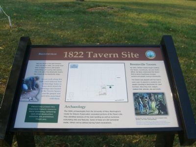
1822 Tavern Site
Brentsville
If you had stood in this spot between 1822 and about 1900, you would have seen a large structure to your right, bustling with activity. This is the site of the Brentsville Tavern, also know as the Brentsville Hotel. You would have also seen the Courthouse and the Jail. Before the Civil War, the Clerk’s Office would also have been visible.
As you walk along this path, you’ll discover how archaeology helps us learn more about the buildings once located in the Tavern Square and the people and activities associated with them.
(sidebar) Please help us protect this important historic resource. Metal detecting, collecting and other destructive activities are prohibited. Thank you.
Archaeology
The 2004, archaeologists from the University of Mary Washington’s Center for Historic Preservation excavated portions of the Tavern site. They identified sections of the main building as well as numerous outbuilding sites and features. Some of these are still somewhat visible. Others will be defined during future excavations.
Brentsville Tavern
By 1822, William Claytor began building the Tavern, Courthouse, Jail and Clerk’s Office. He likely constructed the Tavern first to serve Courthouse complex workers and people moving to Brentsville.
The Tavern was aligned with the town’s main road. It catered to residents and people traveling to Brentsville for court business. Here they met, lodged, stabled their animals, ate and drank.
(caption for lower, right picture)Brentsville Tavern patrons may have enjoyed music, dancing, and other entertainment.
Merrymaking at the Wayside Inn, ca. 1812, by John Lewis Krimmel (1786-1821). Courtesy of the Metropolitan Museum of Art, Rogers Fund, 1942 (42.95.12). Photograph copyright 1989 The Metropolitan Museum of Art
Erected 2007 by Prince William County and the Friends of Brentsville Courthouse Historic Centre.
Topics. This historical marker is listed in these topic lists: Colonial Era • Settlements & Settlers. A significant historical year for this entry is 1822.
Location. 38° 41.373′ N, 77° 30.059′ W. Marker is in Brentsville, Virginia, in Prince William County. Marker is on Bristow Road (County Route 806), on the right. Touch for map. Marker is at or near this postal address: 12235 Bristow Road, Bristow VA 20136, United States of America. Touch for directions.
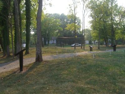
Other nearby markers. At least 12 other markers are within walking distance of this marker. The Tavern (here, next to this marker); Tavern Cellar (a few steps from this marker); Outbuildings (a few steps from this marker); Tavern Square (within shouting distance of this marker); a different marker also named Tavern
(within shouting distance of this marker); Tavern Archaeology (within shouting distance of this marker); Tavern Lot (within shouting distance of this marker); Union Church (within shouting distance of this marker); a different marker also named 1822 Tavern Site (within shouting distance of this marker); Clerk's Office (within shouting distance of this marker); The Town (within shouting distance of this marker); One-Room School (within shouting distance of this marker). Touch for a list and map of all markers in Brentsville.
More about this marker. Prince William County and the Friends of Brentsville Courthouse Historic Centre added several markers in May 2007. This marker is between Union Church and the One-Room School.
Credits. This page was last revised on July 8, 2020. It was originally submitted on October 6, 2007, by Kevin W. of Stafford, Virginia. This page has been viewed 1,146 times since then and 16 times this year. Photos: 1, 2. submitted on October 6, 2007, by Kevin W. of Stafford, Virginia.

