
Milford Mine Memorial Park near Wolford in Crow Wing County, Minnesota — The American Midwest (Upper Plains)
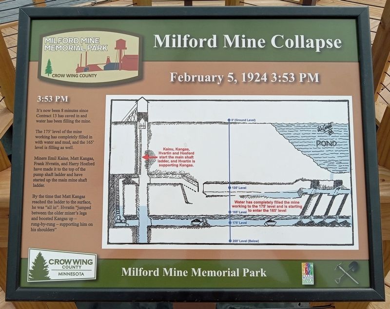
Milford Mine Collapse
February 5, 1924 3:53 PM
| — | Milford Mine Memorial Park | — |
Photographed by McGhiever, June 27, 2025
1. Milford Mine Collapse Marker
3:53 PM
It's now been 8 minutes since Contract 13 has caved in and water has been filling the mine.
The 175' level of the mine working has completely filled in with water and mud, and the 165' level is filling as well.
Miners Emil Kaine, Matt Kangas, Frank Hvratin, and Harry Hosford have made it to the top of the pump shaft ladder and have started up the main mine shaft ladder.
By the time that Matt Kangas reached the ladder to the surface, he was "all in". Hvratin "jumped between the older miner's legs and boosted Kangas up – rung-by-rung – supporting him on his shoulders"
Erected by Crow Wing County.
Topics. This historical marker is listed in this topic list: Disasters. A significant historical date for this entry is February 5, 1924.
Location. 46° 32.142′ N, 93° 58.152′ W. Marker is near Wolford, Minnesota, in Crow Wing County. It is in Milford Mine Memorial Park. It can be reached from Milford Lake Drive. The marker is at the end of the pier in Milford Lake. Touch for map. Marker is in this post office area: Crosby MN 56441, United States of America. Touch for directions.

Regionally, this marker is in Minnesota’s
this page online
Other nearby markers. At least 8 other markers are within walking distance of this marker: A different marker also named Milford Mine Collapse (here, next to this marker); a different marker also named Milford Mine Collapse (here, next to this marker); a different marker also named Milford Mine Collapse (here, next to this marker); Foley Pond/Milford Lake (here, next to this marker); Geology (within shouting distance of this marker); Milford Mine Pre-Disaster (within shouting distance of this marker); Timber Shaft (about 400 feet away, measured in a direct line); Milford Miners Memorial (about 400 feet away). Touch for a list and map of all markers in Wolford.
Photographed by McGhiever, June 27, 2025
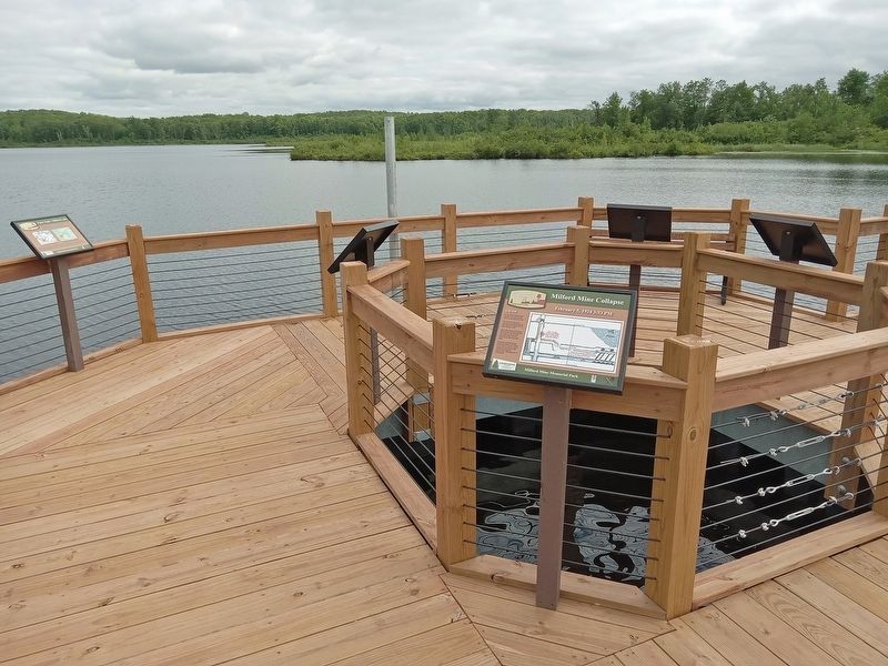
2. 3:53 PM Marker (foreground) directly above the site of the 1924 collapse
Credits. This page was last revised on August 10, 2025. It was originally submitted on August 10, 2025, by McGhiever of Minneapolis, Minnesota. This page has been viewed 132 times since then and 22 times this year. Photos: 1, 2. submitted on August 10, 2025, by McGhiever of Minneapolis, Minnesota.
