Lyme in Lower Connecticut River Valley Region, Connecticut — The American Northeast (New England)
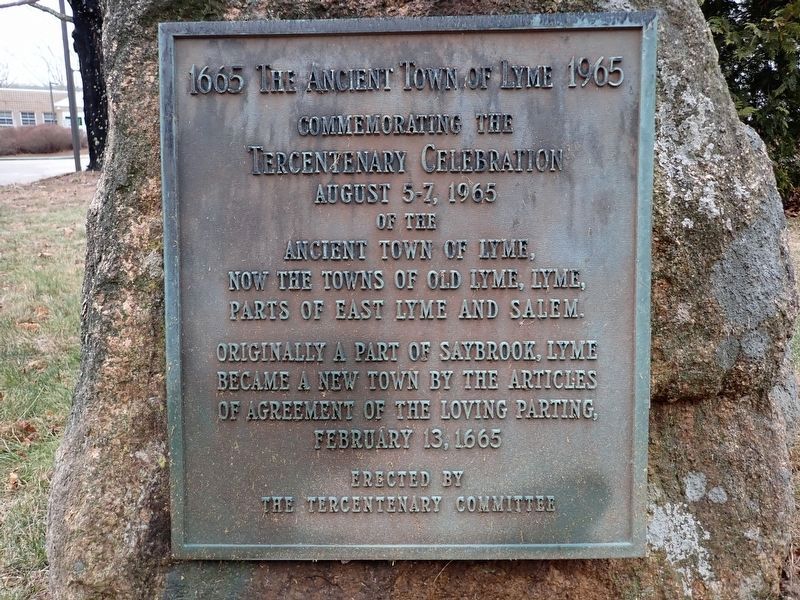
The Ancient Town of Lyme
1665 1965
Photographed by Conrad Ward, January 18, 2025
1. The Ancient Town of Lyme Marker
Tercentenary Celebration
August 5-7, 1965
Originally a part of Saybrook, Lyme became a new town by the articles of agreement of the Loving Parting, February 13, 1665
Erected 1965 by The Tercentenary Committee.
Topics. This historical marker is listed in these topic lists: Political Subdivisions • Settlements & Settlers. A significant historical date for this entry is February 13, 1665.
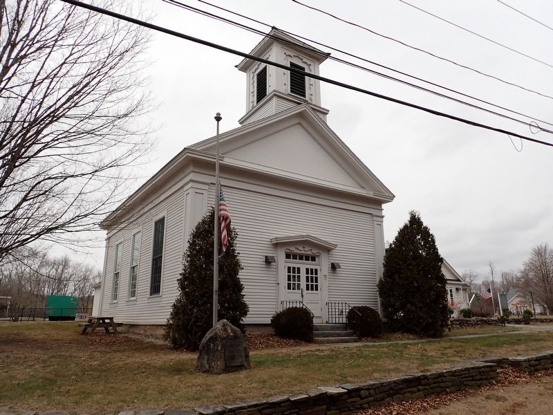
Location. 41° 24.796′ N, 72° 20.207′ W. Marker is in Lyme in Lower Connecticut River Valley Region, Connecticut. It is on Hamburg Road (Connecticut Route 156) north of Beaver Brook Road, on the right when traveling south. Located in front of the Lyme Town Hall. Touch for map. Marker is at or near this postal address: 480 Hamburg Road, Old Lyme CT 06371, United States of America. Touch for directions.

Regionally, this marker is on the Connecticut Shoreline, in Greater New London, in Mystic and the Eastern Shore, and in the Thames River Valley. It is also in the American Northeast, in New England, and on the Eastern Seaboard.
this page online
Other nearby markers. At least 8 other markers are within 5 miles of this marker, measured as the crow flies: The Eagle (within shouting distance of this marker); Lyme (within shouting distance of this marker); Lyme's Veterans Honor Roll (about 300 feet away, measured in a direct line); Lyme Roll of Honor (approx. 2 miles away); Chester-Hadlyme Ferry (approx. 4.8 miles away); Historical Floods of the Connecticut River (approx. 4.8 miles away); The House of Yukitaka Osaki (approx. 4.8 miles away); Impressionism in Connecticut (approx. 4.8 miles away). Touch for a list and map of all markers in Lyme.
Photographed by Conrad Ward, January 18, 2025
2. The Ancient Town of Lyme Marker
Credits. This page was last revised on May 19, 2026. It was originally submitted on August 10, 2025, by Conrad Ward of Guilford, Connecticut. This page has been viewed 100 times since then and 13 times this year. Photos: 1, 2. submitted on August 10, 2025, by Conrad Ward of Guilford, Connecticut. • Andrew Ruppenstein was the editor who published this page.
