Jonesborough in Washington County, Tennessee — The American South (East South Central)
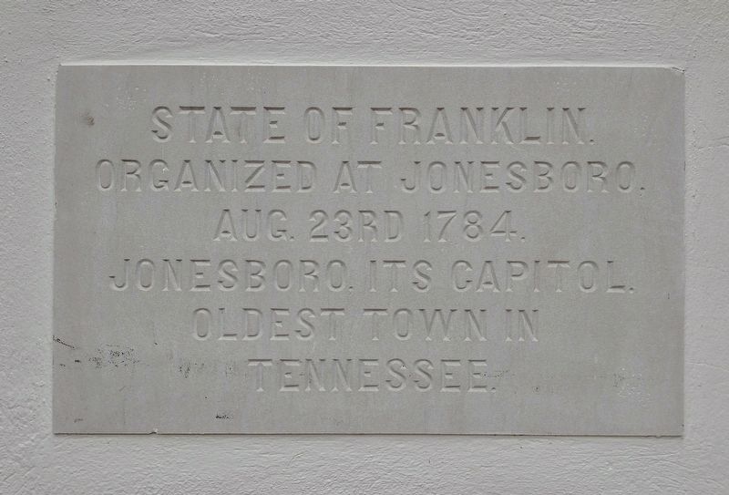
State of Franklin
Photographed by Tom Bosse, August 2, 2025
1. State of Franklin Marker
Organized at Jonesboro, Aug. 23rd 1784.
Jonesboro, its capitol.
Oldest town in Tennessee.
Topics. This historical marker is listed in these topic lists: Political Subdivisions • Settlements & Settlers. A significant historical date for this entry is August 23, 1784.
Location. 36° 17.647′ N, 82° 28.392′ W. Marker is in Jonesborough, Tennessee, in Washington County. It is on East Main Street near Courthouse Square, on the right when traveling east. Touch for map. Marker is at or near this postal address: 100 East Main Street, Jonesborough TN 37659, United States of America. Touch for directions.

Regionally, this marker is in East Tennessee and in the Tri-Cities Area. It is also in the American South, specifically in the Upper South, in Appalachia, and specifically in Southern Appalachia. Globally, it is in North America, the Western Hemisphere, the Western World, and the Anglosphere. Historically, it finds itself in what was once the original Cherokee Nation, the territory of the Mississippian Culture, one of the Confederate States of America, the State of Franklin, and the Antebellum South.
Other nearby markers. At
this page online
Also see . . . State of Franklin (Wikipedia). Overview:
The State of Franklin (also the Free Republic of Franklin, Lost State of Franklin, or the State of Frankland) was an unrecognized proposed state located in present-day East Tennessee, in the United States. Franklin was created in 1784 from part of the territory west of the Appalachian Mountains that had been offered by North Carolina as a cession to Congress to help pay off debts related to the American War for Independence. It was founded with the intent of becoming the 14th state of the new United States.(Submitted on August 13, 2025.)
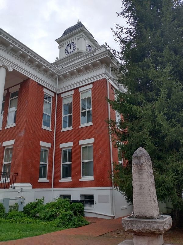
Franklin's first capitalwas Jonesborough. After the summer of 1787, the government of Franklin (which was by then based in Greeneville) ruled as a "parallel government" running alongside (but not harmoniously with) a re-established North Carolina bureaucracy. Franklin was never admitted into the union. The extra-legal state existed for only about four and a half years, ostensibly as a republic, after which North Carolina reassumed full control of the area.Photographed by Tom Bosse, August 2, 20252. State of Franklin MarkerThe marker is on the corner of the building.

Photographed by Tom Bosse, August 2, 2025
3. State of Franklin Marker
Credits. This page was last revised on August 13, 2025. It was originally submitted on August 11, 2025, by Tom Bosse of Jefferson City, Tennessee. This page has been viewed 244 times since then and 105 times this year. Photos: 1, 2, 3. submitted on August 11, 2025, by Tom Bosse of Jefferson City, Tennessee. • Andrew Ruppenstein was the editor who published this page.
