Jefferson Township near Greer in Knox County, Ohio — The American Midwest (Great Lakes)
Covered Bridge
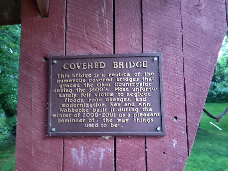
Photographed by Craig Doda, July 26, 2025
1. Covered Bridge Marker
Topics and series. This historical marker is listed in this topic list: Bridges & Viaducts. In addition, it is included in the Covered Bridges series list.
Location. 40° 32.639′ N, 82° 12.476′ W. Marker is near Greer, Ohio, in Knox County. It is in Jefferson Township. It is at the intersection of Wally Road (County Route 360) and Vess Road (County Route 357), on the right when traveling east on Wally Road. Touch for map. Marker is at or near this postal address: 21899 Wally Road, Glenmont OH 44628, United States of America. Touch for directions.

Regionally, this marker is in Amish Country. It is also in the American Midwest and in the Corn Belt. Globally, it is in North America, the Western Hemisphere, the Western World, and the Anglosphere. Historically,
this page online
Other nearby markers. At least 8 other markers are within walking distance of this marker: Walnut Grove School #10 (about 500 feet away, measured in a direct line); 1890's Bank Barn (about 600 feet away); Grande Allée (approx. half a mile away); Mohican Log Cabin (approx. 0.7 miles away); Southern Cross Windmill (approx. 0.7 miles away); The Wally Railroad (approx. ¾ mile away); Mohican State Scenic River (approx. 0.8 miles away); Wally Road Scenic Byway (approx. 0.8 miles away). Touch for a list and map of all markers in Greer.

Photographed by Craig Doda, July 26, 2025
2. Covered Bridge Marker
Note: there is no water under this bridge. It is simply a replica structure.
Credits. This page was last revised on August 12, 2025. It was originally submitted on August 12, 2025, by Craig Doda of Napoleon, Ohio. This page has been viewed 108 times since then and 26 times this year. Photos: 1, 2. submitted on August 12, 2025, by Craig Doda of Napoleon, Ohio. • Andrew Ruppenstein was the editor who published this page.
