Bessemer in Pueblo in Pueblo County, Colorado — The American Mountains (Southwest)
1950s Allen Mine
Davenport Engine
| — | Steelworks Center of the West | — |
Photographed by Mark Hilton, August 11, 2025
1. 1950s Allen Mine Marker
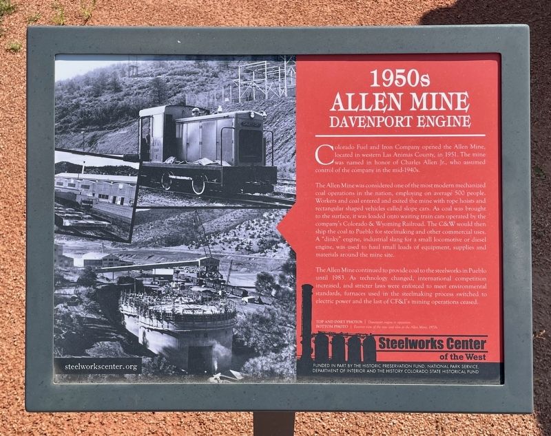
Colorado Fuel and Iron Company opened the Allen Mine, located in western Las Animas County, in 1951. The mine was named in honor of Charles Allen Jr., who assumed control of the company in the mid-1940s.
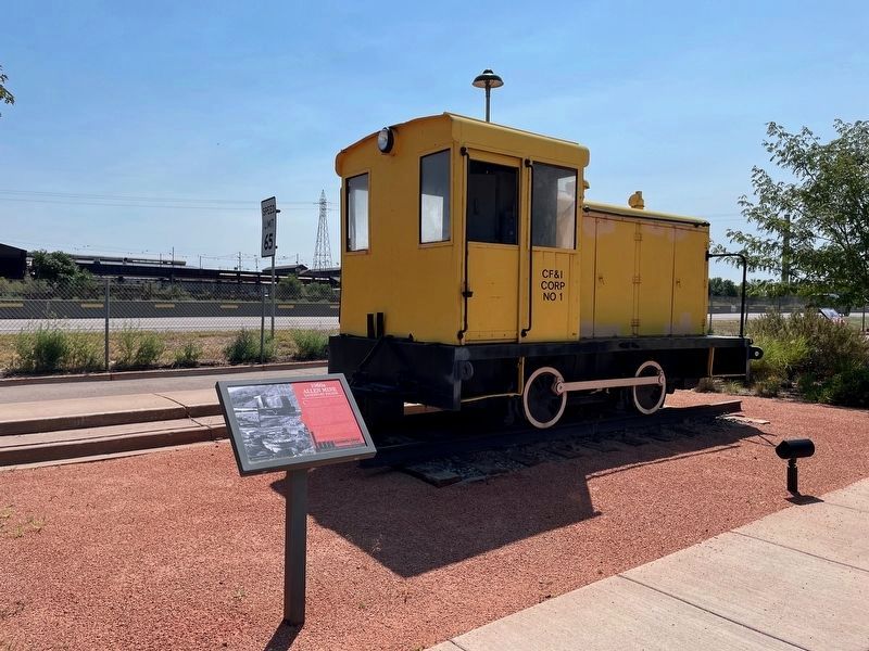
The Allen Mine was considered one of the most modern mechanized coal operations in the nation, employing on average 500 people. Workers and coal entered and exited the mine with rope hoists and rectangular shaped vehicles called slope cars. As coal was brought to the surface, it was loaded onto waiting train cars operated by the company's Colorado & Wyoming Railroad. The C&W would then ship the coal to Pueblo for steelmaking and other commercial uses. A "dinky" engine, industrial slang for a small locomotive or diesel engine, was used to haul small loads of equipment, supplies and materials around the mine site.
The Allen Mine continued to provide coal to the steelworks in Pueblo until 1983. As technology changed, international competition increased, and stricter laws were enforced to meet environmental standards, furnaces used in the steelmaking process switched to electric power and the last
this page online
Citations
Top: Davenport engine in operation.
Bottom: Exterior view of the new coal silos at the Allen Mine, 1970s.
Funded in part by the Historic Preservation Fund, National Park Service, Department of Interior and the History Colorado State Historical Fund
Erected by Steelworks Center of the West.
Topics. This historical marker is listed in this topic list: Industry & Commerce. A significant historical year for this entry is 1951.
Location. 38° 14.316′ N, 104° 36.733′ W. Marker is in Pueblo, Colorado, in Pueblo County. It is in Bessemer. It is on Baystate Avenue east of East Abriendo Avenue, on the right when traveling east. Located behind the Steelworks Center of the West Museum in the Steelworks Park. Touch for map. Marker is at or near this postal address: 215 Canal St, Pueblo CO 81004, United States of America. Touch for directions.

Regionally, this marker is in Colorado’s Arkansas River Valley and in the Front Range. It is also in the American Mountain West. Globally, it is in North America, the Rocky Mountains, the Western Hemisphere, the Western World, and
Photographed by Mark Hilton, August 11, 2025
2. 1950s Allen Mine marker & Davenport Engine.
Other nearby markers. At least 8 other markers are within 2 miles of this marker, measured as the crow flies: Rail Manufacturing (a few steps from this marker); 130 Ton Ladle (a few steps from this marker); The Colorado Fuel & Iron Company (a few steps from this marker); Ore Carts (within shouting distance of this marker); 10 Ton Ladle (within shouting distance of this marker); Site of YMCA #2 (within shouting distance of this marker); Karymor (about 300 feet away, measured in a direct line); The Mormon Battalion (approx. 1.3 miles away). Touch for a list and map of all markers in Pueblo.
Also see . . . Steelworks Park. (Submitted on August 13, 2025, by Mark Hilton of Montgomery, Alabama.)
Credits. This page was last revised on August 13, 2025. It was originally submitted on August 13, 2025, by Mark Hilton of Montgomery, Alabama. This page has been viewed 122 times since then and 39 times this year. Photos: 1, 2. submitted on August 13, 2025, by Mark Hilton of Montgomery, Alabama.
