Bessemer in Pueblo in Pueblo County, Colorado — The American Mountains (Southwest)
Ore Carts
| — | Steelworks Center of the West | — |
Photographed by Mark Hilton, August 11, 2025
1. Ore Carts Marker
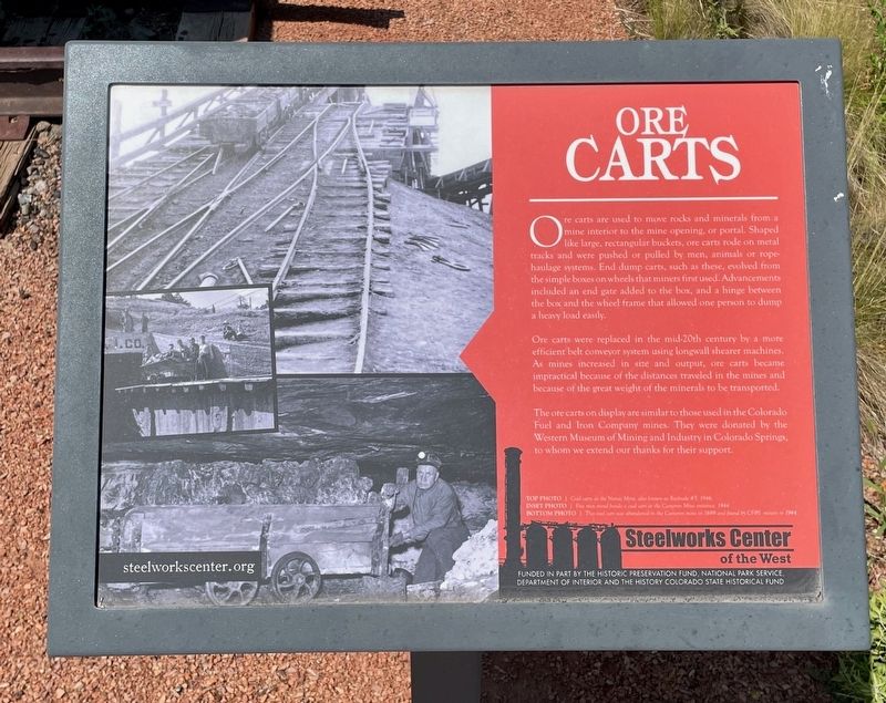
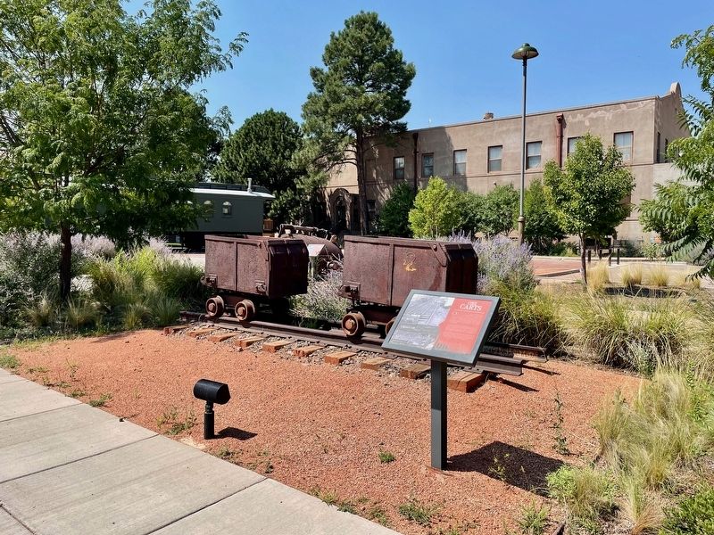
Ore carts are used to move rocks and minerals from a mine interior to the mine opening, or portal. Shaped like large, rectangular buckets, ore carts rode on metal tracks and were pushed or pulled by men, animals or rope- haulage systems. End dump carts, such as these, evolved from the simple boxes on wheels that miners first used. Advancements included an end gate added to the box, and a hinge between the box and the wheel frame that allowed one person to dump a heavy load easily.
Ore carts were replaced in the mid-20th century by a more efficient belt conveyor system using longwall shearer machines. As mines increased in size and output, ore carts became impractical because of the distances traveled in the mines and because of the great weight of the minerals to be transported. The ore carts on display are similar to those used in the Colorado Fuel and Iron Company mines. They were donated by the Western Museum of Mining and Industry in Colorado Springs, to whom we extend our thanks for their support.
Photos:
Top: Coal carts at the Nonac Mine, also known as Rocktale #5, 1946.
Inset: Five men stand beside a coal cart at the Cameron Mine entrance, 1944
Bottom: This coal cart was abandoned in the Cameron mine in 1889 and find by CF&I miners in 1944.
Erected by Steelworks
this page online
Topics. This historical marker is listed in this topic list: Industry & Commerce. A significant historical year for this entry is 1946.
Location. 38° 14.302′ N, 104° 36.737′ W. Marker is in Pueblo, Colorado, in Pueblo County. It is in Bessemer. It can be reached from Baystate Avenue east of East Abriendo Avenue, on the right when traveling east. Located behind the Steelworks Center of the West Museum in the Steelworks Park. Touch for map. Marker is at or near this postal address: 215 Canal St, Pueblo CO 81004, United States of America. Touch for directions.

Regionally, this marker is in Colorado’s Arkansas River Valley and in the Front Range. It is also in the American Mountain West. Globally, it is in North America, the Rocky Mountains, the Western Hemisphere, the Western World, and the Anglosphere. Historically, it finds itself in what was once the Comanchería and also the Republic of Texas.
Other nearby markers. At least 8 other markers are within 2 miles of this marker, measured as the crow flies: 10 Ton Ladle (a few steps from this marker); The Colorado Fuel & Iron Company (a few steps from
Photographed by Mark Hilton, August 11, 2025
2. Ore Carts Marker
Also see . . . Steelworks Park. (Submitted on August 13, 2025, by Mark Hilton of Montgomery, Alabama.)
Credits. This page was last revised on August 13, 2025. It was originally submitted on August 13, 2025, by Mark Hilton of Montgomery, Alabama. This page has been viewed 104 times since then and 40 times this year. Photos: 1, 2. submitted on August 13, 2025, by Mark Hilton of Montgomery, Alabama.
