Port Colborne in Niagara Region, Ontario — Central Canada (North America)
The Ott House
Photographed by Kevin Westell, August 14, 2025
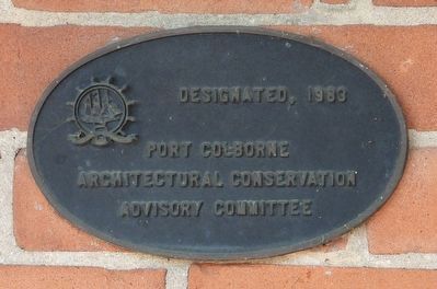
1. The Ott House - Marker
Designated, 1983
Port Colborne Architectural Conservation Advisory Committee
Erected 1983 by Port Colborne Architectural Conservation Advisory Committee.
Topics. This historical marker is listed in this topic list: Notable Buildings. A significant historical year for this entry is 1890.
Location. 42° 53.523′ N, 79° 15.123′ W. Marker is in Port Colborne, Ontario, in Niagara Region. It is at the intersection of King Street and Killaly Street W, on the right when traveling south on King Street. Touch for map. Marker is at or near this postal address: 518 King Street, Port Colborne ON L3K 4H6, Canada. Touch for directions.

Regionally, this marker is on the Golden Horseshoe and in Niagara Canada. It is also in Central Canada. Globally, it is in North America, on the Great Lakes, in the Western Hemisphere, in the Western World, and in the Anglosphere. Historically, it finds itself in what was once a British colony, the Viceroyalty of New France, the Haudenosaunee (Iroquois) Confederacy, and Rupert’s Land.
Other nearby markers. At least 8 other markers are within walking distance of this marker: Thomas Euphronius Reeb House c.1907
this page online
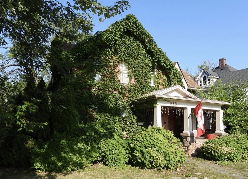
Regarding The Ott House. This building was constructed around 1890 for Frederick Joseph Quinn, "a gentleman". An addition was re-constructed around 1920, using the original bricks. Herman Ott, a member of Humberstone council, lived here from the 1920s to the 1950s. Among the reasons for designating this a heritage building: the house is an early example of the use of brick. For more info, see https://www.historicplaces.ca/en/rep-reg/place-lieu.aspx?id=8974
Photographed by Kevin Westell, August 14, 2025
2. The Ott House
Credits. This page was last revised on August 16, 2025. It was originally submitted on August 15, 2025, by Kevin Westell of St. Catharines, Ontario. This page has been viewed 217 times since then and 38 times this year. Photos: 1, 2. submitted on August 15, 2025, by Kevin Westell of St. Catharines, Ontario. • Andrew Ruppenstein was the editor who published this page.
