
Port Abino in Fort Erie in Niagara Region, Ontario — Central Canada (North America)
Holloway Memorial Chapel Centennial, 1894 - 1994
Photographed by Kevin Westell, August 14, 2025
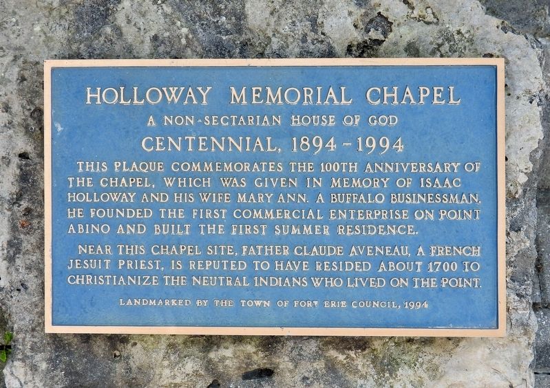
1. Holloway Memorial Chapel Centennial, 1894 - 1994 - Marker
Holloway Memorial Chapel
A non-sectarian house of God
Centennial, 1894 - 1994
This plaque commemorates the 100th anniversary of the chapel, which was given in memory of Isaac
Holloway and his wife Mary Ann. A Buffalo businessman, he founded the first commercial enterprise on Point Abino and built the first summer residence.
Near this chapel site, father Claude Aveneau, a French Jesuit Priest, is reputed to have resided about 1700 to Christianize the Neutral Indians who lived on the point.
Erected 1994 by Town of Fort Erie.
Topics. This historical marker is listed in this topic list: Religion & Religious Structures. A significant historical year for this entry is 1894.
Location. 42° 50.783′ N, 79° 5.575′ W. Marker is in Fort Erie, Ontario, in Niagara Region. It is in Port Abino. It is on Point Abino Road South, on the right when traveling south. Touch for map. Marker is at or near this postal address: 1025 Point Abino Road S, Fort Erie ON L0S 1N0, Canada. Touch for directions.

Regionally, this marker is on Ontario’s Golden Horseshoe and in Niagara Canada. It is also in Central Canada.
this page online
Other nearby markers. At least 8 other markers are within 3 kilometers of this marker, measured as the crow flies: Anchor from the wreck of the Briton (about 90 meters away, measured in a direct line); Point Abino Lighthouse (approx. 1.2 kilometers away); In Memory of Light Vessel 82 and its Crew (approx. 3.2 kilometers away); SS Canadiana (approx. 3.2 kilometers away); Capture of the "Somers" and "Ohio" (approx. 3.2 kilometers away); Crystal Beach Waterfront Park Development Association (approx. 3.2 kilometers away); 1800’s Ships Anchor (approx. 3.2 kilometers away); Waves of Change (approx. 3.3 kilometers away). Touch for a list and map of all markers in Fort Erie.
Photographed by Kevin Westell, August 14, 2025
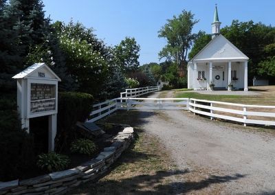
2. Holloway Memorial Chapel Centennial, 1894 - 1994 - Marker in context
Photo faces south-west from the road.
Credits. This page was last revised on August 16, 2025. It was originally submitted on August 15, 2025, by Kevin Westell of St. Catharines, Ontario. This page has been viewed 82 times since then and 12 times this year. Photos: 1. submitted on August 15, 2025, by Kevin Westell of St. Catharines, Ontario. 2. submitted on August 16, 2025, by Kevin Westell of St. Catharines, Ontario. • Andrew Ruppenstein was the editor who published this page.
