Fonthill in Fort Erie in Niagara Region, Ontario — Central Canada (North America)
Capture of the "Somers" and "Ohio"

Photographed by Dale K. Benington, July 28, 2011
1. Capture of the "Somers" and "Ohio" Marker
Erected by Ontario Archeological and Historic Sites Board.
Topics and series. This historical marker is listed in this topic list: War of 1812. In addition, it is included in the Canada, Ontario Heritage Trust series list. A significant historical date for this entry is August 12, 1814.
Location. 42° 51.559′ N, 79° 3.468′ W. Marker is in Fort Erie, Ontario, in Niagara Region. It is in Fonthill. It can be reached from Terrace Lane, on the right when traveling east. The
this page online

Regionally, this marker is on Ontario’s Golden Horseshoe and in Niagara Canada. It is also in Central Canada. Globally, it is in North America, on the Great Lakes, in the Western Hemisphere, in the Western World, and in the Anglosphere. Historically, it finds itself in what was once a British colony, the Viceroyalty of New France, the Haudenosaunee (Iroquois) Confederacy, and Rupert’s Land.
Other nearby markers. At least 8 other markers are within 3 kilometers of this marker, measured as the crow flies: SS Canadiana (a few steps from this marker); In Memory of Light Vessel 82 and its Crew (a few steps from this marker); 1800’s Ships Anchor (within shouting distance of this marker); Waves of Change (within shouting distance of this marker); Crystal Beach Waterfront Park Development Association (about 120 meters away, measured in a direct
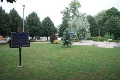
Photographed by Dale K. Benington, July 28, 2011
2. Capture of the "Somers" and "Ohio" Marker
View of the historical marker with the community park's landscaping in the background.
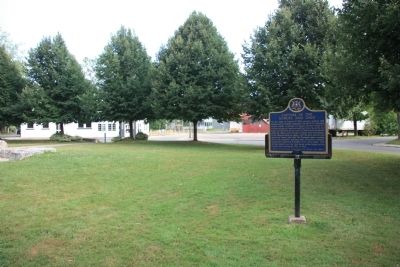
Photographed by Dale K. Benington, July 28, 2011
3. Capture of the "Somers" and "Ohio" Marker
View of the historical marker situated in the community park with the surrounding roadway, Queens Circle, in the background.
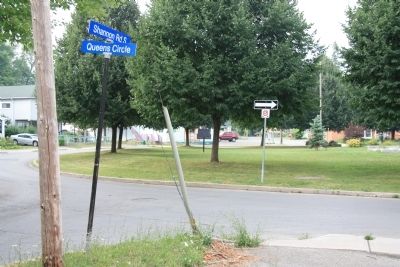
Photographed by Dale K. Benington, July 28, 2011
4. Capture of the "Somers" and "Ohio" Marker
Distant view of the historical marker situated in the community park, which is located on the traffic island formed by the roadway, Queens Circle. In the foreground is the street sign for the intersection of Queens Circle and Shannon Road South.

Photographed by Tim Boyd, April 23, 2025
5. Capture of the "Somers" and "Ohio" marker
In its current location in Crystal Beach Waterfront Park
Credits. This page was last revised on November 10, 2025. It was originally submitted on March 12, 2012, by Dale K. Benington of Toledo, Ohio. This page has been viewed 815 times since then and 28 times this year. Last updated on August 16, 2025, by Kevin Westell of St. Catharines, Ontario. Photos: 1, 2, 3. submitted on March 13, 2012, by Dale K. Benington of Toledo, Ohio. 4. submitted on March 14, 2012, by Dale K. Benington of Toledo, Ohio. 5. submitted on April 23, 2025, by Tim Boyd of Hamilton, Ontario. • Devry Becker Jones was the editor who published this page.
