Erin in Wellington County, Ontario — Central Canada (North America)
Erin Cenotaph
Photographed by Tim Boyd, August 5, 2025
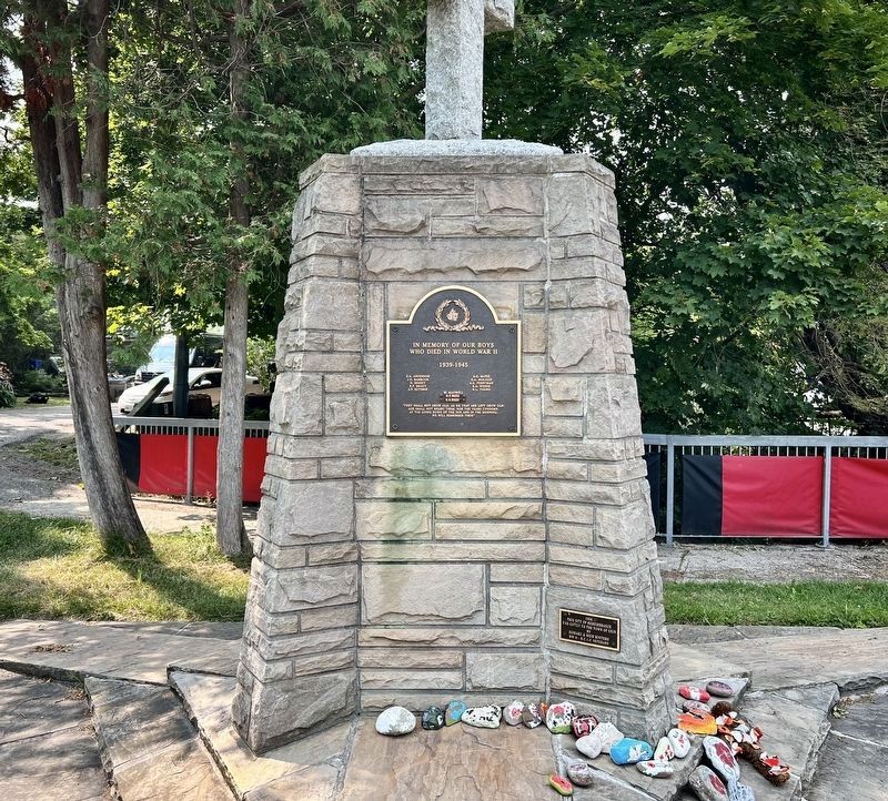
1. Erin Cenotaph (east side)
[east side]
In memory of our boys who died in World War II
1939-1945
E.A. Anderson · J.D. Barbour · E. Bessey · R.P. Brady · I.T. Guthrie · A.G. McFee · G.A. Molozzi · A.E. Perryman · H.L. Young · W. Maxwell · D.P. Reed · G.S.Reed
“They shall nots grow old, as we that are left grow old; Age shall not weary them, nor the years condemn. At the going down of the sun, and in the morning; We will remember them”
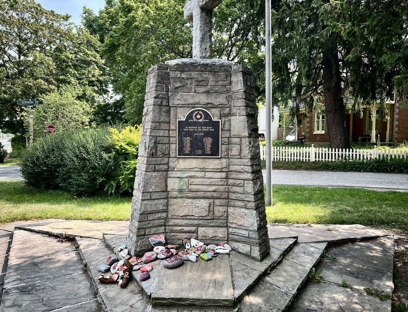
[north side]
In memory of our boys who died in the Great War
1914-1918
W.A. Berry · N.G. Broughton · J.D. Burt · C.G. Currie · C. Cutting · J.D. Gear · W.G. Gibson · C. Holland · C.E. Hume · R. Hurd · W.J. Jackson · E.F. Jeffreys · F.P. King · T. Bird · J. Waldock · W.B. Leslie · D.H. MacDougall · C.R. MacLachlan · H.F. McConnell · J.A. McKinnon · D. McLean · W.F. Murphy · H. Player · H.C. Sanders · E. Scott · J. Spiers · G. Sutton · F. Willis · E.C. White · E.W. Wright · G.F. Leslie · A. Cochrane · A.R. McGill
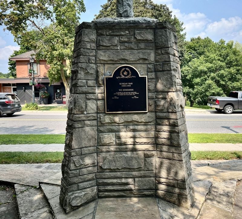
[west side]
Korean War
1950-1953
We Remember
In memory of the military personnel and other Canadians
this page online
1954 D.M. Covert
2006 W.M. Turner
Erected 1956.
Topics. This memorial is listed in these topic lists: War, Korean • War, World I • War, World II.
Location. 43° 46.079′ N, 80° 3.663′ W. Memorial is in Erin, Ontario, in Wellington County. It is at the intersection of Main Street and Union Street, on the right when traveling south on Main Street. Touch for map. Memorial is at or near this postal address: 7-1 Union Street, Erin ON N0B 1T0, Canada. Touch for directions.

Regionally, this memorial is in the Huron-Perth-Waterloo-Wellington Area and in Southwestern Ontario. It is also in Central Canada. Globally, it is in North America, the Western Hemisphere, the Western World, and the Anglosphere. Historically, it finds itself in what was once a British colony, the Viceroyalty of New France, the Haudenosaunee (Iroquois) Confederacy, and Rupert’s Land.
Other nearby markers. At least 8 other markers are within 8 kilometers of this marker, measured as the crow flies: The Founding of Erin (within shouting
Photographed by Tim Boyd, August 5, 2025
2. Erin Cenotaph (north side)
Photographed by Tim Boyd, August 15, 2025
3. Erin Cenotaph (west side)
Photographed by Tim Boyd, August 5, 3035
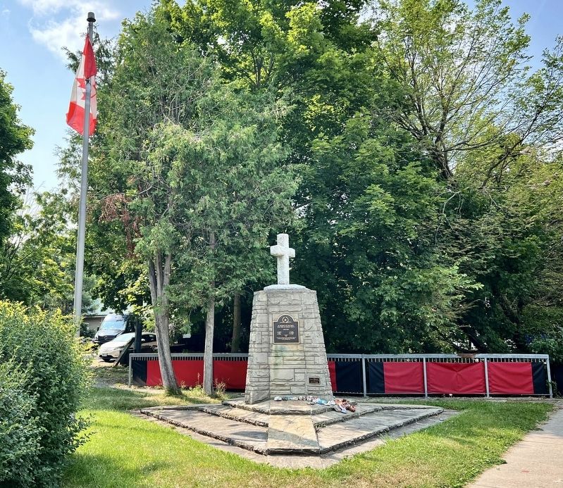
4. Erin Cenotaph
Credits. This page was last revised on August 17, 2025. It was originally submitted on August 17, 2025, by Tim Boyd of Hamilton, Ontario. This page has been viewed 62 times since then and 15 times this year. Photos: 1, 2, 3, 4. submitted on August 17, 2025, by Tim Boyd of Hamilton, Ontario. • Andrew Ruppenstein was the editor who published this page.
