Niagara Falls in Niagara Region, Ontario — Central Canada (North America)
Railways In Niagara
Photographed by Kevin Westell, August 18, 2025
1. Railways In Niagara - Marker
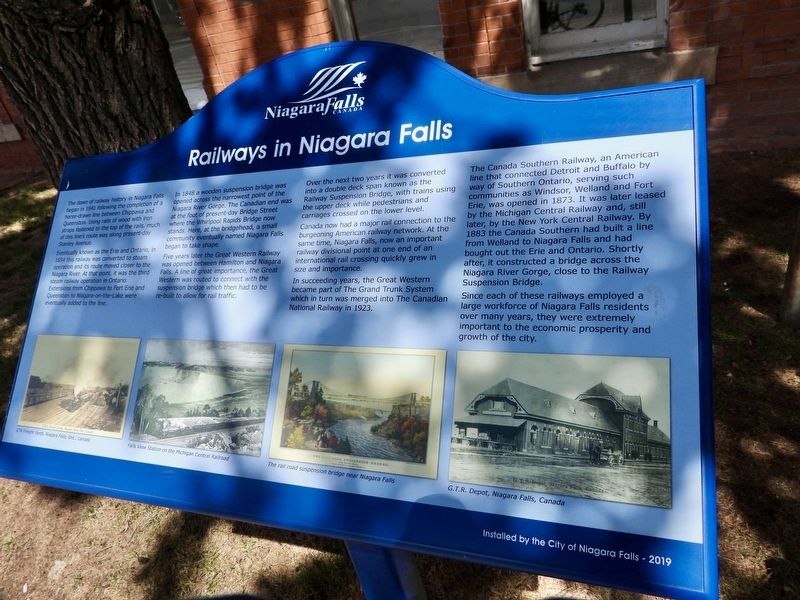
Eventually known as the Erie and Ontario, in 1854 this railway was converted to steam operation and its route moved closer to the Niagara River. At that point, it was the third steam railway operation in Ontario. Extensions from Chippawa to Fort Erie and Queenston to Niagara-on-the-Lake were eventually added to the line.
In 1848 a wooden suspension bridge was opened across the narrowest point of the Niagara River Gorge. The Canadian end was at the foot of present-day Bridge Street where the Whirlpool Rapids bridge now stands. Here, at the bridgehead, a small community eventually named Niagara Falls began to take shape.
Five years later the Great Western Railway was opened between Hamilton and Niagara Falls. A line of great importance, the Great Western was routed to connect with the suspension bridge which then
this page online
Over the next two years it was converted into a double deck span known as the Railway Suspension bridge, with trains using the upper deck while pedestrians and carriages crossed on the lower level.
Canada now had a major rail connection to the burgeoning American railway network. At the same time, Niagara Falls, now an important railway divisional point at one end of an international rail crossing quickly grew in size and importance.
In succeeding years, the Great Western became part of the Grand Trunk system which in turn was merged into the Canadian National Railway in 1923.
The Canada Southern Railway, an American line that connected Detroit and Buffalo by way of Southern Ontario, serving such communities as Windsor, Welland and Fort Erie, was opened in 1873. It was later leased by the Michigan Central Railway and, still later, by the New York Central Railway. By 1883 the Canada Southern had built a line from Welland to Niagara Falls and had bought out the Erie and Ontario. Shortly after, it constructed a bridge across the Niagara River
By Antony-22 - Own work, CC BY-SA 4.0, https://commons.wikimedia.org/w/index.php?curid=156988787, November 14, 2023
2. Niagara Falls Railway Station - south side
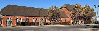
Photo faces north-east, across Queen Street, from the bus station. The marker (right, between two trees) is a white panel on a post facing the street, at the front entrance to the station.
Since each of these railways employed a large workforce of Niagara Falls residents over many years, they were extremely important to the economic prosperity and growth of the city.
Erected 2019 by City of Niagara Falls.
Topics. This historical marker is listed in these topic lists: Industry & Commerce • Railroads & Streetcars. A significant historical year for this entry is 1841.
Location. 43° 6.525′ N, 79° 3.8′ W. Marker is in Niagara Falls, Ontario, in Niagara Region. It is at the intersection of Bridge Street and Erie Avenue, on the right when traveling west on Bridge Street. Touch for map. Marker is at or near this postal address: 4267 Bridge Street, Niagara Falls ON L2E 2P6, Canada. Touch for directions.

Regionally, this marker is on the Golden Horseshoe and in Niagara Canada. It is also in Central Canada. Globally, it is in North America, on the Great Lakes, in the Western Hemisphere, in the Western World, and in the Anglosphere. Historically, it finds itself in what was once a British colony, the Viceroyalty of New France, the Haudenosaunee
Photographed by Kevin Westell, August 18, 2025
3. Niagara Falls Transit - WEGO bus routes
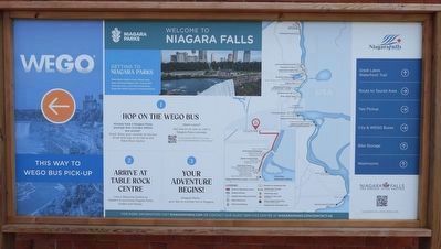
Public transit lives in Niagara Falls! WEGO connects the VIA train station (and adjacent bus station) to many tourist spots along the nearby Niagara river.
Other nearby markers. At least 8 other markers are within walking distance of this marker: McClive Rosberg Block - Erected in 1904 (about 240 meters away, measured in a direct line); Rosberg Family Park (approx. 0.2 kilometers away); Olympic Torch Run Legacy Trail (approx. 0.2 kilometers away); Samuel Zimmerman 1815 - 1857 (approx. 0.2 kilometers away); Binational Heritage Peace Garden Trail (approx. 0.2 kilometers away); Terry Fox (approx. 0.3 kilometers away); Rededication of Centennial Square and Dedication of the Peace Park (approx. 0.3 kilometers away); 1904 - 2004 City of Niagara Falls Canada Celebrating 100 Years (approx. 0.3 kilometers away). Touch for a list and map of all markers in Niagara Falls.
Regarding Railways In Niagara. Where the inscription mentions the 1841 horse-drawn rail line connecting between Chippawa and Queenston: these were the two ends of the existing portage (on the Canadian side) around Niagara Falls; so it initially supported ships using both lakes by portaging their goods.
Photographed by Kevin Westell, May 16, 2019
4. Whirlpool Rapids Bridge
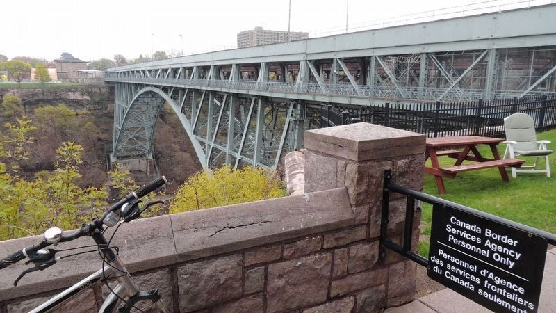
This 1897 bridge has two decks - a single track for rail on top, one-lane each way for cars underneath. This bridge, 200 metres east of the VIA station, serves all the same trains. Across the bridge is a low glass structure for U.S. Customs dealing with auto traffic; then beyond, a taller stone historic U.S. Customs building. The newer but unused rust-red Michigan Central bridge is visible through this gray bridge.
Credits. This page was last revised on August 25, 2025. It was originally submitted on August 20, 2025, by Kevin Westell of St. Catharines, Ontario. This page has been viewed 132 times since then and 44 times this year. Photos: 1, 2, 3, 4. submitted on August 20, 2025, by Kevin Westell of St. Catharines, Ontario. • Andrew Ruppenstein was the editor who published this page.
