Livingston in Park County, Montana — The American West (Mountains)
Sacajawea/Miles Park Historic District
Photographed by Barry Swackhamer, July 28, 2025
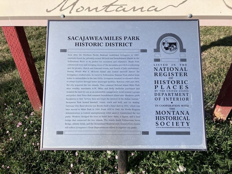
1. Sacajawea/Miles Park Historic District Marker
Soon after the Northern Pacific Railroad established Livingston in 1883, residents found the privately-owned McLeod and Swindlehurst islands in the Yellowstone River to be perfect for recreation and relaxation. Shade from cottonwood trees and sweeping views of the mountains provided a welcoming spot for picnics, church and fraternal events, and Fourth of July celebrations. During World War I, McLeod Island also hosted farewell dances for Livingston’s drafted men. As travel to Yellowstone National Park shifted from trains to automobiles in the late-1910s, Livingston boosters accelerated efforts to attract tourists through better municipal facilities. Between 1920 and 1924, the city acquired the two islands. They renamed McLeod Island Miles Park after wealthy merchants A. W. Miles and Holly Hefferlin purchased and donated the land for use as an automobile campground. Local women’s groups and police chief Peter Holt renamed Swindlehurst Island after Shoshone guide Sacajawea so that “history does not forget the services of the Indian woman.” Sacajawea Park hosted baseball, tennis, track and field, and ice skating. Gateway
this page online
Erected by Montana Historical Society.
Topics and series. This historical marker is listed in these topic lists: Architecture • Railroads & Streetcars • Settlements & Settlers. In addition, it is included in the Montana National Register Sign Program, and the Works Progress Administration (WPA) projects series lists. A significant historical year for this entry is 1883.
Location. 45° 39.217′ N, 110° 33.417′ W. Marker is in Livingston, Montana, in Park County. It is at the intersection of South Yellowstone Street and McGee Drive, on the left when traveling north on South Yellowstone Street. Touch for map.
Photographed by Barry Swackhamer, July 28, 2025
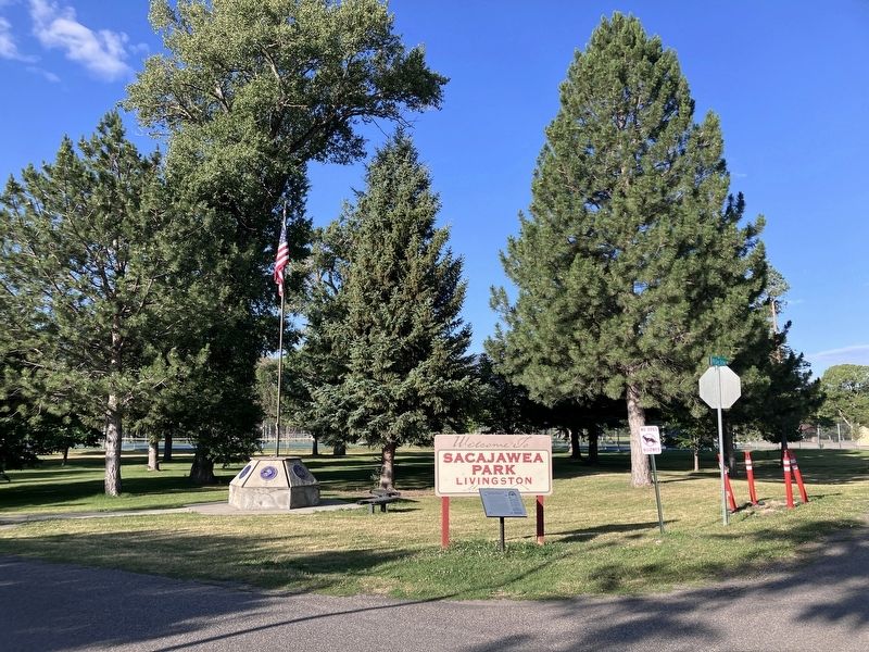
2. Sacajawea/Miles Park Historic District Marker

Regionally, this marker is in Yellowstone Country and in Greater Bozeman. It is also in the American Mountain West and in the Lewis & Clark Corridor. Globally, it is in North America, the Rocky Mountains, the Western Hemisphere, the Western World, and the Anglosphere. Historically, it finds itself in what was once Rupert’s Land and also the Louisiana Purchase.
Other nearby markers. At least 8 other markers are within walking distance of this marker: "Wide bold, rapid and deep" (a few steps from this marker); Sacajawea on the Yellowstone (a few steps from this marker); "At the Yellowstone" (about 500 feet away, measured in a direct line); St. Mary's Catholic Church (approx. 0.4 miles away); On Horseback (approx. 0.4 miles away); Searching for Large Cottonwood (approx. 0.4 miles away); Livingston B Street Historic District (approx. 0.4 miles away); Talcott House (approx. 0.4 miles away). Touch for a list and map of all markers in Livingston.
Credits. This page was last revised on November 5, 2025. It was originally submitted on August 24, 2025, by Barry Swackhamer of Brentwood, California. This page has been viewed 101 times since then and 34 times this year. Photos: 1, 2. submitted on August 24, 2025, by Barry Swackhamer of Brentwood, California.
