
Goderich in Huron County, Ontario — Central Canada (North America)
Gairbraid: the Dream & the Memory
Photographed by Tim Boyd, August 22, 2025
1. Gairbraid: the Dream & the Memory Marker
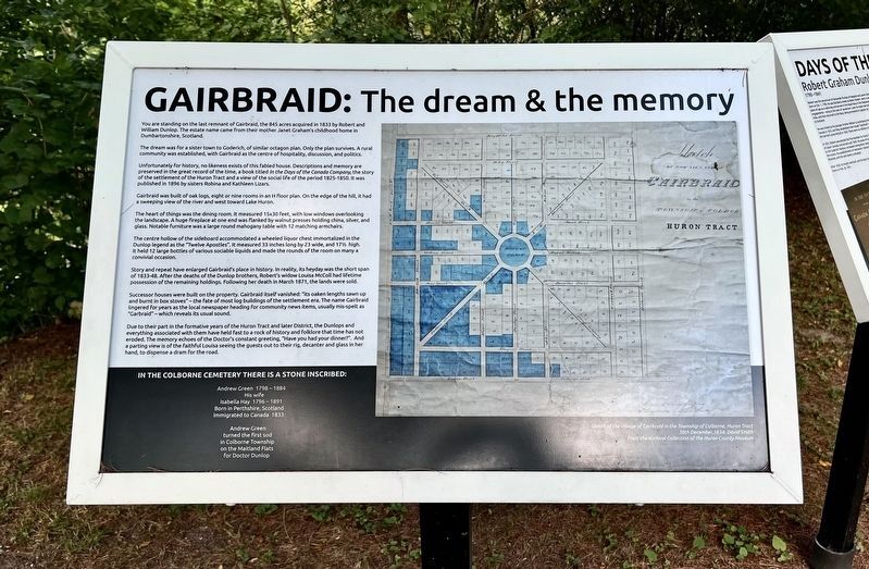
You are standing on the last remnant of Gairbraid, the 845 acres acquired in 1833 by Robert and William Dunlop. The estate name came from their mother Janet Graham's childhood home in Dumbartonshire, Scotland.
The dream was for a sister town to Goderich, of similar octagon plan. Only the plan survives. A rural community was established, with Gairbraid as the centre of hospitality, discussion, and politics.
Unfortunately for history, no likeness exists of this fabled house. Descriptions and memory are preserved in the great record of the time, a book titled In the Days of the Canada Company, the story of the settlement of the Huron Tract and a view of the social life of the period 1825-1850. It was published in 1896 by sisters Robina and Kathleen Lizars.
Gairbraid was built of oak logs, eight or nine rooms in an H floor plan. On the edge of the hill, it had a sweeping view of the river and west toward Lake Huron.
The heart of things was the dining room. It measured 15x30 feet, with low windows overlooking the landscape. A huge fireplace at one end was flanked by walnut presses holding china, silver, and glass.
this page online
The centre hollow of the sideboard accommodated a wheeled liquor chest immortalized in the Dunlop legend as the "Twelve Apostles". It measured 33 inches long by 23 wide, and 17½ high. It held 12 large bottles of various sociable liquids and made the rounds of the room on many a convivial occasion.
Story and repeat have enlarged Gairbraid's place in history. In reality, its heyday was the short span of 1833-48. After the deaths of the Dunlop brothers, Robert's widow Louisa McColl had lifetime possession of the remaining holdings. Following her death in March 1871, the lands were sold.
Successor houses were built on the property. Gairbraid itself vanished: "its oaken lengths sawn up and burnt in box stoves" - the fate of most log buildings of the settlement era. The name Gairbraid lingered for years as the local newspaper heading for community news items, usually mis-spelt as "Garbraid" - which reveals its usual sound.
Due to their part in the formative years of the Huron Tract and later District, the Dunlops and everything associated with them
Photographed by Tim Boyd, August 22, 2025
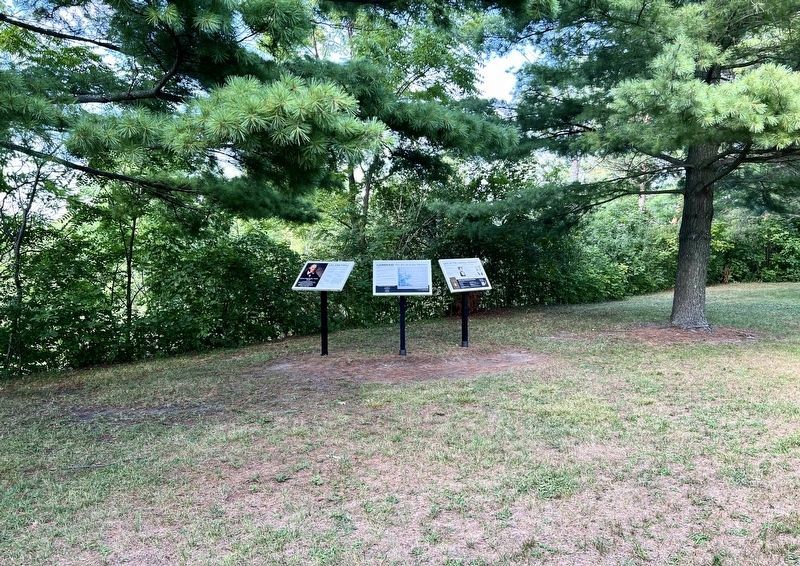
2. Gairbraid: the Dream & the Memory Marker (the middle of the three)
In the Colborne Cemetery there is a stone inscribed:
Andrew Green 1798 - 1884
His wife
Isabella Hay 1796-1891
Born in Perthshire Scotand
Immigrated to Canada 1833
Andrew Green
Turned the first sod
in Colborne Township
on the Maitland Flats
for Doctor Dunlop
Topics. This historical marker is listed in these topic lists: Architecture • Settlements & Settlers. A significant historical year for this entry is 1833.
Location. 43° 45.551′ N, 81° 42.096′ W. Marker is in Goderich, Ontario, in Huron County. It can be reached from River Ridge Crescent. The marker is accessible by foot from the Goderich to Auburn Rail Trail, approx. 350 metres east of the parking area at the end of River Ridge Crescent. Touch for map. Marker is at or near this postal address: 33981A River Ridge Crescent, Goderich ON N7A 3Y2, Canada. Touch for directions.

Regionally,
Photographed by Tim Boyd, August 22, 2025
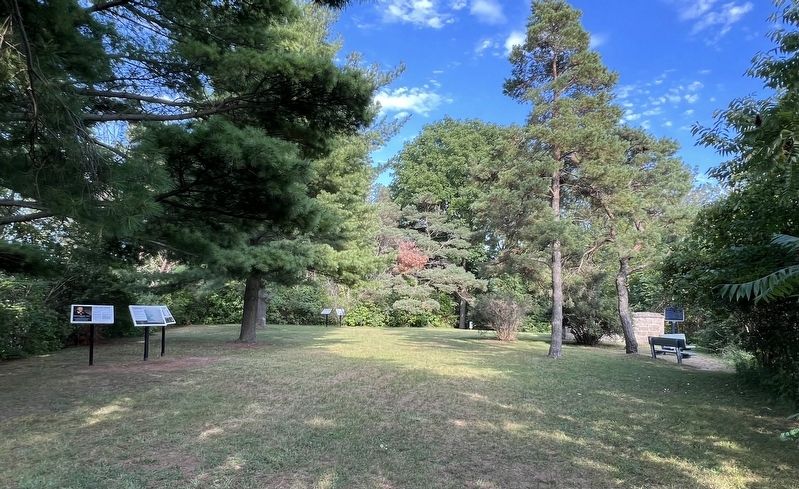
3. The site of the former Gairbraid Estate, 2025
The marker is on the left
Other nearby markers. At least 8 other markers are within walking distance of this marker: Days of the Canada Company (here, next to this marker); Life and Times (here, next to this marker); The Tomb on Dunlop’s Hill (a few steps from this marker); “Tiger” Dunlop 1792-1848 (within shouting distance of this marker); A Resting Place (within shouting distance of this marker); Sky Harbour (approx. 0.8 kilometers away); The British Commonwealth Air Training Plan (approx. 0.8 kilometers away); Huron County Gaol (approx. 1.2 kilometers away). Touch for a list and map of all markers in Goderich.

Photographed by Tim Boyd, August 22, 2025
4. View of the Maitland River and Goderich Harbour from the site of Gairbraid, 2025
Credits. This page was last revised on August 27, 2025. It was originally submitted on August 25, 2025, by Tim Boyd of Hamilton, Ontario. This page has been viewed 101 times since then and 23 times this year. Photos: 1, 2, 3, 4. submitted on August 25, 2025, by Tim Boyd of Hamilton, Ontario. • Andrew Ruppenstein was the editor who published this page.
