Lima in Allen County, Ohio — The American Midwest (Great Lakes)
Wayne C. Gerdeman, P.E., P.S.
11-7-1945 to 8-18-2005
Photographed by Craig Doda, August 23, 2025
1. Wayne C. Gerdeman, P.E., P.S. Marker
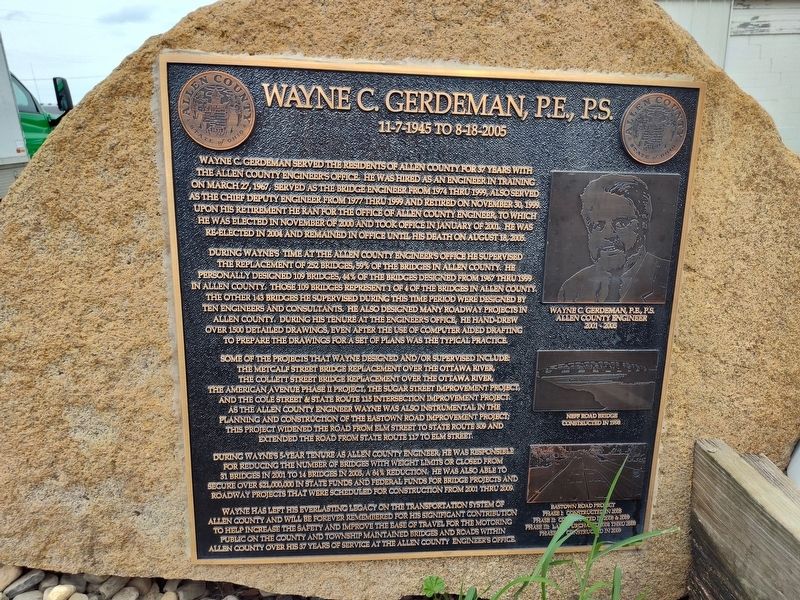
During Wayne's time at the Allen County Engineer's Office he supervised the replacement of 252 bridges, 59% of the bridges in Allen County. He personally designed 109 bridges, 44% of the bridges designed from 1967 thru 1999 in Allen County. Those 109 bridges represent 1 of 4 of the bridges in Allen County. The other 143 bridges he supervised during this time period were designed by ten engineers and consultants. He also designed many roadway projects in Allen County. During his tenure at the engineer's office, he hand-drew over 1500 detailed drawings, even after the use of computer
this page online
Some of the projects that Wayne designed and/or supervised include: the Metcalf Street Bridge Replacement over the Ottawa River, the Collett Street Bridge Replacement over the Ottawa River, the American Avenue Phase II Project, the Sugar Street Improvement Project, and the Cole Street & State Route 115 Intersection Improvement Project. As the Allen County Engineer Wayne was also instrumental in the planning and construction of the Eastown Road Improvement Project; this project widened the road from Elm Street to State Route 309 and extended the road from State Route 117 to Elm Street.
During Wayne's 5-year tenure as Allen County Engineer, he was responsible for reducing the number of bridges with weight limits or closed from 31 bridges in 2001 to 14 bridges in 2005, a 64% reduction. He was also able to secure over $21,000,000 in state funds and federal funds for bridge projects and roadway projects that were scheduled for construction from 2001 thru 2009.
Wayne has left his everlasting legacy on the transportation system of Allen County and will be
Photographed by Craig Doda, August 23, 2025
2. Wayne C. Gerdeman, P.E., P.S. Marker
Topics. This historical marker is listed in this topic list: Bridges & Viaducts. A significant historical month for this entry is January 2001.
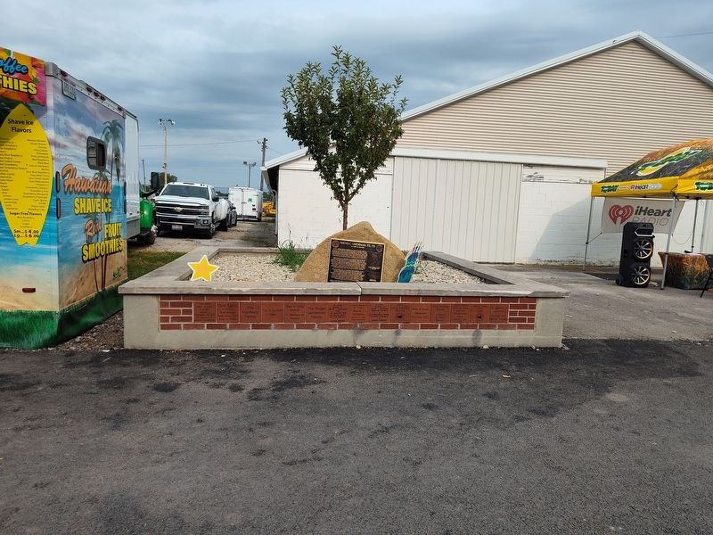
Location. 40° 43.512′ N, 84° 3.305′ W. Marker is in Lima, Ohio, in Allen County. It can be reached from the intersection of Bellefontaine Road (Ohio Route 117) and Bowman Road, on the right when traveling west. On the grounds of the Allen County Fairgrounds. Touch for map. Marker is in this post office area: Lima OH 45804, United States of America. Touch for directions.

Regionally, this marker is in the Till Plains. It is also in the American Midwest and in the Corn Belt. Globally, it is in North America, the Western Hemisphere, the Western World, and the Anglosphere. Historically, it finds itself in what was once the Haudenosaunee (Iroquois) Confederacy, the territory of the Mississippian Culture, and the Northwest Territory.
Other nearby markers. At least 8 other markers are within 2 miles of this marker, measured as the crow flies: Metzger Lake Reservoir (approx. 1½ miles away); Lima Memorial Health System (approx. 1.8 miles away); The Ohio State University at Lima - Galvin Hall (approx. 1.8 miles away); Veterans Memorial (approx. 1.8 miles away); Rhode State College - Tech Ed Lab (approx. 1.9 miles away); Lewis and Clark Smith Grove Cottonwood (approx. 2 miles away); Wilderness Kentucky Coffee Tree (approx. 2 miles away); Walden Woods Weeping Willow (approx. 2 miles away). Touch for a list and map of all markers in Lima.
Credits. This page was last revised on August 28, 2025. It was originally submitted on August 25, 2025, by Craig Doda of Napoleon, Ohio. This page has been viewed 104 times since then and 34 times this year. Photos: 1, 2. submitted on August 25, 2025, by Craig Doda of Napoleon, Ohio. • Andrew Ruppenstein was the editor who published this page.
