
Milford Mine Memorial Park near Wolford in Crow Wing County, Minnesota — The American Midwest (Upper Plains)
Milford Mine Collapse
February 5, 1924 3:58 PM
| — | Milford Mine Memorial Park | — |
Photographed by McGhiever, June 27, 2025
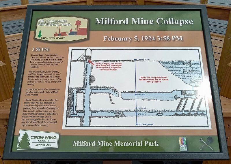
1. Milford Mine Collapse Marker
3:58 PM
It's mow [sic] been 13 minutes since Contract 13 has caved in and water has been filling the mine. Water and mud have been pouring into the working of the mine and have filled the mine completely.
Miners Emil Kaine, Frank Hvratin, and Matt Kangas have made it out of the mine and Harry Hosford is waist deep in water and mud at the top of the shaft on the surface where he is pulled to safety.
At this time, a total of 41 miners have perished as the result of the Milford Mine collapse.
Clinton Harris, who was minding the mine's skip, was also sounding the mine's warning whistle. Harris had probably been warned early enough to save himself, but had either tied the mine's warning whistle to himself so it would continue to blast or had become entangled in the cord. Either way, the whistle blared for hours until engineers could disconnect it.
Erected by Crow Wing County.
Topics. This historical marker is listed in this topic list: Disasters. A significant historical date for this entry is February 5, 1924.
Location. 46° 32.142′ N, 93° 58.153′ W. Marker is near Wolford, Minnesota, in Crow Wing County. It is in Milford
this page online

Regionally, this marker is in Minnesota’s Northland. It is also in the American Midwest, in the Corn Belt, and in the Great River Road Region. Globally, it is in North America, the Great North Woods, the Western Hemisphere, the Western World, and the Anglosphere. Historically, it finds itself in what was once Rupert’s Land, the territory of the Mississippian Culture, and the Northwest Territory.
Other nearby markers. At least 8 other markers are within walking distance of this marker: A different marker also named Milford Mine Collapse (here, next to this marker); a different marker also named Milford Mine Collapse (here, next to this marker); a different marker also named Milford Mine Collapse (here, next to this marker); Foley Pond/Milford Lake (here, next to this marker); Geology (within shouting distance of this marker); Milford Mine Pre-Disaster (within shouting distance of this
Photographed by McGhiever, June 27, 2025
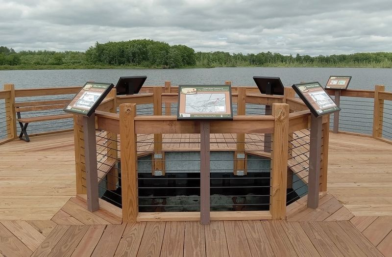
2. 3:58 PM Marker (left) directly above the site of the 1924 collapse
Credits. This page was last revised on August 25, 2025. It was originally submitted on August 25, 2025, by McGhiever of Minneapolis, Minnesota. This page has been viewed 82 times since then and 13 times this year. Photos: 1, 2. submitted on August 25, 2025, by McGhiever of Minneapolis, Minnesota.
