Antonito in Conejos County, Colorado — The American Mountains (Southwest)
Hospitality
Traveling "Around the Circle " in Style

Photographed by Sandra Hughes Tidwell, August 7, 2025
1. Hospitality Marker
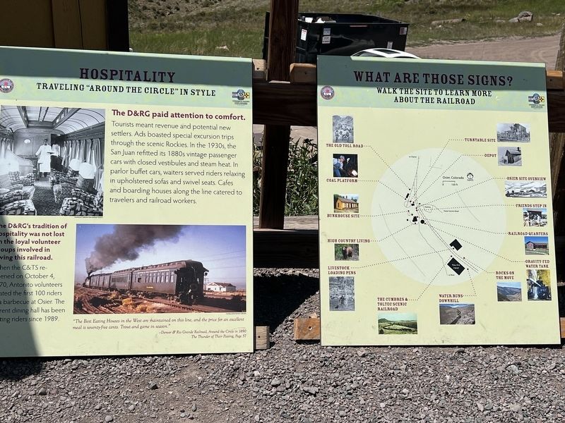
The D & RG paid attention to comfort.
Tourists meant revenue and potential new settlers. Ads boasted special excursion trips through the scenic Rockies. In the 1930s, the San Juan refitted its 1880s vintage passenger cars with closed vestibules and steam heat. In parlor buffet cars, waiters served riders relaxing in upholstered sofas and swivel seats. Cafes and boarding houses along the line catered to travelers and railroad workers.
The D&RG's tradition of hospitality was not lost on the loyal volunteer groups involved in saving this railroad. When the C& TS reopened on October 4, 1970, Antonito volunteers treated the first 100 riders to a barbecue at Osier. The current dining hall has been hosting riders since 1989.
Caption:
"The Best Eating Houses in the West are maintained on this line, and the price for an excellent meal is seventy-five cents. Trout and game in season." - Denver & Rio Grande Railroad, Around the Circle in 1890
The Thunder of Their Passing, Page 57
Topics. This historical marker is listed in this topic list: Railroads & Streetcars. A significant historical date for this entry is October 4, 1970.
Location. 37° 0.745′ N,
this page online

Regionally, this marker is in the San Juan Mountains and in the San Luis Valley. It is also in the American Mountain West. Globally, it is in North America, the Rocky Mountains, the Western Hemisphere, the Western World, and the Anglosphere. Historically, it finds itself in what was once New Spain and also the Republic of Texas.
Other nearby markers. At least 8 other markers are within walking distance of this marker: Rocks on the Move (a few steps from this marker); Livestock Loading Pens (a few steps from this marker); Gravity Fed Water Tank (about 400 feet away, measured in a direct line); Railroad Quarters (about 400 feet away); Osier, Colorado (about 500 feet away); Bunkhouse Site (about 500 feet away); Turntable Site (about 500 feet away); Depot (about 500 feet away). Touch for a list and map of all markers in Antonito.
Photographed by Sandra Hughes Tidwell, August 7, 2025
2. What are those signs?
Old Toll Road, Coal Platform, Bunkhouse, High Country Living, Livestock Loading Pens, The Cumbres & Toltec Scenic Railroad, water runs downhill, Rocks on Move, gravity-fed watertank, Railroad Quartersm frinds Step In, Osier Site Overview, Depot, Turntable site.
Credits. This page was last revised on August 28, 2025. It was originally submitted on August 27, 2025, by Sandra Hughes Tidwell of Killen, Alabama, USA. This page has been viewed 64 times since then and 16 times this year. Photos: 1, 2. submitted on August 27, 2025, by Sandra Hughes Tidwell of Killen, Alabama, USA. • Andrew Ruppenstein was the editor who published this page.
