Near Antonito in Conejos County, Colorado — The American Mountains (Southwest)
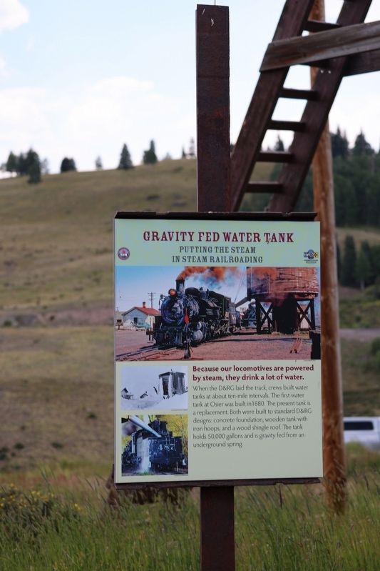
Gravity Fed Water Tank
Putting the Steam in Steam Railroading
Photographed by Sandra Hughes Tidwell, August 7, 2025
1. Gravity Fed Water Tank Marker
Because our locomotives are powered by steam, they drink a lot of water. When the D&RG laid the track, crews built tanks at about ten-mile intervals. The first water tank at Osier was built in 1880. The present tank is a replacement. Both were built to standard D&RG designs: concrete foundation, wooden tank with iron hoops, and a wood shingle roof. The tank holds 50,000 gallons and is gravity-fed from an underground spring.
Topics. This historical marker is listed in this topic list: Railroads & Streetcars. A significant historical year for this entry is 1880.
Location. 37° 0.802′ N, 106° 20.17′ W. Marker is near Antonito, Colorado, in Conejos County. It is on Main Street. Touch for map. Marker is at or near this postal address: 310 Main Street, Antonito CO 81120, United States of America. Touch for directions.

Regionally, this marker is in the San Juan Mountains and in the San Luis Valley. It is also in the American Mountain West. Globally, it is in North America, the Rocky Mountains, the Western Hemisphere, the Western World, and the Anglosphere. Historically, it finds itself in what was once New Spain and also the Republic of Texas.
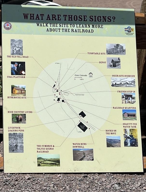
Other nearby markers. At least 8 other markers are within walking distance of this marker: Railroad Quarters (within shouting distance of this marker); Osier, Colorado (within shouting distance of this marker); Bunkhouse Site (within shouting distance of this marker); Turntable Site (within shouting distance of this marker); Depot (within shouting distance of this marker); Coal Platform (within shouting distance of this marker); The Old Toll Road (within shouting distance of this marker); Livestock Loading Pens (about 300 feet away, measured in a direct line). Touch for a list and map of all markers in Antonito.
this page online

Photographed by Sandra Hughes Tidwell, August 7, 2025
2. Gravity Fed Water Tank Marker
Photographed by Sandra Hughes Tidwell, August 7, 2025
3. Gravity Fed Water Tank Marker
Credits. This page was last revised on August 28, 2025. It was originally submitted on August 27, 2025, by Sandra Hughes Tidwell of Killen, Alabama, USA. This page has been viewed 79 times since then and 15 times this year. Photos: 1, 2, 3. submitted on August 27, 2025, by Sandra Hughes Tidwell of Killen, Alabama, USA. • Andrew Ruppenstein was the editor who published this page.
