Near Antonito in Conejos County, Colorado — The American Mountains (Southwest)
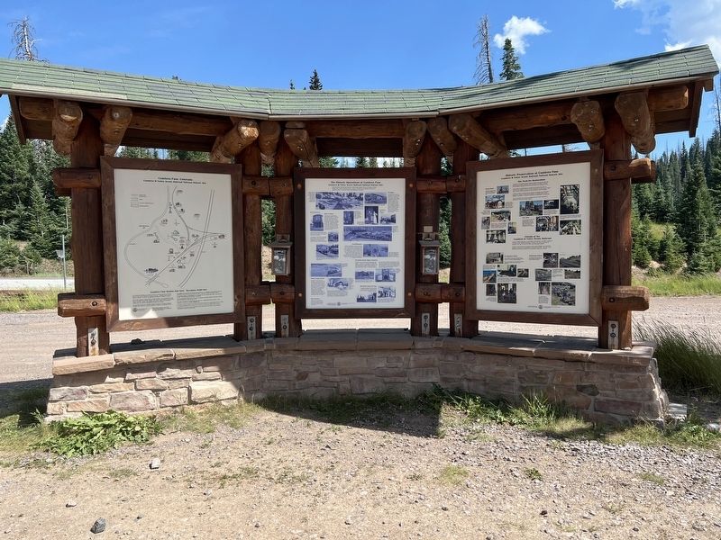
The Historic Operations at Cumbres Pass
Cumbres & Toltec Scenic Railroad National Historic Site
Photographed by Sandra Hughes Tidwell, August 7, 2025
1. The Historic Operations at Cumbres Pass Marker
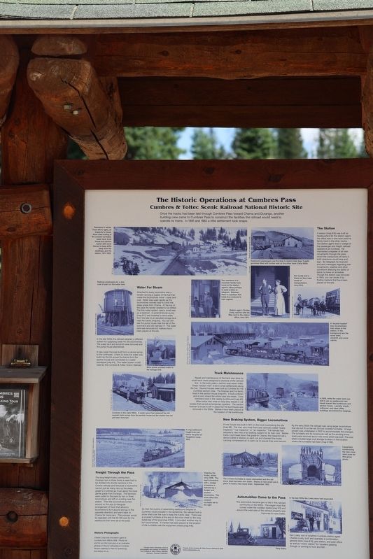
Once the tracks had been laid through Cumbres Pass toward Chama and Durango, another building crew arrived at Cumbres Pass to construct the facilities the railroad would need to operate its trains. In 1881, a little settlement took shape.
Caption:
Panorama in winter. From left to right: car inspector's house, snowshed ending at the covered turntable, water tank, bunkhouse, and section house with snow fences to keep drifts away from the dwellings and the station, 1911-1922.
Caption:
Railroad employees put a new coat of paint on the water tank.
Water for Steam
Attached to every locomotive was a tender carrying a supply of the fuel that made the locomotive move -water and coal. Water was used rapidly as the locomotives worked hard to climb the steep grade from Chama. At the top of the pass, the tender needed to be refilled. The first water system used a small lake as a reservoir. A windmill-driven pump [map#11] was installed to send water from the lake to an elevated storage tank near the tracks [map#5]. You can still see the pump house near the tail of the wye track and old Highway 17. The water tank was removed, but markers have been placed at the site.
In the late 1930s, the railroad adopted a different system for supplying water for the locomotives. The water tank and windmill were removed, and the pump house abandoned.
A new water line was built from a natural spring to the northwest. A tank to store water was built into the hill across the tracks from the section house and connected to a water sandpipe [map #4]. The water system is still used by the Cumbres & Toltec Scenic Railroad.
Caption: Wind power pumped water to the storage tank.
Caption: Cumbres in the early 1950s. A water spout has replaced the old wooden tank across the section house, but the station has not yet been
this page online
Freight Through The Pass
The long freight trains coming from Durango two or three times a week had to be divided into shorter sections in the Chama railroad yard because a locomotive cannot pull as many cars up the steep grade to Cumbres as it can along the more gentle grade from Durango.
The sections were pulled to the pass by two or three locomotives and left on a siding near the station. Then the locomotives turned around on the wye (a triangular arrangement of tracks that allows a locomotive to turn around and go in the opposite direction) and went back to Chama for more cars. This process would be repeated until the 50-100 cars for the eastbound train were all at the pass.
Caption:
Cleaning the tracks, winter circa 1909. A flanger and another locomotive follow the lead locomotive with a wedge snowplow. The snow shed and covered turntable are to the right. So that the routine of assembling eastbound freights at Cumbres could proceed in the wintertime, the railroad built a snow shed over the wye to keep the tracks clear. There was a covered turntable at the end of the snow shed on the extended (west ) leg
Photographed by Sandra Hughes Tidwell, August 7, 2025
2. The Historic Operations at Cumbres Pass Marker
[map #16].
The Station
A station [map #15] was built as headquarters for the station agent. his office was in one room, and his family lived in the other rooms. The station agent was in charge of the passenger and freight railroad operations at Cumbres. He maintained a register of all train movements throughout his pass, which the conductors of trains in both directions would stop and sign. By telegraph, he received and sent messages regarding train movements, weather, and other conditions affecting the ability of trains to move on schedule. Through the station was removed in 1954, you can locate it by finding markers that have been placed at the site.
Captions:
Eastbound passengers use the stop to stretch their legs. Freight gondolas filled with lumber wait on the other track. Early 1930s.
Caption:
Ken Lively and a friend on their main mode of transportation, circa 1919.
Caption:
Two members of a mountain family have come to the station agent's office, perhaps to send a letter or telegram. Between them is a podium that holds the conductor's train register Station agent Charles Lively and his wife, Ida Mae, next to the station office, circa 1911.
Caption:
A "double-headed" (two locomotives) train stops at the station. In the background are the snow shed, windmill, and some cabins.
Track Maintenance
Repair and maintenance of the track was done by small work crews assigned to sections of the railroad line. In the early years, a section was seven miles. These "section men" lived in a small settlement along the line. Several houses were built at Cumbres for the Cumbres section crew. The Forman and his family lived in the section house [map #1]. It had a kitchen, and a room where the whole crew ate meals. Crew members lived in the nearby bunkhouse [map # 2]. When extra men were on duty, they stayed in car bodies that served as temporary quarters. The section Forman's hose is still in place, but the bunkhouses were removed in the 1950s. Markers have been placed at the locations of the bunkhouse.
Caption:
In 1936, while the water tank was still in use, an eastbound train heads toward the bunkhouse and section house. Laundry, sheds, outhouse, and other utility buildings are behind the lodgings.
New Braking System, Bigger Locomotives
A new house was built in 1911, on the knoll overlooking the site [map # 6]. The man who live there was variously called “brake inspector”,”car inspector” or “air inspector”. The railroad had adopted a new king of air braking system for its train cars. Before trains could head down the grade to Chama the inspector set a device called a retainer on each car and checked the hoses caring compressed air to each car to assure they were secure. By the early 1920s the railroad was using larger locomotives that did not fit on the old 50-foot covered turntable. A large project was undertaken in 1922 to accommodate the changes. The turntable and its housing as well as the existing snow shed were removed and a new snow shed was built. The new shed included large coal storage bunkers in the location where the turntable had been [map #13B].
Caption:
The covered turntable is nearly dismantled and the old snow shed has been torn down. Stacks of new wood are in place to build a new snow shed. September 1922.
Caption:
Carpenters constructing the new snow shed pose for this group photo.
Automobiles Come to the Pass
The automobile became part of the life in this railroad community in the 1930s. The wagon road that curved under the wooden trestle [map #3] and around the west side of the railroad property was improved for auto traffic. Early 1930s.
Caption:
In the late 1930s the Lively store had expanded. Ken Lively, son of long time Cumbres station agent Charles Lively, built and operated a combination general store [map #10] , gas station, and post office as well as 'motor cabins' for travelers passing through or coming to hunt and fish.
Topics and series. This historical marker is listed in this topic list: Railroads & Streetcars. In addition, it is included in the Windmills series list. A significant historical year for this entry is 1881.
Location. 37° 1.141′ N, 106° 26.941′ W. Marker is near Antonito, Colorado, in Conejos County. It is on Colorado 17. Touch for map. Marker is at or near this postal address: 3826 CO-17, Antonito CO 81120, United States of America. Touch for directions.

Regionally, this marker is in Colorado’s San Juan Mountains and in the San Luis Valley. It is also in the American Mountain West. Globally, it is in North America, the Rocky Mountains, the Western Hemisphere, the Western World, and the Anglosphere. Historically, it finds itself in what was once New Spain and also the Republic of Texas.
Other nearby markers. At least 8 other markers are within 3 miles of this marker, measured as the crow flies: Cumbres Pass (within shouting distance of this marker); Los Caminos Antiguos (approx. 1.6 miles away); Welcome “Caminante” to… (approx. 1.6 miles away); The Great Race to Build a Railroad (approx. 1.6 miles away); The Secret Died With Him (approx. 1.6 miles away); This is Our land (approx. 2.7 miles away); Who Owns This Land? (approx. 2.7 miles away); Welcome to El Valle de San Luis (approx. 2.7 miles away). Touch for a list and map of all markers in Antonito.
Credits. This page was last revised on August 28, 2025. It was originally submitted on August 27, 2025, by Sandra Hughes Tidwell of Killen, Alabama, USA. This page has been viewed 281 times since then and 50 times this year. Photos: 1, 2. submitted on August 27, 2025, by Sandra Hughes Tidwell of Killen, Alabama, USA. • Andrew Ruppenstein was the editor who published this page.
