
Welland in Niagara Region, Ontario — Central Canada (North America)
Battle of Cook's Mills
⎯⎯⎯
La Bataille de Cook's Mills
Photographed by Dale K. Benington, June 11, 2012
1. Battle of Cook's Mill Marker

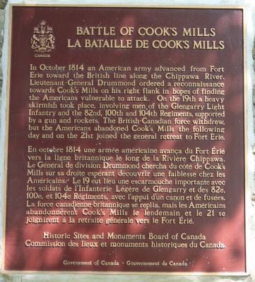
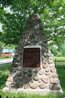
In October 1814 an American army advanced from Fort Erie toward the British line along the Chippawa River. Lieutenant-General Drummond ordered a reconnaissance towards Cook's Mills on his right flank in hopes of finding the Americans vulnerable to attack. On the 19th a heavy skirmish took place, involving men of the Glengarry Light Infantry and the 82nd, 100th and 104th Regiments, supported by a gun and rockets. The British-Canadian force withdrew, but the Amercians abandoned Cook's Mills the following day and on the 21st joined the general retreat to Fort Erie.
this page online
Erected by Historic Sites and Monuments Board of Canada.
Topics and series. This historical marker is listed in this topic list: War of 1812. In addition, it is included in the Canada, Historic Sites and Monuments Board series list. A significant historical date for this entry is October 19, 1814.
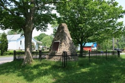
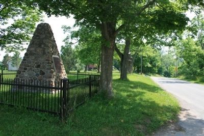
Location. 42° 59.876′ N, 79° 10.488′ W. Marker is in Welland, Ontario, in Niagara Region. It is at the intersection of Lyons Creek Road and Matthews Road, on the right when traveling west on Lyons Creek Road. According to my GPS, this historic marker is located in Welland, Ontario. According to a great site on Ontario's Historic Markers (sponsored by a gentleman named Wayne Cook) this historic marker is located in Cook's Mills (Welland East). It is located on the northeastern corner of the intersection, at the eastern edge of the small rural community, on the high ground overlooking a stream. Touch for map. Marker is at or near this postal address: 896 Lyons Creek Road, Welland ON L3B 5N4, Canada. Touch for directions.

Regionally, this marker is on Ontario’s Golden Horseshoe and in Niagara Canada. It is
Photographed by Dale K. Benington, June 11, 2012
2. Battle of Cook's Mill Marker
Other nearby markers. At least 8 other markers are within 5 kilometers of this marker, measured as the crow flies: Battle of Cook's Mills - Niagara Campaign 1814 (approx. one kilometer away); Battle of Cook's Mills - Oct. 19th 1814 (approx. one kilometer away); 50 Visages Militaires [50 faces of War - French marker] (approx. one kilometer away); 50 Faces Of War (approx. one kilometer away); Crowland Centennial Project (approx. 1.3 kilometers away); Lyon's Creek Cemetery (approx. 3.9 kilometers away); a different marker also named Lyon's Creek Cemetery (approx. 3.9 kilometers away); White Oak at Lyon's Creek Cemetery (approx. 3.9 kilometers away). Touch for a list and map of all markers in Welland.
Photographed by Dale K. Benington, June 11, 2012
3. Battle of Cook's Mill Marker
Photographed by Dale K. Benington, June 11, 2012
4. Battle of Cook's Mill Marker
View of the historic marker looking east along Lyons Creek Road.
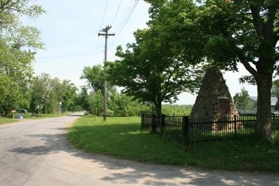
Photographed by Dale K. Benington, June 11, 2012
5. Battle of Cook's Mill Marker
View of the historic marker looking north along Matthews Road.
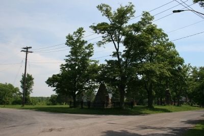
Photographed by Dale K. Benington, June 11, 2012
6. Battle of Cook's Mill Marker
View of the historic marker situated on the northeastern corner of the intersection.
Credits. This page was last revised on November 10, 2025. It was originally submitted on June 22, 2012, by Dale K. Benington of Toledo, Ohio. This page has been viewed 906 times since then and 25 times this year. Last updated on August 29, 2025, by Kevin Westell of St. Catharines, Ontario. Photos: 1, 2, 3, 4, 5, 6. submitted on June 22, 2012, by Dale K. Benington of Toledo, Ohio. • Devry Becker Jones was the editor who published this page.
