
Jordan Station near Lincoln in Niagara Region, Ontario — Central Canada (North America)
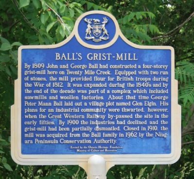
Ball's Grist-Mill
Photographed by Dale K. Benington, June 11, 2012
1. Ball's Grist-Mill Marker
Erected by the Ontario Heritage Foundation, Ministry of Culture and Recreation.
Topics and series. This historical marker is listed in these topic lists: Industry & Commerce • Settlements & Settlers • War of 1812. In addition, it is included in the Canada, Ontario Heritage Trust series list. A significant historical year for this entry is 1809.
Location. 43° 8.012′ N, 79° 22.997′ W.
this page online

Regionally, this marker is on Ontario’s Golden Horseshoe and in Niagara Canada. It is also in Central Canada. Globally, it is in North America, on the Great Lakes, in the Western Hemisphere, in the Western World, and in the Anglosphere. Historically, it finds itself in what was once a British colony, the Viceroyalty of New France, the Haudenosaunee (Iroquois) Confederacy, and Rupert’s Land.
Other nearby markers. At least 8 other markers are within walking distance of this marker: The Ball Home 1846 (within shouting distance of this marker); Glen Elgin Settlement - Ball's Falls (within shouting distance of this marker); St. George Anglican Church 1864 (within shouting
Photographed by Dale K. Benington, June 11, 2012
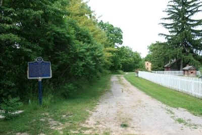
2. Ball's Grist-Mill Marker
View, looking north, of the historic marker located along the roadway leading back to the mill.
More about this marker. In his book, "Guidebook to the Historic Sites of the War of 1812," Gilbert Collins states, "Grist mills became targets for enemy raids during the war, since they provided flour for the British army. Fortunately Ball's Mill was one of the few to survive, and is a four-storey structure that was built by John and George Ball in 1809. Today the mill can be seen in the Ball's Fall's Conservation area, located on Regional Road 24 near, Vineland, Ontario." (page 130)
Regarding Ball's Grist-Mill. My impression was that it wasn't going to be easy for the casual visitor/historian to park their vehicle and do a quick visit of this historic marker site, and to visit and photograph the related buildings. Since I had a number of additional

Photographed by Kevin Westell, July 11, 2025
3. Ball's Grist-Mill - Marker in 2025
The marker may be seasonally concealed by bushes. In this photo from the road, it is half-hidden, just past the bicycle's rear wheel.
Photographed by Dale K. Benington, June 11, 2012
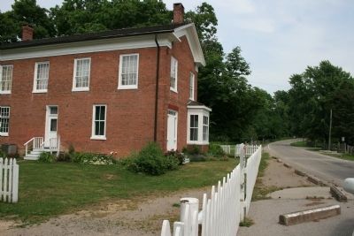
4. Ball's Grist-Mill Marker
View from in front of the historic marker (not seen in picture) looking east along 6th Avenue, with a view of what is perhaps the miller's house.
Photographed by Dale K. Benington, June 11, 2012
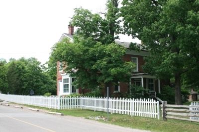
5. Ball's Grist-Mill Marker
View of what is perhaps the miller's residence, with a view of the historic marker just beyond the residence, in the extreme left of the picture.
Photographed by Dale K. Benington, June 11, 2012
6. Ball's Grist-Mill Marker
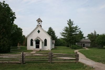
View of some of the additional structures that are part of the Ball's Fall's Conservation area.
Photographed by Dale K. Benington, June 11, 2012
7. Ball's Grist-Mill Marker
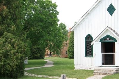
View from the street, seen off in the distance, beyond the church structure, of the Ball's Grist-Mill.
Photographed by Dale K. Benington, June 11, 2012
8. Ball's Grist-Mill Marker
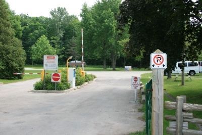
View of the authorized vehicle entrance to the Ball's Fall's Conservation area. Note the no parking sign in the foreground. Both sides of the street, along the Ball's Fall's Consevation area, are lined with no parking signs and portable concrete curbs to eliminate parking along the street.
Credits. This page was last revised on November 10, 2025. It was originally submitted on July 2, 2012, by Dale K. Benington of Toledo, Ohio. This page has been viewed 1,116 times since then and 62 times this year. Last updated on August 29, 2025, by Kevin Westell of St. Catharines, Ontario. Photos: 1, 2. submitted on July 2, 2012, by Dale K. Benington of Toledo, Ohio. 3. submitted on July 12, 2025, by Kevin Westell of St. Catharines, Ontario. 4, 5, 6, 7, 8. submitted on July 2, 2012, by Dale K. Benington of Toledo, Ohio. • Devry Becker Jones was the editor who published this page.
