
Rico in Dolores County, Colorado — The American Mountains (Southwest)
The Atlantic Cable Mine
Photographed by Cosmos Mariner, July 18, 2025
1. The Atlantic Cable Mine Marker
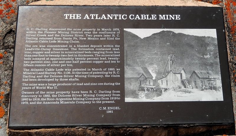
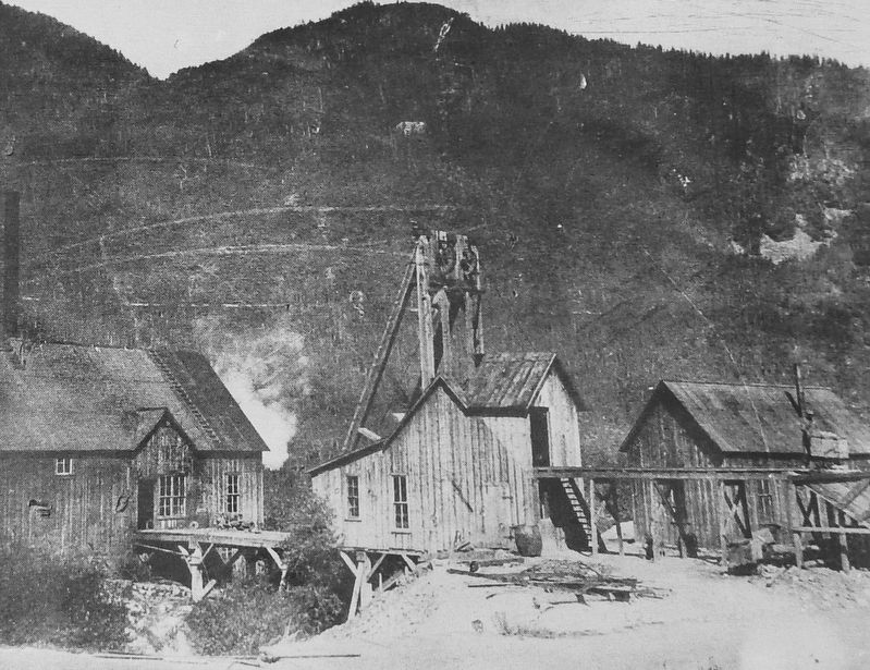
R. C. Darling discovered the mine property in March 1878, within the Pioneer Mining District near the confluence of Silver Creek and the Dolores River. Two years later R. C. Darling returned from Santa Fe, New Mexico and filed the Atlantic Cable Lode Mining Claim.
The ore was concentrated in a blanket deposit within the Leadville-Ouray limestone. The formation contained lead, zinc, copper and silver in mineralized beds ranging from less than one foot to twenty-two feet in thickness. The mineralized beds assayed at approximately twenty percent lead, twenty-two percent zinc, one and one-half percent copper and ten to fifteen ounces of silver per ton.
The Atlantic Cable Lode was patented in March of 1883, as Mineral Land Survey No. 1136. At the time of patenting by R. C. Darling and the Dolores Silver Mining Company, the claim had been developed by three shafts.
The mine was a large producer of lead and zinc ore during the years of World War II.
Owners of the mine property have been R. C. Darling from discovery to 1882, the Dolores Silver Mining Company from 1882 to 1919, the Rico-Argentine Mining Company from 1919 to 1979,
this page online
—C. M. Engel, 1981
Topics. This historical marker is listed in these topic lists: Industry & Commerce • Settlements & Settlers • War, World II. A significant historical month for this entry is March 1878.
Location. 37° 41.665′ N, 108° 1.906′ W. Marker is in Rico, Colorado, in Dolores County. It is at the intersection of North Glasgow Avenue (State Highway 145) and West Soda Street, on the left when traveling north on North Glasgow Avenue. Touch for map. Marker is at or near this postal address: 101 North Glasgow Avenue, Rico CO 81332, United States of America. Touch for directions.

Regionally, this marker is in the Western Slope. It is also in the American Mountain West, on the Colorado Plateau, and at the Four Corners. Globally, it is in North America, the Rocky Mountains, the Western Hemisphere, the Western World, and the Anglosphere. Historically, it finds itself in what was once Mexico’s Alta California.
Other nearby markers. At least 8 other markers are within 11 miles of this marker, measured as the crow flies: Rico, Colorado (here, next to this marker); Colorado Centennial Project
Photographed by Cosmos Mariner, July 18, 2025
2. Marker detail: The Atlantic Cable Mine
Also see . . .
1. Lost Mining Claims of Colorado’s Rico: The Atlantic Cable Mine.
(by by Robenia Mccloskey, 11/17/2024) Excerpt: Nestled in the San Juan Mountains, Rico was once a bustling mining town during the late 1800s. Rich in history and mystery, this area holds secrets of forgotten mines and untold riches. Many prospectors flocked here, hoping to strike it rich with silver and gold.(Submitted on September 3, 2025, by Cosmos Mariner of Cape Canaveral, Florida.)
Named after the first transatlantic telegraph cable, the Atlantic Cable Mine was a significant player in Rico's mining history. It produced both silver and lead, drawing miners from far and wide. Though abandoned, the mine's legacy lives on in the stories of those who once worked its depths.
2. Rico History (westernmininghistory.com ).
Photographed by Cosmos Mariner, July 18, 2025
3. The Atlantic Cable Mine Marker
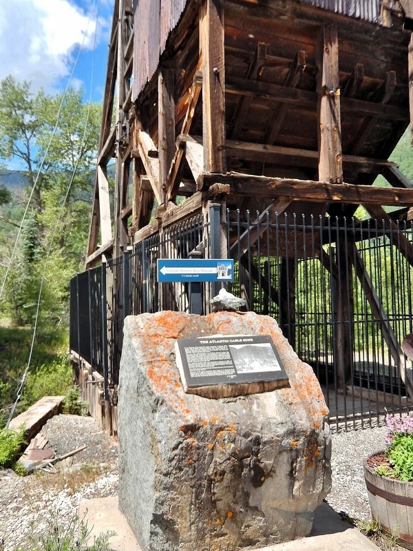
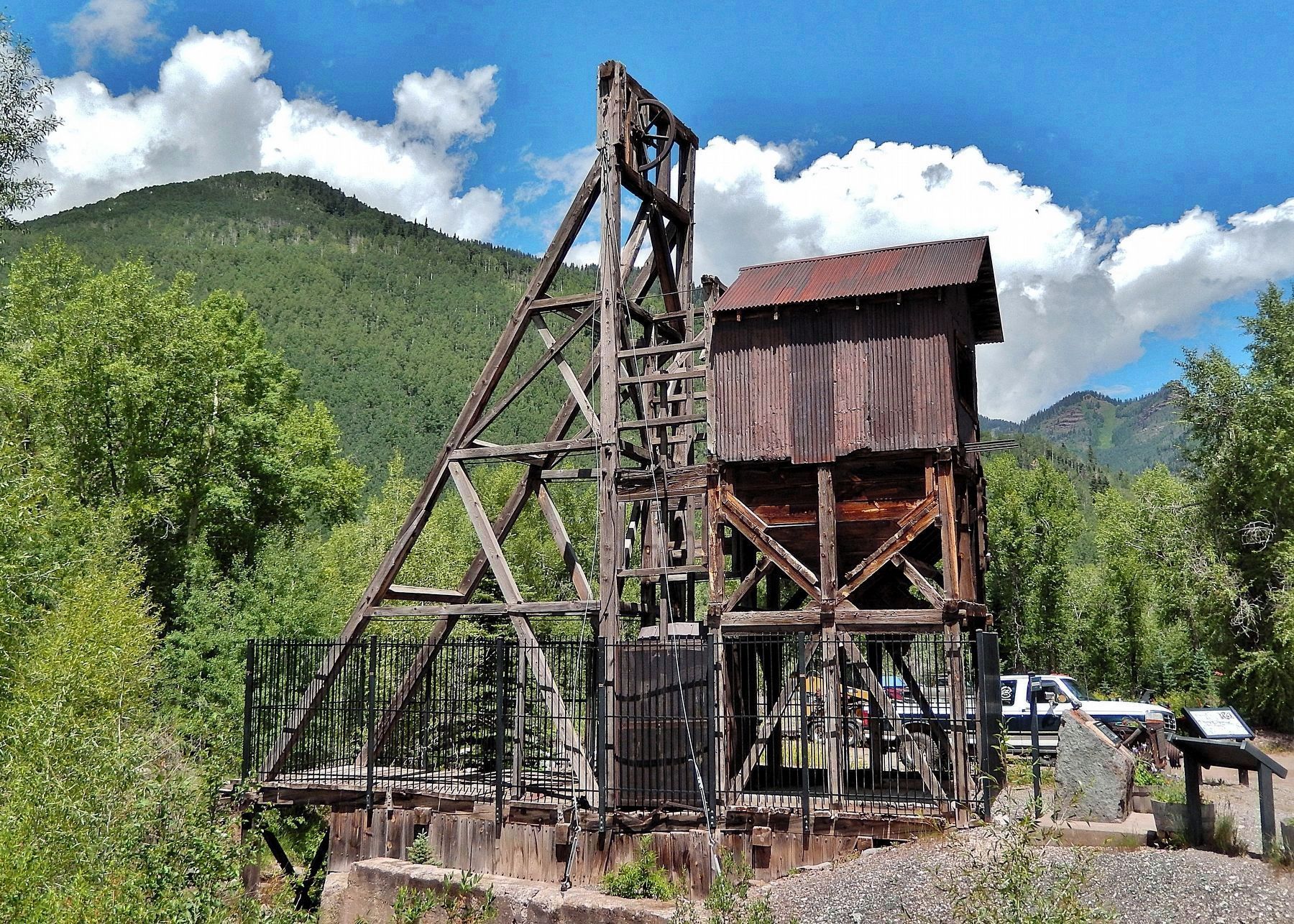
The marker is mounted on a waist-high stone pedestal located in front of the historic headframe structure.
Excerpt: In the mid-1860s, prospectors returned to the San Juan Mountains and actively staked claims in the mountains above what is now Rico. For the next thirty years, access to the Pioneer Mining District was extremely difficult as the land to the south was controlled by the Ute Indians. When Robert C. Darling first settled in Rico in the summer of 1870, residents were few and far between on the Dolores River between Ophir and Big Bend (Dolores). Darling returned to the area after working in the four corners with his brother, Capt. E. N. Darling, surveying Navajo land and boundaries in the 1860s, and set up his homestead and double log cabin on Silver Creek.(Submitted on September 3, 2025, by Cosmos Mariner of Cape Canaveral, Florida.)
In 1877, Washington James Buchanan, of Ouray, discovered carbonate ore in the area, but it was not until 1878 when he took a sample to Long, Stout & Munn’s sampling works in Ouray that anyone realized there were minerals of value waiting to be mined. Despite his failed attempts to return during the winter, he arrived again in March of 1879 and started working immediately. Once word got out, the rush began and from May to July the town saw the arrival of hundreds of newprospectors, miners, and businessmen.Photographed by Cosmos Mariner, July 18, 20254. Atlantic Cable Mine Headframe & MarkersLooking northwest from North Glasgow Avenue (Colorado Highway 145). This marker is on the left side of the historic headframe structure. There are related markers nearby.
Photographed by Cosmos Mariner, July 18, 2025
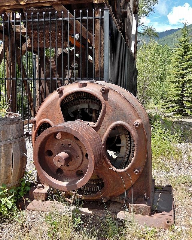
5. Cable Motor & Pulley
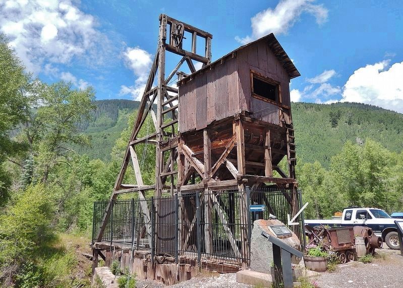
On exhibit near the historic headframe structure.
Photographed by Cosmos Mariner, July 18, 2025
6. Atlantic Cable Mine Headframe
Credits. This page was last revised on September 3, 2025. It was originally submitted on August 29, 2025, by Cosmos Mariner of Cape Canaveral, Florida. This page has been viewed 133 times since then and 49 times this year. Photos: 1, 2, 3, 4, 5, 6. submitted on September 3, 2025, by Cosmos Mariner of Cape Canaveral, Florida.
