Hespeler in Cambridge in Waterloo Region, Ontario — Central Canada (North America)
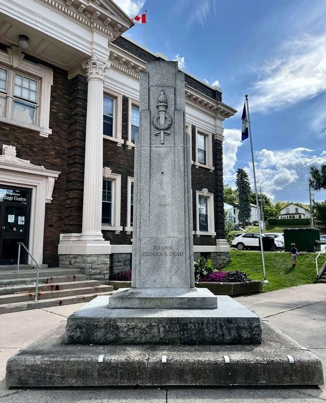
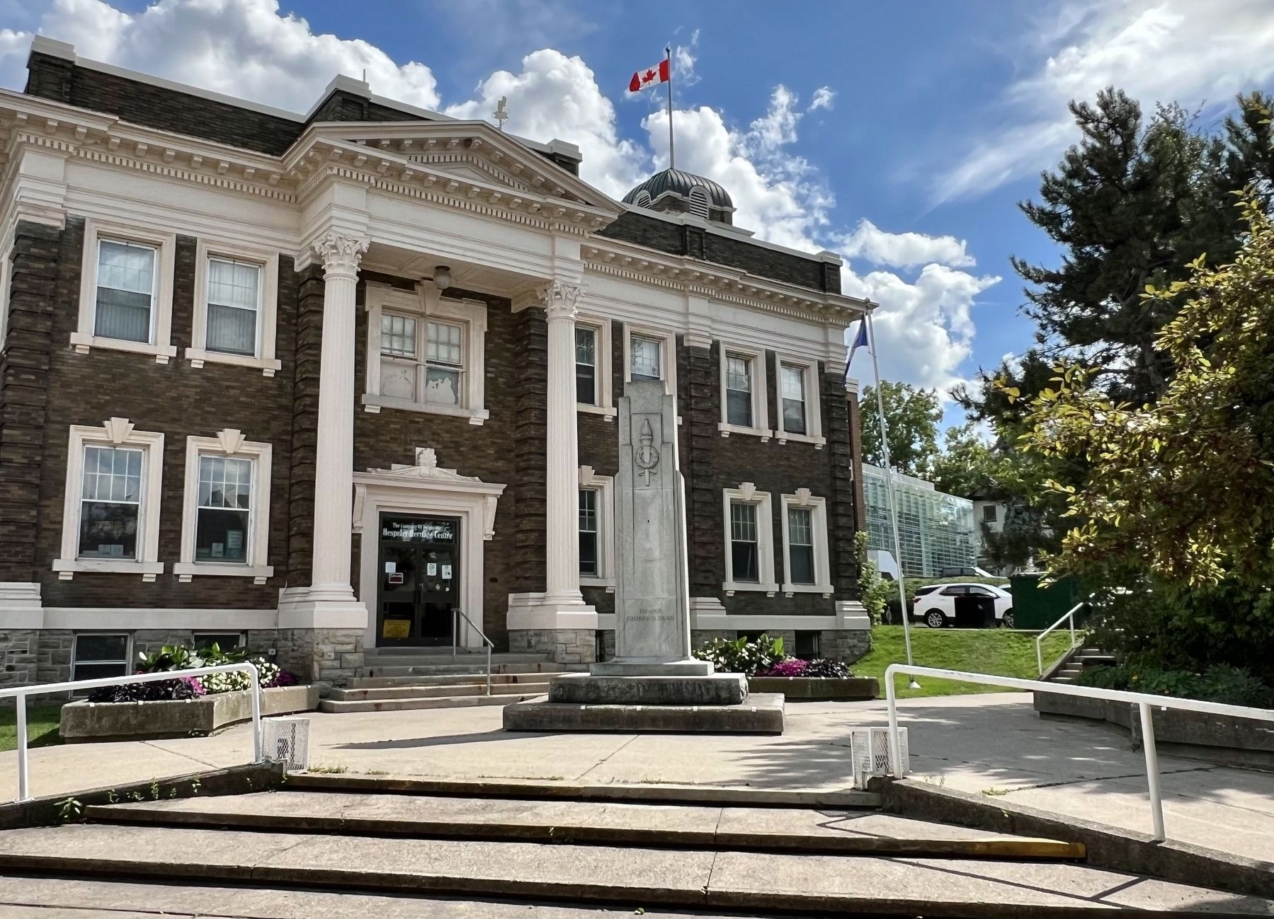
Hespeler Cenotaph
Photographed by Tim Boyd, August 27, 2025
1. Hespeler Cenotaph
South side
[south side]
To Our Glorious Dead
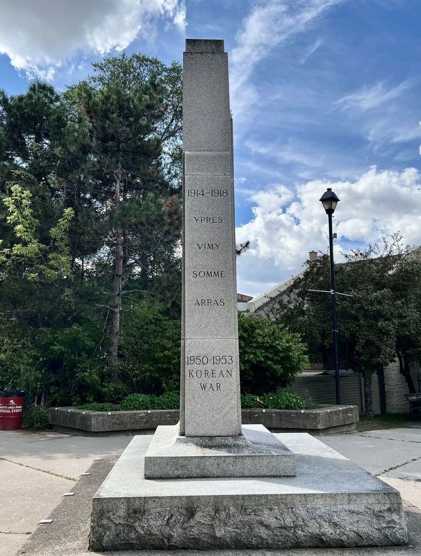
[west side]
1914-1918
Ypres
Vimy
Somme
Arras
1950-1953
Korean War
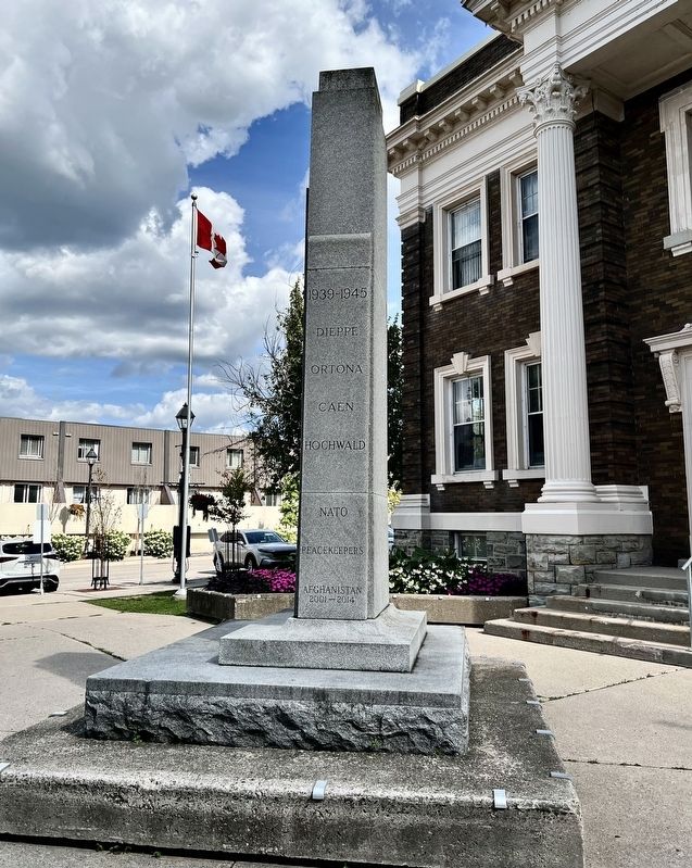
[east side]
1939-1945
Dieppe
Ortona
Caen
Hochwald
NATO
Peacekeepers
Afghanistan
2001-2014
Topics. This memorial is listed in these topic lists: War, Korean • War, World I • War, World II.
Location. 43° 25.885′ N, 80° 18.573′ W. Memorial is in Cambridge, Ontario, in Waterloo Region. It is in Hespeler. It is at the intersection of Tannery Street East and Queen Street East, on the right when traveling south on Tannery Street East. Touch for map. Memorial is at or near this postal address: 24-42 Tannery Street E, Cambridge ON N3C 2A6, Canada. Touch for directions.

Regionally, this memorial is in the Huron-Perth-Waterloo-Wellington Area and in Southwestern Ontario. It is also in Central Canada. Globally, it is in North America, the Western Hemisphere, the Western World, and the Anglosphere. Historically, it finds itself in what was once a British colony, the Viceroyalty of New France, the Haudenosaunee (Iroquois) Confederacy,
this page online
Other nearby markers. At least 8 other markers are within 6 kilometers of this marker, measured as the crow flies: Tannery Street/ Forbes Park Area (within shouting distance of this marker); History of the Riverbank (about 120 meters away, measured in a direct line); Jacob’s Landing and Hespeler Mill Pond (about 210 meters away); First Mennonite Sunday School (approx. 2.2 kilometers away); Site of the Samuel Bechtel Meeting House and Burial Ground (approx. 2.3 kilometers away); Waterloo Township Community Meeting House School and Burial Ground (approx. 2.3 kilometers away); Black Bridge Road Bridge (approx. 2.4 kilometers away); The Settlement of Puslinch (approx. 5.1 kilometers away). Touch for a list and map of all markers in Cambridge.
Photographed by Tim Boyd, August 27, 2029
2. Hespeler Cenotaph
West side
Photographed by Tim Boyd, August 27, 2025
3. Hespeler Cenotaph
East side
Photographed by Tim Boyd, August 27, 2025
4. Hespeler Cenotaph
Credits. This page was last revised on September 8, 2025. It was originally submitted on August 30, 2025, by Tim Boyd of Hamilton, Ontario. This page has been viewed 74 times since then and 30 times this year. Photos: 1, 2, 3, 4. submitted on August 30, 2025, by Tim Boyd of Hamilton, Ontario. • Andrew Ruppenstein was the editor who published this page.
